Fairfax, South Dakota
| Fairfax, South Dakota | |
|---|---|
| Town | |
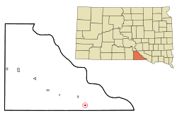 Location in Gregory County and the state of South Dakota | |
| Coordinates: 43°1′41″N 98°53′23″W / 43.02806°N 98.88972°WCoordinates: 43°1′41″N 98°53′23″W / 43.02806°N 98.88972°W | |
| Country | United States |
| State | South Dakota |
| County | Gregory |
| Settled | 1890[1] |
| Area[2] | |
| • Total | 0.30 sq mi (0.78 km2) |
| • Land | 0.30 sq mi (0.78 km2) |
| • Water | 0 sq mi (0 km2) |
| Elevation | 1,949 ft (594 m) |
| Population (2010)[3] | |
| • Total | 115 |
| • Estimate (2012[4]) | 115 |
| • Density | 383.3/sq mi (148.0/km2) |
| Time zone | Central (CST) (UTC-6) |
| • Summer (DST) | CDT (UTC-5) |
| ZIP code | 57335 |
| Area code(s) | 605 |
| FIPS code | 46-20380[5] |
| GNIS feature ID | 1254979[6] |
Fairfax is a town in Gregory County, South Dakota, United States. The population was 115 at the 2010 census.
History
The first settlement at Fairfax was made around 1890.[7] A post office called Fairfax has been in operation since 1892.[8] It was named after Fairfax, Virginia, the former hometown of an early settler.[9]
Geography
Fairfax is located at 43°1′41″N 98°53′23″W / 43.02806°N 98.88972°W (43.028069, -98.889639).[10]
According to the United States Census Bureau, the town has a total area of 0.30 square miles (0.78 km2), all of it land.[2]
Fairfax has been assigned the ZIP code 57335 and the FIPS place code 20380.
Demographics
| Historical population | |||
|---|---|---|---|
| Census | Pop. | %± | |
| 1910 | 500 | — | |
| 1920 | 530 | 6.0% | |
| 1930 | 430 | −18.9% | |
| 1940 | 338 | −21.4% | |
| 1950 | 301 | −10.9% | |
| 1960 | 253 | −15.9% | |
| 1970 | 199 | −21.3% | |
| 1980 | 225 | 13.1% | |
| 1990 | 144 | −36.0% | |
| 2000 | 123 | −14.6% | |
| 2010 | 115 | −6.5% | |
| Est. 2015 | 113 | [11] | −1.7% |
2010 census
As of the census[3] of 2010, there were 115 people, 63 households, and 33 families residing in the town. The population density was 383.3 inhabitants per square mile (148.0/km2). There were 81 housing units at an average density of 270.0 per square mile (104.2/km2). The racial makeup of the town was 97.4% White, 1.7% African American, and 0.9% Native American.
There were 63 households of which 17.5% had children under the age of 18 living with them, 41.3% were married couples living together, 11.1% had a female householder with no husband present, and 47.6% were non-families. 44.4% of all households were made up of individuals and 22.2% had someone living alone who was 65 years of age or older. The average household size was 1.83 and the average family size was 2.52.
The median age in the town was 52.5 years. 15.7% of residents were under the age of 18; 3.3% were between the ages of 18 and 24; 14.7% were from 25 to 44; 37.3% were from 45 to 64; and 28.7% were 65 years of age or older. The gender makeup of the town was 46.1% male and 53.9% female.
2000 census
As of the census[5] of 2000, there were 123 people, 63 households, and 33 families residing in the town. The population density was 414.4 people per square mile (158.3/km²). There were 76 housing units at an average density of 256.1 per square mile (97.8/km²). The racial makeup of the town was 96.75% White and 3.25% Native American.
There were 63 households out of which 17.5% had children under the age of 18 living with them, 44.4% were married couples living together, 6.3% had a female householder with no husband present, and 47.6% were non-families. 47.6% of all households were made up of individuals and 31.7% had someone living alone who was 65 years of age or older. The average household size was 1.95 and the average family size was 2.82.
In the town the population was spread out with 17.9% under the age of 18, 3.3% from 18 to 24, 17.9% from 25 to 44, 25.2% from 45 to 64, and 35.8% who were 65 years of age or older. The median age was 52 years. For every 100 females there were 83.6 males. For every 100 females age 18 and over, there were 80.4 males.
The median income for a household in the town was $19,844, and the median income for a family was $36,000. Males had a median income of $21,250 versus $21,250 for females. The per capita income for the town was $12,805. There were no families and 4.8% of the population living below the poverty line, including no under eighteens and 10.3% of those over 64.
References
- ↑ "SD Towns" (PDF). South Dakota State Historical Society. Retrieved 2010-02-12.
- 1 2 "US Gazetteer files 2010". United States Census Bureau. Retrieved 2012-06-21.
- 1 2 "American FactFinder". United States Census Bureau. Retrieved 2012-06-21.
- ↑ "Population Estimates". United States Census Bureau. Retrieved 2013-05-29.
- 1 2 "American FactFinder". United States Census Bureau. Retrieved 2008-01-31.
- ↑ "US Board on Geographic Names". United States Geological Survey. 2007-10-25. Retrieved 2008-01-31.
- ↑ Federal Writers' Project (1940). South Dakota place-names, v.1-3. University of South Dakota. p. 37.
- ↑ "Gregory County". Jim Forte Postal History. Retrieved 17 March 2015.
- ↑ Chicago and North Western Railway Company (1908). A History of the Origin of the Place Names Connected with the Chicago & North Western and Chicago, St. Paul, Minneapolis & Omaha Railways. p. 70.
- ↑ "US Gazetteer files: 2010, 2000, and 1990". United States Census Bureau. 2011-02-12. Retrieved 2011-04-23.
- ↑ "Annual Estimates of the Resident Population for Incorporated Places: April 1, 2010 to July 1, 2015". Retrieved July 2, 2016.
- ↑ "Census of Population and Housing". Census.gov. Retrieved June 4, 2015.
Municipalities and communities of Gregory County, South Dakota, United States | ||
|---|---|---|
| Cities |  | |
| Towns | ||
| CDP | ||
| Unincorporated communities | ||
| Indian reservation | ||
| Footnotes | ‡This populated place also has portions in an adjacent county or counties | |