Burke, South Dakota
| Burke, South Dakota | |
|---|---|
| City | |
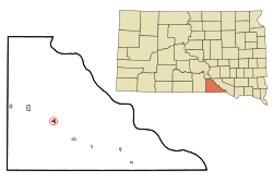 Location in Gregory County and the state of South Dakota | |
| Coordinates: 43°10′59″N 99°17′28″W / 43.18306°N 99.29111°WCoordinates: 43°10′59″N 99°17′28″W / 43.18306°N 99.29111°W | |
| Country | United States |
| State | South Dakota |
| County | Gregory |
| Incorporated | 1906[1] |
| Area[2] | |
| • Total | 0.56 sq mi (1.45 km2) |
| • Land | 0.56 sq mi (1.45 km2) |
| • Water | 0 sq mi (0 km2) |
| Elevation | 2,195 ft (669 m) |
| Population (2010)[3] | |
| • Total | 604 |
| • Estimate (2015)[4] | 589 |
| • Density | 1,078.6/sq mi (416.4/km2) |
| Time zone | Central (CST) (UTC-6) |
| • Summer (DST) | CDT (UTC-5) |
| ZIP code | 57523 |
| Area code(s) | 605 |
| FIPS code | 46-08700[5] |
| GNIS feature ID | 1254165[6] |
Burke is a city in Gregory County, South Dakota, United States. The population was 604 at the 2010 census. It is the county seat of Gregory County.[7]
History
Burke was laid out in 1904[8] and incorporated in 1906.[9] It was named for the congressman Charles H. Burke.[10]
Geography
Burke is located at 43°10′59″N 99°17′28″W / 43.18306°N 99.29111°W (43.182992, -99.291065).[11]
According to the United States Census Bureau, the city has a total area of 0.56 square miles (1.45 km2), all of it land.[2]
Burke has been assigned the ZIP code 57523 and the FIPS place code 08700.
Demographics
| Historical population | |||
|---|---|---|---|
| Census | Pop. | %± | |
| 1910 | 311 | — | |
| 1920 | 628 | 101.9% | |
| 1930 | 605 | −3.7% | |
| 1940 | 602 | −0.5% | |
| 1950 | 829 | 37.7% | |
| 1960 | 811 | −2.2% | |
| 1970 | 892 | 10.0% | |
| 1980 | 859 | −3.7% | |
| 1990 | 756 | −12.0% | |
| 2000 | 676 | −10.6% | |
| 2010 | 604 | −10.7% | |
| Est. 2015 | 589 | [12] | −2.5% |
| U.S. Decennial Census[13] 2015 Estimate[4] | |||
2010 census
As of the census[3] of 2010, there were 604 people, 324 households, and 161 families residing in the city. The population density was 1,078.6 inhabitants per square mile (416.4/km2). There were 398 housing units at an average density of 710.7 per square mile (274.4/km2). The racial makeup of the city was 94.2% White, 0.2% African American, 3.5% Native American, 0.2% from other races, and 2.0% from two or more races. Hispanic or Latino of any race were 0.7% of the population.
There were 324 households of which 19.4% had children under the age of 18 living with them, 42.9% were married couples living together, 4.6% had a female householder with no husband present, 2.2% had a male householder with no wife present, and 50.3% were non-families. 48.5% of all households were made up of individuals and 27.8% had someone living alone who was 65 years of age or older. The average household size was 1.86 and the average family size was 2.62.
The median age in the city was 52.2 years. 17.9% of residents were under the age of 18; 3.9% were between the ages of 18 and 24; 18.3% were from 25 to 44; 30.4% were from 45 to 64; and 29.5% were 65 years of age or older. The gender makeup of the city was 44.5% male and 55.5% female.
2000 census
As of the census[5] of 2000, there were 676 people, 327 households, and 177 families residing in the city. The population density was 1,210.1 people per square mile (466.1/km²). There were 385 housing units at an average density of 689.2 per square mile (265.4/km²). The racial makeup of the city was 97.49% White, 1.78% Native American, and 0.74% from two or more races.
There were 327 households out of which 22.3% had children under the age of 18 living with them, 47.4% were married couples living together, 4.9% had a female householder with no husband present, and 45.6% were non-families. 44.3% of all households were made up of individuals and 30.0% had someone living alone who was 65 years of age or older. The average household size was 2.03 and the average family size was 2.85.
In the city the population was spread out with 21.7% under the age of 18, 3.8% from 18 to 24, 20.4% from 25 to 44, 23.1% from 45 to 64, and 30.9% who were 65 years of age or older. The median age was 48 years. For every 100 females there were 77.9 males. For every 100 females age 18 and over, there were 74.0 males.
The median income for a household in the city was $23,056, and the median income for a family was $32,333. Males had a median income of $23,438 versus $19,250 for females. The per capita income for the city was $14,210. About 7.2% of families and 15.7% of the population were below the poverty line, including 12.9% of those under age 18 and 22.5% of those age 65 or over.
Education
Burke Public Schools are part of the Burke School District. The district has one elementary school, one middle school, and one high school. Students attend Burke High School.[14]
Notable people
- Larry D. Shippy a Republican member of the Wyoming House of Representatives.
- Kathy Lou Schultz - American poet and scholar
- Julie Bartling - South Dakota State Senator
- James Connell -first mayor of Burke. Remained mayor until his death in 1931
References
- ↑ "SD Towns" (PDF). South Dakota State Historical Society. Archived from the original (PDF) on 2010-02-10. Retrieved 2010-02-11.
- 1 2 "US Gazetteer files 2010". United States Census Bureau. Archived from the original on 2012-01-24. Retrieved 2012-06-21.
- 1 2 "American FactFinder". United States Census Bureau. Retrieved 2012-06-21.
- 1 2 "Population Estimates". United States Census Bureau. Retrieved June 13, 2016.
- 1 2 "American FactFinder". United States Census Bureau. Archived from the original on 2013-09-11. Retrieved 2008-01-31.
- ↑ "US Board on Geographic Names". United States Geological Survey. 2007-10-25. Retrieved 2008-01-31.
- ↑ "Find a County". National Association of Counties. Archived from the original on 2011-05-31. Retrieved 2011-06-07.
- ↑ Federal Writers' Project (1940). South Dakota place-names, v.1-3. University of South Dakota. p. 29.
- ↑ Hellmann, Paul T. (May 13, 2013). "Historical Gazetteer of the United States". Routledge. p. 984. Retrieved 30 November 2013.
- ↑ Chicago and North Western Railway Company (1908). A History of the Origin of the Place Names Connected with the Chicago & North Western and Chicago, St. Paul, Minneapolis & Omaha Railways. p. 49.
- ↑ "US Gazetteer files: 2010, 2000, and 1990". United States Census Bureau. 2011-02-12. Retrieved 2011-04-23.
- ↑ "Annual Estimates of the Resident Population for Incorporated Places: April 1, 2010 to July 1, 2015". Retrieved July 2, 2016.
- ↑ United States Census Bureau. "Census of Population and Housing". Archived from the original on May 11, 2015. Retrieved June 13, 2016.
- ↑ "Burke Public School District 26-2". Burke Public School District 26-2. Retrieved August 5, 2012.
External links
Municipalities and communities of Gregory County, South Dakota, United States | ||
|---|---|---|
| Cities | 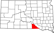 | |
| Towns | ||
| CDP | ||
| Unincorporated communities | ||
| Indian reservation | ||
| Footnotes | ‡This populated place also has portions in an adjacent county or counties | |