Snyder, Colorado
| Snyder, Colorado | |
|---|---|
| Unincorporated community | |
|
Snyder, looking north on Colorado State Highway 71. | |
 Location in Morgan County and the state of Colorado | |
| Coordinates: 40°19′43″N 103°35′47″W / 40.32861°N 103.59639°WCoordinates: 40°19′43″N 103°35′47″W / 40.32861°N 103.59639°W | |
| Country |
|
| State |
|
| County | Morgan County[1] |
| Elevation[1] | 4,203 ft (1,281 m) |
| Time zone | MST (UTC-7) |
| • Summer (DST) | MDT (UTC-6) |
| ZIP code[2] | 80750 |
| GNIS feature ID | 0182931 |

Snyder is an unincorporated community and a U.S. Post Office located in Morgan County, Colorado, United States. The Snyder Post Office has the ZIP Code 80750.[2]
Name
The town is named after J.W. Snyder (1837-1922), a pioneer rancher.[3][4][5]
Geography
Snyder is located at 40°19′43″N 103°35′47″W / 40.32861°N 103.59639°W (40.328749,-103.596439).
See also
References
- 1 2 "US Board on Geographic Names". United States Geological Survey. 2007-10-25. Retrieved 2008-01-31.
- 1 2 "ZIP Code Lookup" (JavaScript/HTML). United States Postal Service. January 3, 2007. Retrieved January 3, 2007.
- ↑ Dawson, John Frank. Place names in Colorado: why 700 communities were so named, 150 of Spanish or Indian origin. Denver, CO: The J. Frank Dawson Publishing Co. p. 47.
- ↑ Lewis Atherton, The Cattle Kings. Lincoln: Univ. of Nebraska Press 1972.
- ↑ Atherton, Lewis (1972-01-01). The Cattle Kings. U of Nebraska Press. ISBN 0803257597.
Municipalities and communities of Morgan County, Colorado, United States | ||
|---|---|---|
| Cities | 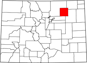 | |
| Towns | ||
| CDPs | ||
| Unincorporated community | ||
| Ghost towns | ||
This article is issued from Wikipedia - version of the 7/10/2016. The text is available under the Creative Commons Attribution/Share Alike but additional terms may apply for the media files.