Log Lane Village, Colorado
| Town of Log Lane Village, Colorado | |
|---|---|
| Statutory Town | |
|
A gas station in Log Lane Village. | |
 Location in Morgan County and the state of Colorado | |
| Coordinates: 40°16′15″N 103°49′39″W / 40.27083°N 103.82750°WCoordinates: 40°16′15″N 103°49′39″W / 40.27083°N 103.82750°W | |
| Country |
|
| State |
|
| County[1] | Morgan |
| Incorporated (town) | June 12, 1956[2] |
| Government | |
| • Type | Statutory Town[1] |
| Area | |
| • Total | 0.2 sq mi (0.6 km2) |
| • Land | 0.2 sq mi (0.6 km2) |
| • Water | 0 sq mi (0 km2) |
| Elevation[3] | 4,324 ft (1,318 m) |
| Population (2010) | |
| • Total | 873 |
| • Density | 4,365/sq mi (1,455/km2) |
| Time zone | Mountain (MST) (UTC-7) |
| • Summer (DST) | MDT (UTC-6) |
| ZIP code[4] | 80705 |
| Area code(s) | 970 |
| FIPS code | 08-45695 |
| GNIS feature ID | 1669460 |

The Town of Log Lane Village is a Statutory Town in Morgan County, Colorado, United States. The town population was 873 at the 2010 United States Census.
Log Lane Village was named from the presence of log houses in the village.[5]
Geography
Log Lane Village is located at 40°16′15″N 103°49′39″W / 40.27083°N 103.82750°W (40.270752, -103.827374).[6]
According to the United States Census Bureau, the town has a total area of 0.2 square miles (0.52 km2), all of it land.
Demographics
| Historical population | |||
|---|---|---|---|
| Census | Pop. | %± | |
| 1960 | 310 | — | |
| 1970 | 329 | 6.1% | |
| 1980 | 709 | 115.5% | |
| 1990 | 667 | −5.9% | |
| 2000 | 1,006 | 50.8% | |
| 2010 | 873 | −13.2% | |
| Est. 2015 | 873 | [7] | 0.0% |
As of the census[9] of 2000, there were 1,006 people, 289 households, and 239 families residing in the town. The population density was 4,043.5 people per square mile (1,553.7/km²). There were 324 housing units at an average density of 1,302.3 per square mile (500.4/km²). The racial makeup of the town was 73.86% White, 0.50% African American, 1.49% Native American, 0.89% Asian, 19.58% from other races, and 3.68% from two or more races. Hispanic or Latino of any race were 52.78% of the population.
There were 289 households out of which 52.6% had children under the age of 18 living with them, 65.7% were married couples living together, 12.8% had a female householder with no husband present, and 17.0% were non-families. 12.8% of all households were made up of individuals and 3.8% had someone living alone who was 65 years of age or older. The average household size was 3.48 and the average family size was 3.83.
In the town the population was spread out with 38.5% under the age of 18, 9.4% from 18 to 24, 29.8% from 25 to 44, 16.9% from 45 to 64, and 5.4% who were 65 years of age or older. The median age was 26 years. For every 100 females there were 106.6 males. For every 100 females age 18 and over, there were 99.7 males.
The median income for a household in the town was $33,947, and the median income for a family was $35,536. Males had a median income of $25,913 versus $19,167 for females. The per capita income for the town was $11,502. About 13.0% of families and 16.6% of the population were below the poverty line, including 20.0% of those under age 18 and 9.3% of those age 65 or over.
See also
References
- 1 2 "Active Colorado Municipalities". State of Colorado, Department of Local Affairs. Retrieved 2007-09-01.
- ↑ "Colorado Municipal Incorporations". State of Colorado, Department of Personnel & Administration, Colorado State Archives. 2004-12-01. Retrieved 2007-09-02.
- ↑ "US Board on Geographic Names". United States Geological Survey. 2007-10-25. Retrieved 2008-01-31.
- ↑ "ZIP Code Lookup" (JavaScript/HTML). United States Postal Service. Retrieved November 15, 2007.
- ↑ Exploring Colorado Highways: Trip Trivia. Exploring America's Highway. 2007. p. 111. ISBN 978-0-9777301-0-0.
- ↑ "US Gazetteer files: 2010, 2000, and 1990". United States Census Bureau. 2011-02-12. Retrieved 2011-04-23.
- ↑ "Annual Estimates of the Resident Population for Incorporated Places: April 1, 2010 to July 1, 2015". Retrieved July 2, 2016.
- ↑ "Census of Population and Housing". Census.gov. Retrieved June 4, 2015.
- ↑ "American FactFinder". United States Census Bureau. Retrieved 2008-01-31.
External links
Municipalities and communities of Morgan County, Colorado, United States | ||
|---|---|---|
| Cities | 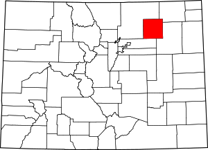 | |
| Towns | ||
| CDPs | ||
| Unincorporated community | ||
| Ghost towns | ||
