Snowflake, Arizona
| Snowflake, Arizona | |
|---|---|
| Town | |
|
The LDS Temple in Snowflake | |
 Location in Navajo County and the state of Arizona | |
 Snowflake Location in the United States | |
| Coordinates: 34°30′40″N 110°4′59″W / 34.51111°N 110.08306°WCoordinates: 34°30′40″N 110°4′59″W / 34.51111°N 110.08306°W | |
| Country |
|
| State |
|
| County | Navajo |
| Founded | 1878 |
| Founded by | Erastus Snow and William Jordan Flake |
| Government | |
| • Type | Council-Manager |
| • Body | Snowflake City Council |
| • Mayor | Kelly Willis (R) |
| Area | |
| • Total | 30.9 sq mi (80 km2) |
| • Land | 30.8 sq mi (79.8 km2) |
| • Water | 0.1 sq mi (0.1 km2) |
| Elevation[1] | 5,682 ft (1,732 m) |
| Population (2010)[2] | |
| • Total | 5,590 |
| • Estimate (2014)[3] | 5,644 |
| • Density | 180.55/sq mi (69.88/km2) |
| Time zone | Mountain (UTC-7) |
| • Summer (DST) | no DST/PDT (UTC−7) |
| ZIP codes | 85937, 85942 |
| Area code(s) | 928 |
| FIPS code | 04-67800 |
| GNIS ID(s) | 34591, 2413301 |
| Website | Town of Snowflake |


Snowflake is a town in Navajo County, Arizona, United States. It was founded in 1878 by Erastus Snow and William Jordan Flake, Mormon pioneers and colonizers.[4] It has frequently been noted on lists of unusual place names.[5][6] According to 2012 Census Bureau estimates, the population of the town is 5,564.[7]
Snowflake is 25 miles south of Interstate 40 (formerly U.S. Route 66) via Highway 77. The Apache Railway provides freight service, from 1961 to 2012 serving the Snowflake Mill.
Geography
Snowflake is located at 34°30′40″N 110°4′59″W / 34.51111°N 110.08306°W (34.511187, -110.082974).[8]
According to the United States Census Bureau, the town has a total area of 30.9 square miles (80 km2), of which, 30.8 square miles (80 km2) of it is land and 0.1 square miles (0.26 km2) of it (0.16%) is water.
Demographics
| Historical population | |||
|---|---|---|---|
| Census | Pop. | %± | |
| 1880 | 275 | — | |
| 1910 | 494 | — | |
| 1920 | 758 | 53.4% | |
| 1930 | 1,259 | 66.1% | |
| 1950 | 929 | — | |
| 1960 | 982 | 5.7% | |
| 1970 | 1,977 | 101.3% | |
| 1980 | 3,510 | 77.5% | |
| 1990 | 3,679 | 4.8% | |
| 2000 | 4,460 | 21.2% | |
| 2010 | 5,590 | 25.3% | |
| Est. 2015 | 5,666 | [9] | 1.4% |
| U.S. Decennial Census[10] 2014 Estimate[3] | |||
As of the census[11] of 2000, there were 4,460 people, 1,312 households, and 1,070 families residing in the town. The population density was 144.8 people per square mile (55.9/km²). There were 1,536 housing units at an average density of 49.9 per square mile (19.2/km²). The racial makeup of the town was 87.24% White, 0.27% Black or African American, 6.93% Native American, 0.49% Asian, 0.07% Pacific Islander, 3.00% from other races, and 2.00% from two or more races. 8.05% of the population were Hispanic or Latino of any race.
There were 1,312 households out of which 46.5% had children under the age of 18 living with them, 69.5% were married couples living together, 9.1% had a female householder with no husband present, and 18.4% were non-families. 15.8% of all households were made up of individuals and 6.7% had someone living alone who was 65 years of age or older. The average household size was 3.37 and the average family size was 3.81.
In the town the population was spread out with 37.9% under the age of 18, 9.8% from 18 to 24, 21.8% from 25 to 44, 19.8% from 45 to 64, and 10.7% who were 65 years of age or older. The median age was 28 years. For every 100 females there were 99.7 males. For every 100 females age 18 and over, there were 95.3 males.
The median income for a household in the town was $37,439, and the median income for a family was $42,500. Males had a median income of $30,517 versus $21,164 for females. The per capita income for the town was $13,391. About 10.4% of families and 15.0% of the population were below the poverty line, including 18.7% of those under age 18 and 14.1% of those age 65 or over.
Recently, the town and surrounding area have experienced steady growth, primarily to the east, west and south. An additional 9-holes were added to the 18-hole golf course where the Snowflake Arizona Temple was built by The Church of Jesus Christ of Latter-day Saints in 2002. To the east of town, a substantial community of individuals suffering from multiple chemical sensitivity syndrome (MCS) has grown since the 1980s.[12] As of July 2016 there were approximately 20 households comprising this community of individuals.[13]
Seasonal events
- Silver Creek Performing Arts Association
- Thursday Night at the Park
- Ground Hog Breakfast
- Little Theater
- Easter Egg Hunt
- Fourth of July Celebrations
- Pioneer Days Celebration
- Silver Creek Symphony
- 12 Days of Christmas
Education
Snowflake is a part of the Snowflake Unified School District, consisting of Highland Primary School, Snowflake Intermediate School, Snowflake Junior High and Snowflake High School. Taylor Elementary School in the neighboring town of Taylor, Arizona is also part of the Snowflake Unified school District.
Northland Pioneer College's Silver Creek campus extension is located in Snowflake.
Climate
Snowflake experiences a four season climate with a warm (sometimes hot) summer, mild autumn, mild to cold winter and cool, windy spring. Typical high temperatures hover around 90 °F (32 °C) during July and August and 30 to 55 °F (13 °C) in December/January.
| ||||||||||||||||||||||||||||||||||||||||||||||||||||||||||||||||||||||||||||||||||||||||||||||||||||||||||||||||||||||||||||||||||||||||||||||||||||||||||
In popular culture
- The logging crew involved in the Travis Walton abduction incident lived in this town, and several events surrounding that incident happened here. These events were dramatized in the science fiction film Fire in the Sky (1993).[15][16]
- References to Snowflake are made in the 2001 murder mystery Brigham City, and the 2004 war film Saints and Soldiers.
- A character named Jonah Flake appears in Armistead Maupin's Mary Ann in Autumn, a Tales of the City novel published in 2010. Jonah is from Snowflake and says he is a descendant of the Flake family that helped found the city.
- 99 Percent Invisible did a podcast show about the people in Snowflake with MCS.
Notable people
- Jake Flake, former State Senator,
- Sylvia Allen, State Senator,
- Jeff Flake, United States Senator,
- Devin Flake, member of Vocal Point,
- Jesse N. Smith (1834-1906), was a Mormon pioneer, church leader, politician and colonizer of Snowflake. The Jesse N. Smith House (Snowflake, Arizona), is listed on the National Register of Historic Places.
- Travis Walton, who was allegedly abducted by Aliens, is a book writer and was played by D.B. Sweeney in the 1993 film Fire In The Sky, lives in Snowflake.
See also
References
- ↑ "Feature Detail Report for: Snowflake". Geographic Names Information System. United States Geological Survey.
- ↑ "American FactFinder". United States Census Bureau. Retrieved 2014-08-23.
- 1 2 "Population Estimates". United States Census Bureau. Retrieved July 11, 2015.
- ↑ History of Snowflake, AZ
- ↑ Thompson, George E. (2009). You Live Where?: Interesting and Unusual Facts about where We Live. iUniverse. p. 5.
- ↑ Gallant, Frank K. (2012). A Place Called Peculiar: Stories about Unusual American Place-Names. Courier Dover Publications. p. 18.
- ↑ "Snowflake(town) QuickFacts from the US Census Bureau". Quickfacts.census.gov. Retrieved December 8, 2013.
- ↑ "US Gazetteer files: 2010, 2000, and 1990". United States Census Bureau. 2011-02-12. Retrieved 2011-04-23.
- ↑ "Annual Estimates of the Resident Population for Incorporated Places: April 1, 2010 to July 1, 2015". Retrieved July 2, 2016.
- ↑ United States Census Bureau. "Census of Population and Housing". Retrieved August 23, 2014.
- ↑ "American FactFinder". United States Census Bureau. Retrieved 2008-01-31.
- ↑ In One Arizona Community, an Oasis in a Toxic World - New York Times
- ↑ "Allergic to life: the Arizona residents 'sensitive to the whole world'". The Guardian. Retrieved September 12, 2016.
- ↑ "Snowflake, AZ" (PDF). National Oceanic and Atmospheric Administration. Retrieved December 11, 2013.
- ↑ Jerome Clark. The UFO Book: Encyclopedia of the Extraterrestrial. Visible Ink, 1998 ISBN 1-57859-029-9
- ↑ Travis Walton. "Human?" travis-walton.com
Further reading
- Bernstein, Fred (2005). "In One Arizona Community, an Oasis in a Toxic World". The New York Times, July 10.
External links
| Cities | 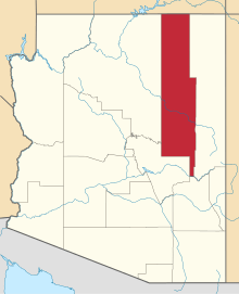 | |
|---|---|---|
| Towns | ||
| CDPs |
| |
| Unincorporated communities | ||
| Indian reservations |
| |
| Ghost towns | ||
| Footnotes | ‡This populated place also has portions in an adjacent county or counties | |