Show Low, Arizona
| Show Low, Arizona | |
|---|---|
| City | |
 | |
 Location in Navajo County and the state of Arizona | |
 Show Low Location in the United States | |
| Coordinates: 34°14′37″N 110°2′53″W / 34.24361°N 110.04806°W | |
| Country |
|
| State |
|
| County | Navajo |
| Founded | 1870 |
| Incorporated | 1953 |
| Government | |
| • Type | Council-Manager |
| • Body | Show Low City Council |
| • Mayor | Daryl Seymore (R) |
| Area | |
| • Total | 27.9 sq mi (72.3 km2) |
| • Land | 27.9 sq mi (72.1 km2) |
| • Water | 0.1 sq mi (0.2 km2) |
| Elevation[1] | 6,345 ft (1,934 m) |
| Population (2010)[2] | |
| • Total | 10,660 |
| • Estimate (2014)[3] | 10,841 |
| • Density | 382.08/sq mi (147.44/km2) |
| Time zone | Mountain (UTC-7) |
| • Summer (DST) | no DST/PDT (UTC−7) |
| ZIP codes | 85901, 85902, 85911 |
| Area code(s) | 928 |
| FIPS code | 04-66470 |
| GNIS ID(s) | 42850, 2411895 |
| Website | City of Show Low |
Show Low is a city in Navajo County, Arizona, United States. It lies on the Mogollon Rim in east central Arizona, at an elevation of 6,345 feet (1,934 m). The city was established in 1870 and incorporated in 1953. According to the 2010 census, the population of the city was 10,660.[2]
Name and history
According to a legend, the city's unusual name[4][5] resulted from a marathon poker game between Corydon E. Cooley and Marion Clark.
The two men were equal partners in a 100,000-acre (400 km2) ranch; however, the partners determined that there was not enough room for both of them in their settlement, and agreed to settle the issue over a game of poker (with the winner taking the ranch and the loser leaving).
After the game seemed to have no winner in sight, Clark said, "If you can show low, you win." In response, Cooley turned up the deuce of clubs (the lowest possible card) and replied, "Show low it is."[6]
As a tribute to the legend, Show Low's main street is named "Deuce of Clubs" in remembrance.[5]
In 2002, a large forest fire, the Rodeo-Chediski fire, threatened the city and forced an evacuation. The fire was extinguished less than a half mile from the city's border, and Show Low was completely spared. The city is near extensive forests, and is a popular recreational area.
Geography
Show Low is located at 34°14′37″N 110°2′53″W / 34.24361°N 110.04806°W (34.243595, -110.048173).[7]
According to the United States Census Bureau, the city has a total area of 27.9 square miles (72 km2), of which, 27.9 square miles (72 km2) of it is land and 0.1 square miles (0.26 km2) of it (0.25%) is water.
Climate
Winters in Show Low bring highs between 45 °F (7 °C) and 55 °F (13 °C), with lows usually below freezing between November and March, averaging in the 20s December through February, and in the low 30s for November and March.
In the summer, highs in Show Low average approximately 85 °F (29 °C), with an occasional day above 90 °F (32 °C) not uncommon for the city. As the sun sets in the summertime, temperatures plummet dramatically, sometimes upwards of 30 degrees. This nightly temperature swing results in summertime lows typically ranging between 50 °F (10 °C) and 60 °F (16 °C).
Show Low has reached below-freezing temperatures every month at least once in its history except July and August, where temperatures have only reached 38 °F (3 °C) and 37 °F (3 °C) respectively.
Show Low has twice reached 100 °F (38 °C), its record high temperature: once on May 31, 1969, and again on July 14, 2003. Show Low's record low temperature of -25 °F (-32 °C) was set on January 8, 1971.
Show Low averages about 18.3 inches (460 mm) of rain per year.
| Climate data for Show Low Airport, Arizona | |||||||||||||
|---|---|---|---|---|---|---|---|---|---|---|---|---|---|
| Month | Jan | Feb | Mar | Apr | May | Jun | Jul | Aug | Sep | Oct | Nov | Dec | Year |
| Record high °F (°C) | 69 (21) |
71 (22) |
77 (25) |
84 (29) |
100 (38) |
98 (37) |
100 (38) |
95 (35) |
93 (34) |
86 (30) |
77 (25) |
68 (20) |
100 (38) |
| Average high °F (°C) | 47.2 (8.4) |
52.4 (11.3) |
57.7 (14.3) |
65.6 (18.7) |
74.4 (23.6) |
84.6 (29.2) |
86.9 (30.5) |
83.9 (28.8) |
79.3 (26.3) |
68.8 (20.4) |
56.2 (13.4) |
47.7 (8.7) |
67.1 (19.5) |
| Average low °F (°C) | 22.9 (−5.1) |
26.4 (−3.1) |
31.4 (−0.3) |
36.4 (2.4) |
44.7 (7.1) |
53.2 (11.8) |
59.4 (15.2) |
57.7 (14.3) |
51.4 (10.8) |
40.1 (4.5) |
29.9 (−1.2) |
23.0 (−5) |
39.7 (4.3) |
| Record low °F (°C) | −25 (−32) |
−3 (−19) |
−7 (−22) |
4 (−16) |
14 (−10) |
30 (−1) |
38 (3) |
37 (3) |
25 (−4) |
12 (−11) |
−14 (−26) |
−22 (−30) |
−25 (−32) |
| Average precipitation inches (mm) | 1.32 (33.5) |
1.37 (34.8) |
1.45 (36.8) |
0.68 (17.3) |
0.72 (18.3) |
0.46 (11.7) |
2.18 (55.4) |
3.30 (83.8) |
1.78 (45.2) |
1.76 (44.7) |
1.52 (38.6) |
1.59 (40.4) |
18.13 (460.5) |
| Average snowfall inches (cm) | 4.5 (11.4) |
5.3 (13.5) |
5.9 (15) |
2.1 (5.3) |
0 (0) |
0 (0) |
0 (0) |
0 (0) |
0 (0) |
0.6 (1.5) |
2.5 (6.4) |
5.6 (14.2) |
26.5 (67.3) |
| Average precipitation days (≥ 0.01 in) | 6.2 | 5.7 | 6.8 | 4.5 | 4.2 | 3.3 | 11.1 | 13.5 | 7.2 | 5.6 | 4.8 | 5.2 | 78.1 |
| Average snowy days (≥ 0.1 in) | 1.8 | 1.6 | 2.0 | 0.7 | 0 | 0 | 0 | 0 | 0 | 0.2 | 0.9 | 1.7 | 8.9 |
| Source: NOAA [8][9] | |||||||||||||
Demographics
| Historical population | |||
|---|---|---|---|
| Census | Pop. | %± | |
| 1910 | 201 | — | |
| 1920 | 258 | 28.4% | |
| 1930 | 315 | 22.1% | |
| 1960 | 1,625 | — | |
| 1970 | 2,129 | 31.0% | |
| 1980 | 4,298 | 101.9% | |
| 1990 | 5,019 | 16.8% | |
| 2000 | 7,695 | 53.3% | |
| 2010 | 10,660 | 38.5% | |
| Est. 2015 | 10,860 | [10] | 1.9% |
| U.S. Decennial Census[11] 2014 Estimate[3] | |||
As of the census[12] of 2000, there were 7,695 people, 2,885 households, and 2,117 families residing in the city. The population density was 859 people per square mile (106.6/km²). There were 7186 housing units at an average density of 155.7 per square mile (60.1/km²). The racial makeup of the city was 90.3% White, 0.4% Black or African American, 3.2% Native American, 0.5% Asian, 0.1% Pacific Islander, 3.4% from other races, and 2.2% from two or more races. 9.4% of the population were Hispanic or Latino of any race.
There were 2,885 households out of which 34.8% had children under the age of 18 living with them, 58.2% were married couples living together, 11.1% had a female householder with no husband present, and 26.6% were non-families. 21.9% of all households were made up of individuals and 9.5% had someone living alone who was 65 years of age or older. The average household size was 2.62 and the average family size was 3.04.
In the city the population was spread out with 29.2% under the age of 18, 7.4% from 18 to 24, 24.9% from 25 to 44, 23.5% from 45 to 64, and 15.0% who were 65 years of age or older. The median age was 37 years. For every 100 females there were 95.1 males. For every 100 females age 18 and over, there were 88.5 males.
The median income for a household in the city was $32,356, and the median income for a family was $36,397. Males had a median income of $28,882 versus $24,590 for females. The per capita income for the city was $15,536. About 11.7% of families and 15.0% of the population were below the poverty line, including 23.6% of those under age 18 and 6.0% of those age 65 or over.
Transportation
Show Low Regional Airport (IATA: SOW, ICAO: KSOW) provides passenger airline service through Boutique Air to Phoenix and to Denver through Farmington, New Mexico; the airport maintains a single passenger terminal for this purpose. The airport is also commonly used for air cargo, air-taxi, and as a fixed-base operator for general aviation.
The city also maintains a minor public transportation operation in conjunction with neighboring Pinetop-Lakeside. Two shuttles service multiple retail, high-traffic, and government offices and also the airport and nearby Hon-Dah casino (57 stops in all).
Education
Almost all of the city is a part of the Show Low Unified School District. A portion of the city is within the boundaries of the Blue Ridge Unified School District.
Schools that serve the SLUSD portion of the city include Linden Elementary, Nikolaus Homestead Elementary, Whipple Ranch Elementary, White Mountain Institute, Show Low Junior High School, and Show Low High School.
Show Low is home to one of Northland Pioneer College's four regional campuses, the White Mountain Campus.
Economy
Top employers
According to the City's 2014 Comprehensive Annual Financial Report,[13] the top employers in the city are:
| # | Employer | # of Employees |
|---|---|---|
| 1 | Summit Healthcare Regional Medical Center | 900 |
| 2 | Walmart | 490 |
| 3 | Show Low Unified School District | 300 |
| 4 | Cellular One | 187 |
| 5 | City of Show Low | 153 |
| 6 | The Home Depot | 150 |
| 7 | Citizens Telecommunications Company of the White Mountains | 125 |
| 8 | Northland Pioneer College | 110 |
| 9 | Lowe's | 108 |
| 10 | Tate's Auto Group | 70 |
Notable residents
- Dan Deublein — American actor from the television series Beverly Hills, 90210.
- George Takei- American actor from the television series Star Trek. (Owns a vacation home in town)
- Mike Furyk - American golfer Jim Furyk's father
References
Schools, Show Low Unified School District Retrieved July 24, 2009
- ↑ "Feature Detail Report for: Show Low". Geographic Names Information System. United States Geological Survey.
- 1 2 "American FactFinder". United States Census Bureau. Retrieved 2014-08-05.
- 1 2 "Population Estimates". United States Census Bureau. Retrieved July 11, 2015.
- ↑ Thompson, George E. (2009). You Live Where?: Interesting and Unusual Facts about where We Live. iUniverse. p. 5.
- 1 2 Gallant, Frank K. (2012). A Place Called Peculiar: Stories about Unusual American Place-Names. Courier Dover Publications. p. 15.
- ↑ M.r. Montgomery (18 March 1996). Many Rivers to Cross: Of Good Running Water, Native Trout, and the Remains Of Wilderness. Simon and Schuster. p. 60. ISBN 978-0-684-81829-0.
- ↑ "US Gazetteer files: 2010, 2000, and 1990". United States Census Bureau. 2011-02-12. Retrieved 2011-04-23.
- ↑ "Climatography of the United States No. 20: SHOW LOW AP, AZ 1971–2000" (PDF). National Oceanic and Atmospheric Administration. Retrieved 2012-04-07.
- ↑ "NOAA". NOAA.
- ↑ "Annual Estimates of the Resident Population for Incorporated Places: April 1, 2010 to July 1, 2015". Retrieved July 2, 2016.
- ↑ "U.S. Decennial Census". Census.gov. Archived from the original on May 11, 2015. Retrieved August 5, 2014.
- ↑ "American FactFinder". United States Census Bureau. Retrieved 2008-01-31.
- ↑ "Comprehensive Annual Financial Report". City of Show Low, Arizona. 2014.
External links
Coordinates: 34°14′37″N 110°02′53″W / 34.243595°N 110.048173°W
| Cities | 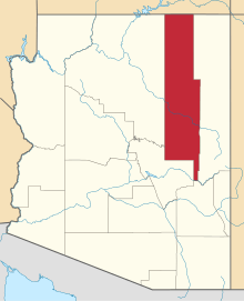 | |
|---|---|---|
| Towns | ||
| CDPs |
| |
| Unincorporated communities | ||
| Indian reservations |
| |
| Ghost towns | ||
| Footnotes | ‡This populated place also has portions in an adjacent county or counties | |