Sidney (village), New York
| Sidney, New York | |
|---|---|
| Village | |
 Sidney Location within the state of New York | |
| Coordinates: 42°18′29″N 75°23′47″W / 42.30806°N 75.39639°WCoordinates: 42°18′29″N 75°23′47″W / 42.30806°N 75.39639°W | |
| Country | United States |
| State | New York |
| County | Delaware |
| Town | Sidney |
| Area | |
| • Total | 2.39 sq mi (6.19 km2) |
| • Land | 2.37 sq mi (6.15 km2) |
| • Water | 0.02 sq mi (0.04 km2) |
| Elevation | 991 ft (302 m) |
| Population (2010) | |
| • Total | 3,900 |
| • Density | 1,643/sq mi (634.2/km2) |
| Time zone | Eastern (EST) (UTC-5) |
| • Summer (DST) | EDT (UTC-4) |
| ZIP code | 13838 |
| Area code(s) | 607 |
| FIPS code | 36-67334 |
| GNIS feature ID | 0965212 |
| Website |
villageofsidney |
Sidney is a village in Delaware County, New York, United States. The population was 3,900 at the 2010 census.[1] The village is in the west part of the town of Sidney.
History
The village was named for Admiral Sir Sidney Smith.[2]
Pioneer Cemetery and the Sidney Historic District are listed on the National Register of Historic Places.[3][4]
Notable inhabitants
- Lt. Col. Evans Carlson, US Marine Corps, leader of "Carlson's Rangers" in World War II
- Edward Howell, former US congressman
Geography
Sidney is located at the western end of the town of Sidney at 42°18′29″N 75°23′47″W / 42.30806°N 75.39639°W (42.308175, -75.396465),[5] on the south side of the Susquehanna River. It is in the northwest corner of Delaware County, bordered by Otsego County to the north across the Susquehanna, and by Chenango County to the west.
Interstate 88 passes just south of the village, with access from Exit 9 (New York State Route 8). I-88 leads northeast 23 miles (37 km) to Oneonta and southwest 36 miles (58 km) to Binghamton. Route 8 leads north 62 miles (100 km) to Utica and south 21 miles (34 km) to Deposit.
According to the United States Census Bureau, the village of Sidney has a total area of 2.4 square miles (6.2 km2), of which 0.02 square miles (0.04 km2), or 0.64%, is water.[1]
Demographics
| Historical population | |||
|---|---|---|---|
| Census | Pop. | %± | |
| 1890 | 1,358 | — | |
| 1900 | 2,331 | 71.6% | |
| 1910 | 2,507 | 7.6% | |
| 1920 | 2,670 | 6.5% | |
| 1930 | 2,444 | −8.5% | |
| 1940 | 3,012 | 23.2% | |
| 1950 | 4,815 | 59.9% | |
| 1960 | 5,157 | 7.1% | |
| 1970 | 4,789 | −7.1% | |
| 1980 | 4,861 | 1.5% | |
| 1990 | 4,720 | −2.9% | |
| 2000 | 4,068 | −13.8% | |
| 2010 | 3,900 | −4.1% | |
| Est. 2015 | 3,755 | [6] | −3.7% |
As of the census of 2010, the total population was 3,900 people (1,835 males, 2,065 females). The median age was 41.5 years, with 6.6% of the population under 5 years and 3.5% of the population 85 years and over. The age range with the lowest percentage of the population was 80 to 84 years with 2.3%. The age range with the highest percentage of the population was 50 to 54 years with 7.7%.[8]
The racial makeup of the village was 96.1% White, 0.8% Black or African American, 0.1% Native American, 1.1% Asian, 0.0% Pacific Islander, 0.5% from other races, and 1.4% from two or more races. Hispanic or Latino of any race were 2.3% of the population.[8]
There were 1,697 households (1,005 family households and 692 nonfamily households) residing in the village. The average household size was 2.28 and the average family size was 2.90.[8] The U.S. Census Bureau uses the following definitions: "Family households" consist of a householder and one or more other people related to the householder by birth, marriage, or adoption. They do not include same-sex married couples even if the marriage was performed in a state issuing marriage certificates for same-sex couples. Same-sex couple households are included in the family households category if there is at least one additional person related to the householder by birth or adoption. Same-sex couple households with no relatives of the householder present are tabulated in nonfamily households. "Nonfamily households" consist of people living alone and households which do not have any members related to the householder.[8]
As of the census[9] of 2000, there were 4,068 people, 1,748 households, and 1,054 families residing in the village. The population density was 1,722.7 people per square mile (665.5/km2). There were 1,951 housing units at an average density of 826.2 per square mile (319.2/km2). The racial makeup of the village was 95.99% White, 0.91% Black or African American, 0.42% Native American, 0.96% Asian, 0.02% Pacific Islander, 0.34% from other races, and 1.35% from two or more races. Hispanic or Latino of any race were 1.52% of the population.
There were 1,748 households out of which 30.4% had children under the age of 18 living with them, 42.1% were married couples living together, 14.0% had a female householder with no husband present, and 39.7% were non-families. 33.8% of all households were made up of individuals and 18.0% had someone living alone who was 65 years of age or older. The average household size was 2.29 and the average family size was 2.92.
In the village the population was spread out with 25.8% under the age of 18, 7.2% from 18 to 24, 24.6% from 25 to 44, 22.9% from 45 to 64, and 19.5% who were 65 years of age or older. The median age was 40 years. For every 100 females there were 86.7 males. For every 100 females age 18 and over, there were 82.5 males.
The median income for a household in the village was $27,411, and the median income for a family was $31,734. Males had a median income of $28,596 versus $23,125 for females. The per capita income for the village was $15,123. About 15.4% of families and 18.5% of the population were below the poverty line, including 27.8% of those under age 18 and 12.9% of those age 65 or over.
The Great Flood of 2006
In June 2006, Sidney, along with other parts of New York and Pennsylvania, was hit by severe flooding. Carr's Creek washed out a 50-foot-long (15 m) section of Interstate 88 east of Sidney. Around 6:20 am on Wednesday, June 28, two trucks from different directions drove into the chasm, apparently unaware of it, killing both drivers. David Swingle, 42, of Waverly, New York, who was driving westbound, was identified shortly after the accident. The eastbound trucker was Patrick O'Connell, 55, of Lisbon, Maine. His body was found downstream several days after the water receded.
The New York State Department of Transportation finished preliminary repairs on I-88 by the end of 2006. Additional construction was completed within the next year due to the settling of the highway.
The village itself was also flooded, particularly the westernmost part of the town on the south side of the Susquehanna River. Hardest hit were parts of Willow, Maple, Oak, Winegard, Bridge, and River streets, some of which took on over 4 feet (1.2 m) of muddy water during the flood, and repairs to many of the homes found therein are ongoing. Many other areas were also affected. The entire downtown area north of the railroad tracks was also evacuated due to the rising levels of the Susquehanna River.
References
- 1 2 "Geographic Identifiers: 2010 Demographic Profile Data (G001): Sidney village, New York". U.S. Census Bureau, American Factfinder. Retrieved November 10, 2015.
- ↑ "Profile for Sidney, New York". ePodunk. Retrieved 2010-06-06.
- ↑ National Park Service (2010-07-09). "National Register Information System". National Register of Historic Places. National Park Service.
- ↑ "National Register of Historic Places". Weekly List of Actions Taken on Properties: 9/02/13 through 9/06/13. National Park Service. 2013-09-13.
- ↑ "US Gazetteer files: 2010, 2000, and 1990". United States Census Bureau. 2011-02-12. Retrieved 2011-04-23.
- ↑ "Annual Estimates of the Resident Population for Incorporated Places: April 1, 2010 to July 1, 2015". Retrieved July 2, 2016.
- ↑ "Census of Population and Housing". Census.gov. Retrieved June 4, 2015.
- 1 2 3 4 "U.S. Census Bureau, "American FactFinder" Profile of General Population and Housing Characteristics: 2010 Demographic Profile Data". Retrieved October 2, 2016.
- ↑ "American FactFinder". United States Census Bureau. Retrieved 2008-01-31.
External links
Municipalities and communities of Delaware County, New York, United States | ||
|---|---|---|
| Towns | 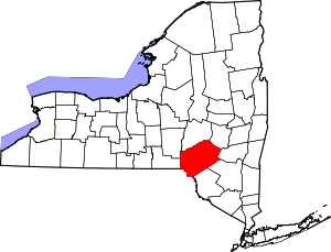 | |
| Villages | ||
| CDPs | ||
| Hamlets | ||
| Footnotes | ‡This populated place also has portions in an adjacent county or counties | |