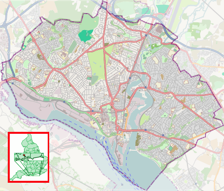
Shirley, Southampton
Coordinates: 50°55′18″N 1°25′56″W / 50.9218°N 1.4323°W
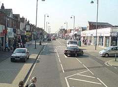
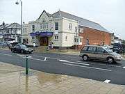
Shirley is a district on the Western side of Southampton, England. Shirley's main roles are retailing and residential. It is the most important suburban shopping area in the west of the city. Housing is a mixture of council houses in the centre of the district surrounded by private housing, with larger suburban houses concentrated in Upper Shirley. Shirley is separated from Highfield by Southampton Common, a large green park-like area which sees many dog-walkers, joggers.
It is part of the Southampton Test constituency, with Alan Whitehead as Member of Parliament.
History
The place-name "Shirley" means 'bright glade', from the Old English scir (bright) and leah (cleared land in a wood).[1] Local belief today suggests it was meant as a ' bright clearing in the woods', and later referenced to 'a place of hope' for those who settled there.
Shirley is recorded as a manor with a mill in the Domesday book, 1086. Shirley Mill originally stood to the west of the present Romsey Road/Winchester Road junction, at the confluence of the Hollybrook and Tanner's Brook streams. Shirley Mill had three large ponds, to the north of Winchester Road. Only one of those three mill ponds remains today, accessible by following the Lordswood Greenway. In 1887, The South of England Bread and Biscuit Company opened a works at Shirley Mill.[2] In the nineteenth century an iron works was built, which was converted into a brewery in 1880 and subsequently into a laundry at the beginning of the 20th century. The laundry was owned by Royal Mail and used to service the mail ships visiting Southampton.
The outflow from the mill was crossed by a ford on the Romsey Road. The stream is culverted under the major traffic junction which stands there, and continues to the Test to the east of modern Tebourba Way, open in parts and culverted in others. A further Mill was also constructed at what is now the Junction of Oakley Road and Tebourba Way. This site was later a paint factory known as Atlantic Works and mill buildings survive in commercial use on both sides of Oakley road astride the old mill leat.
The district grew rapidly in the 1830s following the enclosure of Shirley Common (not to be confused with Southampton Common) under an Act of Parliament passed in May 1829.[3] For example, the Hampshire Chronicle announced on Monday 12 April 1830 that "Several elegant villas are about to be erected on Shirley Common"[4] and the Commissioner announced in 1831 that he was ready to present his decisions.[5] On the 28 November 1830 in the context of the Swing riots there was a non violent protest in Shirley and Millbrook by laborers demanding increased wages.[6]The parish church was built in 1836.
The council estate was built in the 1960s to replace relatively dense terraced housing.
Shirley and Freemantle Local Board of Health


The Shirley Local board of health was established in 1853. It merged with Freemantle in 1880.[7] Shirley and Freemantle Urban District Council was formed on 2 January 1895 but was abolished on 8 November 1895 when the district became a suburb of Southampton.[8][9][10]
The Board originally met in Church Street but moved to Ravenswood in July 1885.[11] Ravenswood had previously been a house: the contents were auctioned off in 1870 following the bankruptcy of Mr. Gabriel Scott[12] who was, however, still living there in 1876.[13] It later became the headquarters of the Seventh-day Adventist Church in the British Isles.[14] The Board meetings held at Ravenswood are reported in detail in the Hampshire Advertiser. Regular subjects for discussion included the state of the roads, especially surfacing by rolling gravel and the introduction of kerbstones; drainage and sewerage; street lighting; wells; slaughterhouses; and infectious diseases. One meeting in 1893 received statistics concerning scarletina, typhoid fever, diphtheria, erysipelas, and smallpox.[15] Smallpox was a particular issue. At another 1893 meeting, concern was expressed about Southampton's smallpox hospital ship being anchored off Freemantle where children played on the beach.[16] The Board received reports from the South Stoneham Poor Law Union because that Union's responsibilities included "the parish of Millbrook" which "includes the hamlets of Hill, and Sidford, the tything of Millbrook, and the village of Shirley."[17]
In 1887 the Board constructed a drinking fountain to celebrate the Golden Jubilee of Queen Victoria. Originally in Shirley High Street, the fountain has now been incorporated into the shopping precinct. The fountain is Grade II listed.[18] Another was constructed at Fourposts.[19]
By 1892, Shirley and Freemantle Local Board of Health were considering building new offices on the Brooklyn estate, which the 1860s Ordnance Survey map shows to be consistent with the extant building's location. Plans were submitted in 1892 and a Public inquiry was held in January 1893.[15] The building has a foundation stone laid by W.A.Killby esq, chairman of the Shirley and Freemantle Local Board, 12 June 1893. The stone also mentions that H.J.West was the architect and F.Osman was the contractor. Speeches at the laying ceremony were used to attempt to justify the expense of the building, criticise Southampton for polluting the Itchen, and express resistance to Southampton ever annexing Shirley. The report in the Hampshire Advertiser also describes the building which would include an upstairs boardroom 30 ft long by 25 ft wide, and downstairs offices for the clerk, surveyor, inspector of nuisances, and the collector (of revenues).[20] A dinner to celebrate the opening of the new building was held on 12 January 1894.[21] After the move, Ravenswood appears to have been used again by the Seventh-day Adventist church.[22]
The Local Board became the Urban District Council in 1895 with the same membership. It dealt with similar issues, for example the 27 November meeting included a report about "how Shirley and Freemantle are drained" but actually about problems with the system.[23] It was to become preoccupied with the question of "Annexation" by Southampton which had recently been raised in some detail at a special meeting of the former Local Board on 28 November 1894. The Hampshire Advertiser report of the first UDC meeting, held on 2 January 1895, ended with "The 'Annexation' Scheme: At a special meeting of the Board, held on Saturday, it was resolved that one or two counsel be retained to represent the district at the forthcoming inquiry relative to the extension of the Southampton Borough boundaries." There was much concern about the impact of annexation on the rates, particularly given the incomplete state of mains water and drainage, but it was announced at 6 July meeting that these had been resolved.[24][25] Subsequent UDC meetings were no less skeptical and the Hampshire advertiser reports continue to use the word "annexation" throughout.
As abolition approached, the 16 October 1895 meeting started late and was brief. The subsequent meeting reported on 26 October was even briefer and concludes with "This was all the business".[26]
Transport

In the late 1800's the Didcot, Newbury and Southampton Railway planned to build a railway through Shirley, to a new station near Sothampton's Royal Pier. In the event the line was only built as far as Winchester Chesil Station. Deposited plans showed the line continuing South via Twyford, Chandlers Ford, Chilworth, Lordswood, the East side of Dale Valley, under Winchester Road, through land now occupied by Shirley Junior School and on to the East side of Hill Lane near Archers Road where there is a surviving (but never used) embankment to the North of Commercial Road. A story grew up that St James' Park, Southampton, in Shirley was to have been a local railway station (still repeated in books) but plans deposited with Hampshire Record Office for this and later versions of the same scheme show this not to have been the case, with the intended route of the railway passing to the North East.[27] Although some land was purchased and work undertaken, the large depression in which St James Park sits was in fact caused by gravel extraction, although there are Didcot, Newbury and Stratton (formerly Station) Roads to the South of this park. Station Road did contain a Police Station at one time. Nothing came of this or later similar schemes which finally petered out prior to World War One.
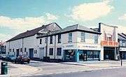
From 1879, a route of Southampton Corporation Tramways operated from Southampton via Fourposts Hill along Shirley High Street.[28] It ran until 1949 as far as what is now the current Shirley Precinct. This stop is still known as "Shirley Terminus" to some residents when using bus services. A large Tram depot was located in Carlisle Road, later being used as a bus depot until demolition in the 1980's.
Education
Shirley is home to several schools including Upper Shirley High School (formerly Bellemoor Boys School), Richard Taunton Sixth Form College (the Hill Lane site was formerly the Girls' Grammar[29]) and the 450-year-old King Edward VI School. The area is also served by Regents Park Community College (formerly Regents park Girls School). The Atherley School, founded in 1924,[30] was in Hill Lane from 1926 to 1997.
Shirley also has a mixture of both infant schools and junior schools for mixed abilities and genders.
Pubs
- Current and former public houses
 The Old Thatched House in Old Shirley
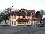 The Blacksmith's Arms, Old Shirley
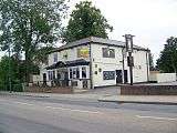 The Brass Monkey, formerly the Rising Sun
 The Crown, Shirley High Street
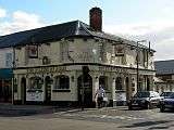 The Salisbury Arms
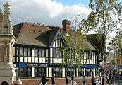 The Windsor Castle, Shirley High St
 The Shirley
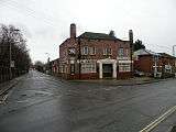 The Griffin, Anglesea Road
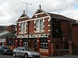 The King's Arms, Church Street
Cinemas
| Former cinemas | ||||||
|---|---|---|---|---|---|---|
|

Cemeteries

Southampton Old Cemetery is on the Shirley side of Southampton Common in Hill Lane. It was set out following an Act of Parliament passed in 1843.[31]
Hollybrook Cemetery is notable for being the resting place of several famous individuals, including the 1966 World Cup winning footballer Alan Ball (1945-2007) and the comedian Benny Hill (1924-1992). It also contains the Commonwealth War Graves Commission's (CWGC) Hollybrook Memorial to 1,883 Commonwealth land and air force personnel who were lost at sea in World War I and have no known grave; those listed include Field Marshal Earl Kitchener and those of his military entourage who were lost on HMS Hampshire in 1916, and most of the South African Native Labour Corps personnel who were lost in the sinking of SS Mendi in 1917.[32] The CWGC also maintain and register graves within the cemetery of 113 Commonwealth service personnel of World War I, most of them in a war graves plot before the Memorial, and 186 from World War II, including three unidentified Merchant Navy seamen, besides 67 non-Commonwealth war graves, mostly German (two of them unidentified).[33] It also contains the grave of Frederick Fleet, lookout of the RMS Titanic on the night of its loss in 1912. Fleet was buried in a pauper's grave which went unmarked until 1993, when a headstone bearing an engraving of the Titanic was erected through donations by the Titanic Historical Society.
See also
References
- ↑ John Ayto, Ian Crofton (2005). Brewer's Britain & Ireland. Weidenfeld & Nicolson. ISBN 0-304-35385-X.
- ↑ "The South of England Bread and Biscuit Company Limited". Hampshire Advertiser. 17 September 1887 – via British Newspaper Archive. (subscription required (help)).
- ↑ "Shirley July 29: The home for aged women". Hampshire Advertiser. 29 July 1876 – via British Newspaper Archive. (subscription required (help)).
- ↑ "Southampton". Hampshire Chronicle. 12 April 1830 – via British Newspaper Archive. (subscription required (help)).
- ↑ "Hill and Shirley Inclosure". Hampshire Advertiser. 9 April 1831.
(Under) An Act for inclosing Lands within the Tything of Hill and Shirley in the Parish of Millbrook in the County of Southampton ... I have ascertained the respective rights and interests of the several Leaseholders claiming, under Gifford Warriner and Arthur Atherley, esqrs. respectively in, over, and upon the Commons and waste grounds, lo be divided, allotted, and inclosed, by virtue of the said Act
- ↑ Patterson, A. Temple (1966). A History of Southampton 1700–1914 Vol.I An Oligarchy in Decline 1700–1835. The University of Southampton. p. 154-155.
- ↑ On 3 January 1880, the Hampshire Advertiser reported that Freemantle was seeking Local Board of Health status. On 23 June 1880, it reported that the Local Government Board had informed South Stoneham Union Board of Guardians that Freemantle's request had been refused. On 31 July 1880 it described the enquiry into a merger with Shirley and on 9 October 1880 it quoted a letter from the Local Government Board proposing the merger. By 5 November 1881, the Shirley Board was discussing its new name so the merger had gone ahead by then.
- ↑ Guilmant (ed), John (1997). Shirley from Domesday to D-Day. Southampton City Council.
- ↑ Rance, Adrian (1986). Shirley 1836–1986. St James Church, Shirley.
- ↑ Guilmant (ed), John (1983). Suburbs of Southampton III: Shirley. Local Studies Group, Southampton.
- ↑ "Southampton News: Shirley and Freemantle Local Board of Health". Hampshire Advertiser. 8 July 1885. p. 4 – via British Newspaper Archive. (subscription required (help)).
This board have removed their offices from Church-road (sic), Shirley, to Ravenswood, Shirley-road, and the first meeting in the new boardroom was held last (Tuesday) night, the inaugural assembly being of a rather turbulent character. The proceedings will be reported in Saturday's Advertiser.
- ↑ "Near bottom of column 3". Hampshire Advertiser. 16 April 1870. p. 4.
...including a drawing-room suite in rosewood, mahogany dining and breakfast-room furniture, large chimney glasses, Brussels and other carpets, rosewood pianoforte, French and eight-day clock, prints, ornaments, plated goods, sewing machine ; brass, iron, and other bed-steads, and furniture; mattress, feather beds and bedding, mahogany chamber furniture, china, glass, books, linen, gas fittings, kitchen requisites, &c
- ↑ Cox's Street Directory (PDF). p. 180.
Scott, Gabriel, bonemills, artificial manure merchant, Test Valley Works, Redbridge; private residence, Ravenswood, Shirley road, Freemantle
- ↑ "History of the British Union Conference Headquarters (page 4 in booklet)" (PDF).
- 1 2 "Shirley and Freemantle Local Board". Hampshire Advertiser. 7 January 1893. p. 7.
- ↑ "The Infectious Hospital Ship". Hampshire Advertiser. 18 February 1893.
- ↑ Fleming, H. (30 July 1862). A return of the area and population of the several Unions and Parishes in England and Wales; together with an Alphabetical Index to such Unions and Parishes. House of Commons.
- ↑ Southampton City Council: Listed buildings in Southampton Accessed 13 September 2007.
- ↑ Hampshire Advertiser. 7 December 1889.
The Finance Committee reported that the South Hants Water Company had sent in a claim of £4 8s for water supplied to the drinking fountains at Shirley and Four-posts
Missing or empty|title=(help) - ↑ Hampshire Advertiser. 14 June 1893. Missing or empty
|title=(help) - ↑ Hampshire Advertiser. 13 January 1894. Missing or empty
|title=(help) - ↑ "Southampton Adventist Church: About us". including a larger version of the image of Ravenswood in c.1900
- ↑ Hampshire Advertiser. 27 November 1895. Missing or empty
|title=(help) - ↑ "The extension of the Southampton borough boundaries: a settlement arrived at". Hampshire Advertiser. 6 July 1895.
- ↑ The issue of parity of payments given disparity of mains services also came up at a South Stoneham Union Board of Governors meeting reported in the Hampshire Advertiser on Saturday 17 August 1895
- ↑ Hampshire Advertiser. 26 October 1895.
The Shirley District Council dies hard. Although the time is near at hand when the whole neighbourhood will be included within the boundaries of the borough of Southampton, the members intend to faithfully carry out their duties to the last hour.
Missing or empty|title=(help) - ↑ Deposited Plans Hampshire Record Office Collection DP/384/1 Didcot Newbury and Southampton Junction Railway: deposited plan 1881
- ↑ "The Shirley Tramways". Hampshire Advertiser. 11 June 1879. p. 3 – via British Newspaper Archive. The article describes the celebrations. It also comments on associated road improvements which had taken place at Fourposts Hill but were still needed at Tintern Grove (which was south-east of its current location).
- ↑ "Old Tauntonians' Association". Retrieved 1 January 2015.
- ↑ "A new future for Embley Park and The Atherley Schools" (PDF). 2004. Retrieved 22 August 2015.
- ↑ "Friends of Southampton Old Cemetery: The History of the Cemetery". Retrieved 8 January 2015.
- ↑ Hollybrook Memorial CWGC Cemetery Report
- ↑ Hollybrook Cemetery CWGC Cemetery Report
 |
Lordshill | Coxford | Bassett | |
| Millbrook, Hampshire | |
Southampton Common | ||
| ||||
| | ||||
| Freemantle | Southampton City Centre |
External links
| Wikimedia Commons has media related to Shirley, Southampton. |
- Shirley Baptist Church
- Shirley Junior School
- Southern life: Shirley
- St Boniface (Roman Catholic) Church
- Southampton Christadelphian Church
Areas and suburbs of Southampton | |||||||||
|---|---|---|---|---|---|---|---|---|---|
| |||||||||
| Southampton Itchen |
| ||||||||
| Southampton Test | |||||||||
| Romsey and Southampton North | |||||||||
| |||||||||