Shire of Kalamunda
This article is about a local government authority. For the suburb, see Kalamunda, Western Australia.
| Shire of Kalamunda Western Australia | |||||||||||||
|---|---|---|---|---|---|---|---|---|---|---|---|---|---|
 | |||||||||||||
| Population | 60,830 (2015 est)[1] | ||||||||||||
| • Density | 187.63/km2 (485.96/sq mi) | ||||||||||||
| Established | 1897 | ||||||||||||
| Area | 324.2 km2 (125.2 sq mi) | ||||||||||||
| President | Andrew Waddell | ||||||||||||
| Council seat | Kalamunda | ||||||||||||
| Region | Eastern Metropolitan Perth Darling Scarp | ||||||||||||
| State electorate(s) | Darling Range, Forrestfield, Kalamunda | ||||||||||||
| Federal Division(s) | Hasluck, Pearce | ||||||||||||
|
| |||||||||||||
| Website | Shire of Kalamunda | ||||||||||||
| |||||||||||||
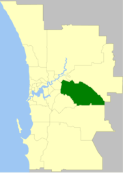
The Shire of Kalamunda is a local government area in the eastern metropolitan region of the Western Australian capital city of Perth about 25 kilometres (15.5 mi) east of Perth's central business district. The Shire covers an area of 324.2 square kilometres (125.2 sq mi), much of which is state forest rising into the Darling Scarp to the east. It has a population of 53,567 (2011), making it the most populous shire (as opposed to cities or towns) in Western Australia.
History
The Darling Range Road District was gazetted in 1897. On 1 July 1961, it became the Shire of Kalamunda after the enactment of the Local Government Act 1960.[2]
Wards
The shire has been divided into five wards.
- East Ward (one councillor)
- North Ward (three councillors)
- North West Ward (two councillors)
- South Ward (three councillors)
- South West Ward (three councillors)
Suburbs
Population
| Historical population | |||||||||||||||||||||||||||||||||||||||||||||||||||||||
|---|---|---|---|---|---|---|---|---|---|---|---|---|---|---|---|---|---|---|---|---|---|---|---|---|---|---|---|---|---|---|---|---|---|---|---|---|---|---|---|---|---|---|---|---|---|---|---|---|---|---|---|---|---|---|---|
|
| ||||||||||||||||||||||||||||||||||||||||||||||||||||||
References
- ↑ "3218.0 – Regional Population Growth, Australia, 2014–15". Australian Bureau of Statistics. Retrieved 29 September 2016.
- ↑ WA Electoral Commission, Municipality Boundary Amendments Register (release 3.0), 31 July 2007.
External links
Coordinates: 31°58′26″S 116°03′29″E / 31.974°S 116.058°E
This article is issued from Wikipedia - version of the 11/21/2016. The text is available under the Creative Commons Attribution/Share Alike but additional terms may apply for the media files.