Shire of Chapman Valley
| Shire of Chapman Valley Western Australia | |||||||||||||
|---|---|---|---|---|---|---|---|---|---|---|---|---|---|
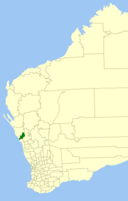 Location in Western Australia | |||||||||||||
| Population | 1,214 (2013 est)[1] | ||||||||||||
| • Density | 0.30620/km2 (0.7931/sq mi) | ||||||||||||
| Established | 1901 | ||||||||||||
| Area | 3,964.7 km2 (1,530.8 sq mi) | ||||||||||||
| President | John Collingwood | ||||||||||||
| Council seat | Nabawa | ||||||||||||
| Region | Mid West | ||||||||||||
| State electorate(s) | Moore | ||||||||||||
| Federal Division(s) | Durack | ||||||||||||
|
| |||||||||||||
| Website | Shire of Chapman Valley | ||||||||||||
| |||||||||||||
The Shire of Chapman Valley is a local government area located in the Mid West region of Western Australia, immediately northeast of the city of Geraldton and about 440 kilometres (273 mi) north of Perth, the state capital. The Shire covers an area of 3,965 square kilometres (1,531 sq mi) and its seat of government is the small town of Nabawa.
History
The Upper Chapman Road District was established on 25 January 1901. On 28 March 1958, it was renamed to Chapman Valley Road District and on 1 July 1961, it became a Shire under the Local Government Act 1960.[2]
Wards
The Shire has been divided into 3 wards, each with 3 councillors:
- Central Ward
- Southwest Ward
- Yuna Ward
Towns
- Nabawa
- Howatharra
- Mount Erin
- Nanson
- Naraling
- Narra Tarra
- Oakajee
- Protheroe
- Rockwell
- Whelarra
- Yetna
- Yuna
Population
| Year | Population |
|---|---|
| 1921 | 1,167 |
| 1933 | 1,468 |
| 1947 | 1,233 |
| 1954 | 1,550 |
| 1961 | 1,469 |
| 1966 | 806 |
| 1971 | 845 |
| 1976 | 867 |
| 1981 | 852 |
| 1986 | 771 |
| 1991 | 776 |
| 1996 | 782 |
| 2001 | 875 |
| 2006 | 914 |
| 2009 | 1069 |
References
- ↑ "3218.0 Regional Population Growth, Australia. Table 5. Estimated Resident Population, Local Government Areas, Western Australia". 3 April 2014. Retrieved 11 September 2014.
- ↑ WA Electoral Commission, Municipality Boundary Amendments Register (release 2.0), 31 May 2003.
External links
Coordinates: 28°30′00″S 114°47′20″E / 28.500°S 114.789°E
This article is issued from Wikipedia - version of the 11/27/2016. The text is available under the Creative Commons Attribution/Share Alike but additional terms may apply for the media files.