City of Gosnells
| City of Gosnells Western Australia | |||||||||||||
|---|---|---|---|---|---|---|---|---|---|---|---|---|---|
 | |||||||||||||
| Population | 125,051 (2015 est)[1] | ||||||||||||
| • Density | 977/km2 (2,530/sq mi) | ||||||||||||
| Established | 1907 | ||||||||||||
| Area | 128 km2 (49.4 sq mi) | ||||||||||||
| Mayor | Cr Olwen Searle | ||||||||||||
| Council seat | Gosnells | ||||||||||||
| Region | SE Metropolitan Perth | ||||||||||||
| State electorate(s) | Cannington, Gosnells, Jandakot, Kalamunda, Southern River | ||||||||||||
| Federal Division(s) | Hasluck, Canning | ||||||||||||
|
| |||||||||||||
| Website | City of Gosnells | ||||||||||||
| |||||||||||||
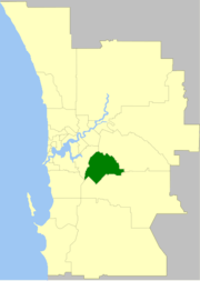
The City of Gosnells is a local government area in the southeastern suburbs of the Western Australian capital city of Perth, located northwest of Armadale and about 20 kilometres (12 mi) southeast of Perth's central business district. The City covers an area of 128 square kilometres (49.42 sq mi), much of which is state forest rising into the Darling Scarp to the east, and had a population of 106,585 at the 2011 Census.
History
The name Gosnells dates back to 1862 when Charles Gosnell who was the owner of London cosmetic company John Gosnell & Co., bought Canning location 16 from the Davis family who were the original grantees in 1829. While the purchase of the land was a personal investment by Charles Gosnell, when the land was sold to developers in 1903 the developers used the association to the well known cosmetic company, claiming it had bought the land because of its fertile soil to grow flowers for the manufacture of its perfume range. The abundance of the Arum Lily (Zantedeschia aethiopica) in the area and the marketing by the developers contributed to the myth about the Gosnell company, being so successful that the Gosnells railway station was constructed on the Armadale line in 1903.[2][3]
Gosnells Road District was created out of the abolished Canning Road District on 1 July 1907. Industry in the form of brickworks were introduced to Beckenham in the early 1990s. Between 1912-15 fruit fly wiped out nearly all of the stone fruit crops in the region and many farmers turned to dairying and market gardening. Irrigation was vital due to sandy, infertile soils of Canning Vale. In 1923, the City received land from Jandakot Road District when that entity was abolished. Significant development did not occur until the post-war years. The population grew from 7,400 in 1954 to about 11,000 in 1966, and then to 21,000 in 1970.[4] On 1 July 1961, Gosnells Road District became a Shire following enactment of the Local Government Act 1960. On 1 July 1973 it became a Town and exactly four years later it attained City status.[5]
The primary housing market role that the City has been to provide affordable home owning opportunities for families and prospective families from southern Perth. This role is likely to continue in the short term with the continued development of the growth areas of Canning Vale and Southern River and the re-zoning of market gardens for residential development; however, in the longer term, these patterns are expected to change. The availability of large tracts of 'greenfield' land and suitable sites is decreasing within the City, whilst significant sites are being made available in the neighbouring area of the City of Armadale, which is likely, in future, to meet an increasing proportion of the regional demand for housing.
Mayors
The present mayor is Cr Olwen Searle.
Wards
There are currently no wards within the City of Gosnells with the entire electorate represented by 12 councillors. The mayor is now elected by popular vote from the elected councillors.
Prior to 2011, the city was divided into 3 wards, each of 4 councillors. The mayor was directly elected. The three wards were:
- Canning Vale Ward
- Bickley Ward
- Gosnells Ward
Suburbs
- Beckenham
- Canning Vale *
- Gosnells
- Huntingdale
- Kenwick
- Langford
- Maddington
- Martin
- Orange Grove
- Southern River
- Thornlie
( * indicates suburb partially located within City)
Population
| Year | Population |
|---|---|
| 1911 | 737 |
| 1921 | 1,936 |
| 1933 | 3,016 |
| 1947 | 4,405 |
| 1954 | 7,366 |
| 1961 | 7,524 |
| 1966 | 11,374 |
| 1971 | 22,040 |
| 1976 | 40,422 |
| 1981 | 52,419 |
| 1986 | 60,610 |
| 1991 | 69,342 |
| 1996 | 73,421 |
| 2001 | 79,782 |
| 2006 | 91,579 |
| 2011 | 106,585 |
References
- ↑ "3218.0 – Regional Population Growth, Australia, 2014–15". Australian Bureau of Statistics. Retrieved 29 September 2016.
- ↑ "A Condensed History" (PDF). Retrieved 2015-07-14., City of Gosnells 2007
- ↑ "North Otago Times, Volume IX, Issue 262, 26 November 1867, Page 1". Papers Past. Retrieved 2008-04-23., 1867 the arrival of perfumes Direct from John Gosnells & Co., Perfumers to Her Majesty(Queen Victoria), was noted in the business section of the New Zealand newspaper North Otago Times
- ↑ http://forecast2.id.com.au/templates/forecast2/Clients/328Gosn/PDF/10.pdf
- ↑ WA Electoral Commission, Municipality Boundary Amendments Register (release 2.0), 31 May 2003.
External links
- Official website
- City of Gosnells Population and Housing Forecasts, 2011
Coordinates: 32°04′19″S 115°59′42″E / 32.072°S 115.995°E