Shaw-cum-Donnington
| Shaw-cum-Donnington | |
 Lake, lawn and house at Donnington Grove, the area's hotel resort. |
|
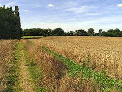 Public footpath across barley field, typical of the north of the area. |
|
 Shaw-cum-Donnington |
|
| Area | 8.6 km2 (3.3 sq mi) |
|---|---|
| Population | 1,686 (2011 census)[1] |
| – density | 196/km2 (510/sq mi) |
| OS grid reference | SU4767 |
| – London | 51 miles (82 km)[2] |
| Civil parish | Shaw cum Donnington |
| Unitary authority | West Berkshire |
| Ceremonial county | Berkshire |
| Region | South East |
| Country | England |
| Sovereign state | United Kingdom |
| Post town | NEWBURY |
| Postcode district | RG14, RG18 (small part) |
| Dialling code | 01635 |
| Police | Thames Valley |
| Fire | Royal Berkshire |
| Ambulance | South Central |
| EU Parliament | South East England |
| UK Parliament | Newbury |
Coordinates: 51°24′54″N 1°18′54″W / 51.415°N 1.315°W
Shaw-cum-Donnington is a civil parish in West Berkshire, Berkshire, England with all of its urban or suburban area immediately north of (contiguous with) the largest town in the district, Newbury. It comprises the villages of Shaw and Donnington and contains the partially ruined castle of Donnington Castle which has most of its various outside walls intact.
Geography
The area is mostly green space but where developed is almost entirely residential with shops and cafés. It has housing immediately north of (contiguous with) the town of Newbury. It comprises the villages of Shaw and Donnington and contains the partially ruined castle of Donnington Castle which has most of its various outside walls intact.
Amenities
The ecclesiastical parish church which crosses the River Lambourn bounding the civil parish to the south for a few hundred metres, is of the same name and otherwise of about the same borders. It has one church which has an active Church of England community at Shaw.[3]
Shaw, the eastern clustered development also has the area's Church of England primary school.
Demography
| Output area | Homes owned outright | Owned with a loan | Socially rented | Privately rented | Other | km² roads | km² water | km² domestic gardens | Usual residents | km² |
|---|---|---|---|---|---|---|---|---|---|---|
| Civil parish | 231 | 216 | 162 | 83 | 13 | 0.240 | 0.110 | 0.494 | 1686 | 8.6 |
References
External links
![]() Media related to Shaw cum Donnington at Wikimedia Commons
Media related to Shaw cum Donnington at Wikimedia Commons