Seneca, Kansas
| Seneca, Kansas | |
|---|---|
| City | |
 Location within Nemaha County and Kansas | |
 KDOT map of Nemaha County (legend) | |
| Coordinates: 39°50′8″N 96°3′58″W / 39.83556°N 96.06611°WCoordinates: 39°50′8″N 96°3′58″W / 39.83556°N 96.06611°W | |
| Country | United States |
| State | Kansas |
| County | Nemaha |
| Government | |
| • Type | Mayor–Council |
| Area[1] | |
| • Total | 1.63 sq mi (4.22 km2) |
| • Land | 1.63 sq mi (4.22 km2) |
| • Water | 0 sq mi (0 km2) |
| Elevation | 1,138 ft (347 m) |
| Population (2010)[2] | |
| • Total | 1,991 |
| • Estimate (2012[3]) | 1,993 |
| • Density | 1,200/sq mi (470/km2) |
| Time zone | Central (CST) (UTC-6) |
| • Summer (DST) | CDT (UTC-5) |
| ZIP code | 66538 |
| Area code | 785 |
| FIPS code | 20-63950 [4] |
| GNIS feature ID | 0472949 [5] |
| Website | Seneca-Kansas.us |
Seneca is a city in and the county seat of Nemaha County, Kansas, United States.[6] As of the 2010 census, the city population was 1,991.[7]
History
.jpg)
Seneca was founded in 1857. It was named after Seneca County, Ohio.[8]
The first post office in Seneca was established in November 1858.[9]
Seneca grew up along the wagon route from St. Joseph, Missouri to Oregon and California. British explorer Richard Francis Burton en route to California in 1860 passed through town and noted: "... Seneca, a city consisting of a few shanties ..."[10]
Seneca was a station on the Pony Express of the early 1860s. The station was located in the Smith Hotel, at the present-day location of Fourth and Main Streets.[11]
Seneca was incorporated as a city in 1870.[12]
Geography
According to the United States Census Bureau, the city has a total area of 1.63 square miles (4.22 km2), all land.[1]
Demographics
| Historical population | |||
|---|---|---|---|
| Census | Pop. | %± | |
| 1880 | 1,203 | — | |
| 1890 | 2,032 | 68.9% | |
| 1900 | 1,846 | −9.2% | |
| 1910 | 1,806 | −2.2% | |
| 1920 | 1,885 | 4.4% | |
| 1930 | 1,864 | −1.1% | |
| 1940 | 2,015 | 8.1% | |
| 1950 | 1,911 | −5.2% | |
| 1960 | 2,072 | 8.4% | |
| 1970 | 2,182 | 5.3% | |
| 1980 | 2,389 | 9.5% | |
| 1990 | 2,027 | −15.2% | |
| 2000 | 2,122 | 4.7% | |
| 2010 | 1,991 | −6.2% | |
| Est. 2015 | 2,034 | [13] | 2.2% |
| U.S. Decennial Census | |||
2010 census
As of the census[2] of 2010, there were 1,991 people, 908 households, and 509 families residing in the city. The population density was 1,221.5 inhabitants per square mile (471.6/km2). There were 982 housing units at an average density of 602.5 per square mile (232.6/km2). The racial makeup of the city was 98.6% White, 0.4% African American, 0.2% Native American, 0.1% Asian, 0.1% Pacific Islander, 0.3% from other races, and 0.4% from two or more races. Hispanic or Latino of any race were 0.7% of the population.
There were 908 households of which 21.8% had children under the age of 18 living with them, 47.6% were married couples living together, 6.3% had a female householder with no husband present, 2.2% had a male householder with no wife present, and 43.9% were non-families. 40.5% of all households were made up of individuals and 22.7% had someone living alone who was 65 years of age or older. The average household size was 2.09 and the average family size was 2.84.
The median age in the city was 49.2 years. 20.2% of residents were under the age of 18; 4.8% were between the ages of 18 and 24; 18.3% were from 25 to 44; 28.7% were from 45 to 64; and 28.2% were 65 years of age or older. The gender makeup of the city was 48.5% male and 51.5% female.
2000 census
As of the census[4] of 2000, there were 2,122 people, 897 households, and 539 families residing in the city. The population density was 1,375.0 people per square mile (532.0/km²). There were 978 housing units at an average density of 633.7 per square mile (245.2/km²). The racial makeup of the city was 98.82% White, 0.42% African American, 0.05% Native American, 0.05% Asian, 0.05% from other races, and 0.61% from two or more races. Hispanic or Latino of any race were 0.66% of the population.
There were 897 households out of which 27.9% had children under the age of 18 living with them, 52.7% were married couples living together, 5.5% had a female householder with no husband present, and 39.8% were non-families. 36.9% of all households were made up of individuals and 23.4% had someone living alone who was 65 years of age or older. The average household size was 2.29 and the average family size was 3.06.
In the city the population was spread out with 25.5% under the age of 18, 6.1% from 18 to 24, 22.0% from 25 to 44, 19.4% from 45 to 64, and 27.0% who were 65 years of age or older. The median age was 42 years. For every 100 females there were 86.6 males. For every 100 females age 18 and over, there were 84.6 males.
The median income for a household in the city was $31,288, and the median income for a family was $40,819. Males had a median income of $27,875 versus $16,944 for females. The per capita income for the city was $19,076. About 4.4% of families and 7.1% of the population were below the poverty line, including 6.8% of those under age 18 and 8.0% of those age 65 or over.
Notable people
- John Riggins, Pro Football Hall of Famer
- Ira K. Wells, Judge, United States District Court for the District of Puerto Rico
- Edward White, Philippine–American War veteran and recipient of the Medal of Honor
References
- 1 2 "US Gazetteer files 2010". United States Census Bureau. Retrieved 2012-07-06.
- 1 2 "American FactFinder". United States Census Bureau. Retrieved 2012-07-06.
- ↑ "Population Estimates". United States Census Bureau. Retrieved 2013-05-29.
- 1 2 "American FactFinder". United States Census Bureau. Retrieved 2008-01-31.
- ↑ "US Board on Geographic Names". United States Geological Survey. 2007-10-25. Retrieved 2008-01-31.
- ↑ "Find a County". National Association of Counties. Retrieved 2011-06-07.
- ↑ "2010 City Population and Housing Occupancy Status". U.S. Census Bureau. Retrieved March 27, 2011.
- ↑ Kansas State Historical Society (1916). Biennial Report of the Board of Directors of the Kansas State Historical Society. Kansas State Printing Plant. p. 249.
- ↑ "Kansas Post Offices, 1828-1961 (archived)". Kansas Historical Society. Archived from the original on October 9, 2013. Retrieved 18 June 2014.
- ↑ Richard Burton, (1862) The Look of the West 1860, Lincoln: Univ. Nebraska Press, reprint, n.d., p.27.
- ↑ "Kansas Stations". XP Pony Express Home Station. Retrieved March 2016. Check date values in:
|access-date=(help) - ↑ Blackmar, Frank Wilson (1912). Kansas: A Cyclopedia of State History, Volume 2. Standard Publishing Company. p. 668.
- ↑ "Annual Estimates of the Resident Population for Incorporated Places: April 1, 2010 to July 1, 2015". Retrieved July 2, 2016.
Further reading
- History of the State of Kansas; William G. Cutler; A.T. Andreas Publisher; 1883. (Online HTML eBook)
- Kansas : A Cyclopedia of State History, Embracing Events, Institutions, Industries, Counties, Cities, Towns, Prominent Persons, Etc; 3 Volumes; Frank W. Blackmar; Standard Publishing Co; 944 / 955 / 824 pages; 1912. (Volume1 - Download 54MB PDF eBook),(Volume2 - Download 53MB PDF eBook), (Volume3 - Download 33MB PDF eBook)
External links
| Wikimedia Commons has media related to Seneca, Kansas. |
- City
- Schools
- USD 115, local school district
- Maps
- Seneca City Map, KDOT
Municipalities and communities of Nemaha County, Kansas, United States | ||
|---|---|---|
| Cities | 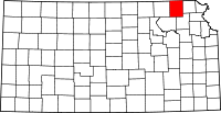 | |
| CDP | ||
| Unincorporated communities | ||
| Footnotes | ‡This populated place also has portions in an adjacent county or counties | |