Selfoss (town)
| Selfoss | |
|---|---|
| Town | |
|
Night view in December | |
 Location of the Municipality of Árborg | |
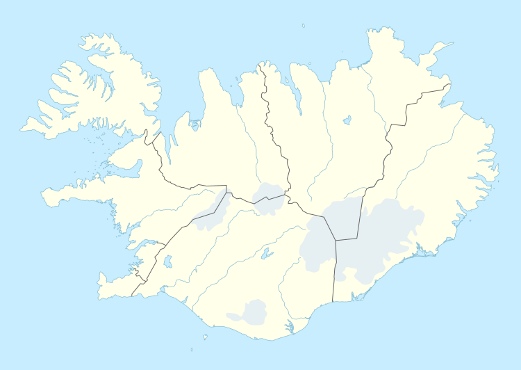 Selfoss Location in Iceland | |
| Coordinates: 63°56′N 21°00′W / 63.933°N 21.000°WCoordinates: 63°56′N 21°00′W / 63.933°N 21.000°W | |
| Country |
|
| Constituency[1] | South Constituency |
| Region[2] | Southern Region |
| Municipality | Árborg |
| Area | |
| • Total | 2 km2 (0.8 sq mi) |
| Population (2011) | |
| • Total | 6,512 |
| • Density | 3,137/km2 (8,120/sq mi) |
| Time zone | GMT (UTC+0) |
| Website | Official website |

Selfoss is a town in southern Iceland on the banks of the Ölfusá river.
It is a part of, and the seat, of the municipality of Árborg. The Icelandic Ring Road (Icelandic: Hringvegur) runs through the town on its way between Hveragerði and Hella. The town is a centre of commerce and small industries with a population of 6,512 (2011), making it the largest residential area in South Iceland.
Geography
The town is located about 11 km inland from the southwestern coast of Iceland, and 50 km from Reykjavík. It is the major town and the administrative seat of the Southern Region. The closest other towns are Eyrarbakki, Stokkseyri and Hveragerði.
Climate
| Climate data for Reykir í Ölfusi (1972-2000), 11.8 km (7.3 mi) from Selfoss | |||||||||||||
|---|---|---|---|---|---|---|---|---|---|---|---|---|---|
| Month | Jan | Feb | Mar | Apr | May | Jun | Jul | Aug | Sep | Oct | Nov | Dec | Year |
| Record high °C (°F) | 10.5 (50.9) |
9.3 (48.7) |
12.1 (53.8) |
14.0 (57.2) |
19.8 (67.6) |
22.6 (72.7) |
27.5 (81.5) |
25.5 (77.9) |
18.5 (65.3) |
15.1 (59.2) |
11.0 (51.8) |
10.8 (51.4) |
27.5 (81.5) |
| Average high °C (°F) | 2.0 (35.6) |
2.4 (36.3) |
2.6 (36.7) |
5.2 (41.4) |
9.2 (48.6) |
12.0 (53.6) |
13.9 (57) |
13.1 (55.6) |
10.2 (50.4) |
6.5 (43.7) |
3.6 (38.5) |
2.3 (36.1) |
6.92 (44.46) |
| Daily mean °C (°F) | −0.3 (31.5) |
0.2 (32.4) |
0.4 (32.7) |
2.5 (36.5) |
6.1 (43) |
8.8 (47.8) |
10.7 (51.3) |
10.2 (50.4) |
7.5 (45.5) |
4.4 (39.9) |
1.5 (34.7) |
−0.1 (31.8) |
4.32 (39.79) |
| Average low °C (°F) | −2.8 (27) |
−2.3 (27.9) |
−2.2 (28) |
0.1 (32.2) |
3.7 (38.7) |
6.5 (43.7) |
8.5 (47.3) |
8.2 (46.8) |
5.2 (41.4) |
2.2 (36) |
−0.7 (30.7) |
−2.4 (27.7) |
2 (35.62) |
| Record low °C (°F) | −19.7 (−3.5) |
−19.3 (−2.7) |
−18.9 (−2) |
−18.8 (−1.8) |
−8.2 (17.2) |
−3.0 (26.6) |
0.5 (32.9) |
−1.2 (29.8) |
−6.4 (20.5) |
−14.9 (5.2) |
−17.9 (−0.2) |
−19.8 (−3.6) |
−19.8 (−3.6) |
| Average precipitation mm (inches) | 94.2 (3.709) |
96.4 (3.795) |
95.4 (3.756) |
81.7 (3.217) |
65.6 (2.583) |
78.2 (3.079) |
71.8 (2.827) |
101.9 (4.012) |
100.1 (3.941) |
119.9 (4.72) |
103.5 (4.075) |
104.8 (4.126) |
1,113.5 (43.84) |
| Average precipitation days (≥ 0.1 mm) | 17.7 | 16.8 | 18.4 | 16.8 | 15.2 | 16.2 | 16.1 | 16.9 | 16.8 | 18.8 | 16.1 | 18.1 | 203.9 |
| Mean monthly sunshine hours | 21.9 | 47.5 | 101.0 | 139.8 | 161.6 | 152.8 | 144.6 | 122.0 | 112.2 | 79.8 | 42.1 | 15.0 | 1,140.3 |
| Source #1: Icelandic Met Office (extremes 1957-2015 for Eyrarbakki-11 km (7 mi) from Selfoss) [3][4] | |||||||||||||
| Source #2: Icelandic Met Office (precipitation 1961-90 for Lækjarbakki precipitation station in the town of Selfoss, precipitation days 1961-90 for Forsæti-17 km (10 mi) from Selfoss) [5][6] | |||||||||||||
History
Name
Although "foss" means waterfall in Icelandic, there are no waterfalls in the town.
Overview
Selfoss was settled by Þórir Ásason sometime after 1000; however, the Icelandic sagas mention that Ingólfur Arnarson was here during the winter of 873-74 under the Ingólfsfjall mountain, which is west of the Ölfusá river.
In the summer of 1891, due to the lobbying of Tryggvi Gunnarsson, a member of the Alþing, the first suspension bridge was built over the Ölfusá. This was a major breakthrough in Icelandic infrastructure. The bridge made the town a logical centre for services for the surrounding agricultural region. The current bridge was built in 1945 after the original structure collapsed.
In 1900 the town was home to only 40 inhabitants, but by 2011 the population had climbed to 6,500.
In 1931 the dairy firm Mjólkurbú Flóamanna and general store Kaupfélag Árnesinga were established. These two companies were the main employers in the area for several decades. During World War II the British stationed troops at Selfoss to guard the strategic bridge.
Present day
Today, with more efficient transportation, Selfoss benefits from its proximity to the Reykjavík area and is predicted to grow further in the coming years as businesses and residents relocate to the town because of lower property prices. This has also led to many relocating their homes from Reykjavík to the much calmer Selfoss. It enjoys low rates of unemployment and is the home of one of the largest colleges in the country; FSU Fjölbrautaskóli Suðurlands. In early August, the town holds a festival called "Sumar á Selfossi", meaning "Summer in Selfoss". Local residents decorate their gardens with ribbons, coloured according to neighbourhood, and a fete is held on the public grassland behind the civic library. The fete involves the selling of homemade goods on small stalls, performances by musicians and magicians on a temporary stage, and in 2011, a "Strongest Man" competition was held, with video recording by Icelandic television channel Stöð 2. In the evening, the revelry continues with a large bonfire and free fireworks display.
Selfoss is the town in which the former World Chess Champion Bobby Fischer is buried.[7]
2008 earthquake
| Wikinews has related news: Strong earthquake strikes southwestern Iceland |
According to the United States Geological Survey, an earthquake with a moment magnitude of 6.3 occurred near Selfoss on the afternoon of Thursday 29 May 2008, causing considerable damage to some buildings and roads.[8][9] The earthquake was felt across southern Iceland, including in the capital Reykjavík and the airbase at Keflavik. At least 30 people were injured; however, there were no reports of human deaths.[10] A number of sheep in the Selfoss area were killed.[9]

Sports
The town has a football club, UMF Selfoss, which was founded in 1932 and has played in the Icelandic leagues since 1966. The club spent two seasons in the top division Úrvalsdeild, in 2010 and 2012, but were relegated in both seasons.
The professional basketball club in Selfoss is FSu, which currently competes in Division 1 but has spent time in the Premier League. Part of the local college and the club serve as a development academy for young players that attend the school.
Selfoss has a premier league team in handball. The team promoted to premier league in the 2015-2016 season after beating Fjölnir in a five games series in 1. division playoffs. Fjölnir won first two games but Selfoss came back and won the last three.
Transport
Selfoss sits on Route 1, the Icelandic ring road, and is the first major stop east of Reykjavik.
Selfoss Airport is a privately run airstrip located just to the southwest of the town.
Notable people
- Guðni Ágústsson, politician.
- Vésteinn Hafsteinsson, former discus thrower and a coach.
- Bjarni Harðarson, politician, writer, and bookseller.
- Jón Arnar Magnússon, former decathlete
- Davíð Oddsson, politician was brought up in Selfoss.
- Björgvin G. Sigurðsson, politician.
- Thorir Hergeirsson, handball coach for the Norway women's national handball team.
- Þórir Ólafsson, handballer.
- Gunnar Ólason, a member of the band Skítamórall.
- Björk, singer, lived in Selfoss as a child.
See also
- List of cities in Iceland
- Laugardælir - closest town to Selfoss.
References
- ↑ Political division
- ↑ Mainly statistical division
- ↑ "Climatological Data for Eyrarbakki". Icelandic Meteorological Office. Retrieved 24 November 2016.
- ↑ "Climatological Data for Reykir í Ölfusi". Icelandic Meteorological Office. Retrieved 24 November 2016.
- ↑ "Climatological Data for Lækjarbakki". Icelandic Meteorological Office. Retrieved 24 November 2016.
- ↑ "1961-90 Precipitation Normals for Forsæti". Icelandic Meteorological Office. Retrieved 24 November 2016.
- ↑ "Life Is Rescues". The New Yorker. 2015-11-09. Retrieved 2015-11-26.
- ↑ "Strong earthquake rocks Iceland". BBC. 2008-05-29. Retrieved 2008-05-29.
- 1 2 "Magnitude 6.3 - ICELAND REGION". United States Geological Survey. 2008-05-29. Archived from the original on January 11, 2005. Retrieved 2008-06-17.
- ↑ "Earthquake strikes Iceland, causing some injuries". International Herald Tribune. 2008-05-29. Retrieved 2008-05-29.
External links
| Wikimedia Commons has media related to Selfoss. |
- (Icelandic) Árborg municipal website
- Map of Selfoss