Egilsstaðir
| Egilsstaðir | |
|---|---|
| Town | |
|
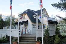
View of Egilsstaðir | |
 Location of the Municipality of Fljótsdalshérað | |
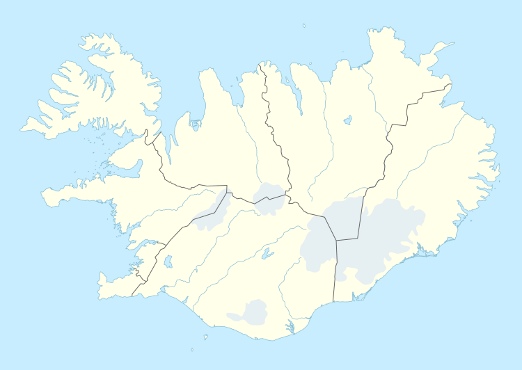 Egilsstaðir Location in Iceland | |
| Coordinates: 65°17′N 14°23′W / 65.283°N 14.383°W | |
| Country |
|
| Constituency[1] | Northeast Constituency |
| Region[2] | Eastern Region |
| Municipality | Fljótsdalshérað |
| Population (2011) | |
| • Total | 2,257 |
| Time zone | GMT (UTC+0) |
| Website |
www |
Egilsstaðir is a town in east Iceland on the banks of the Lagarfljót river.
It is part of the municipality of Fljótsdalshérað, the county seat of Norður-Múlasýsla and the largest settlement of the Eastern Region with, as of 2011, a population of 2,257 inhabitants.
Overview
Egilsstadir is located at 65°17′N 14°23′W / 65.283°N 14.383°WCoordinates: 65°17′N 14°23′W / 65.283°N 14.383°W. The town is young, even by Icelandic standards where urbanization is a fairly recent trend compared to mainland Europe. It was established in 1947 as an effort by the surrounding rural districts recognizing it had become a regional service centre. The town, which is named after Egilsstaðir farm, is near the bridge over Lagarfljót where all the main roads of the region meet, Route 1 as well as the main routes to the Eastern Region.
Egilsstaðir has grown to become the largest town of East Iceland and its main service, transportation, and administration centre. The town has an airport, college, and a hospital. The town grew quickly during the economic boom in the region from 2004 to 2008 associated with the building of the Kárahnjúkar Hydropower Plant and Alcoa's aluminium smelting plant in Reyðarfjörður. The growth has slowed markedly since the banking collapse in 2008.
History
In written accounts, Egilsstaðir is first mentioned in the 15th century as a place for legislative assembly. The nearby river Eyvindará is mentioned in the Saga of the Sons of Droplaug and Saga of the inhabitants of Fljótsdalur.
Urbanization in Egilsstaðir can be traced to Jón Bergsson (1855–1923), a farmer, who laid the groundwork for increased commerce and services at the Egilsstaðir farm by erecting a large residential building there at the start of the 20th century. The house is still in use as a hotel. Jón bought the farm Egilsstaðr at the close of the 19th century because of its location when he predicted "Crossroads will be here", which proved prescient. [3] Along with others, Jón Bergsson also took the initiative to establish the co-operative Kaupfélag Héraðsbúa (KHB) with headquarters there in 1909. [4] [5] In subsequent years, bridges were built over Lagarfljót river and Eyvindará river and a road made over Fagridalur to Reyðarfjörður. Later, the regional headquarters for mail and telephone services were located at Egilsstaðir. [6]
In 1947 Egilsstaðir was incorporated as a town and a rural jurisdiction Egilsstaðahreppur, with neighbouring jurisdictions Vallahreppur and Eiðahreppur joining the new jurisdiction. The town soon grew and by 1980 the population exceeded 1000. In 1987, the status of the town was upgraded to kaupstaður and renamed Egilsstaðabær, or the city of Egilsstaðir. In early 2011, the population was 2,257 and had increased by 41 percent from the year 2001, when 1,600 were registered there. [7]
On June 7, 1998 Egilsstaðabær was united with Vallahreppur, Skriðdalshreppur, Eiðahreppur and Hjaltastaðarhreppur under the name Austur-Hérað. Austur-Hérað then became Fljótsdalshérað in the year 2004.
Climate
Egilsstaðir has a subpolar oceanic climate (Köppen: Cfc) like most towns in coastal Iceland. But winters here tend to be colder than other towns with similar climates, and summers tend to have daytime highs often exceeding 15 °C (59 °F), higher than most of Iceland, but at night it's colder than most towns with a similar climate.
It should be noted that the figures here given for precipitation days and sunshine hours belong to Grímsárvirkjun and Hallormsstaður, which are 15 kilometres (9 mi) and 25 kilometres (16 mi) away from Egilsstaðir respectively and get around 100 millimetres (4 in) more precipitation than Egilsstaðir, so it is possible that Egilsstaðir has fewer days with precipitation and gets more sunlight than stated below. The climate has significantly warmed in recent years.
| Climate data for Egilsstaðir (1961-1990) | |||||||||||||
|---|---|---|---|---|---|---|---|---|---|---|---|---|---|
| Month | Jan | Feb | Mar | Apr | May | Jun | Jul | Aug | Sep | Oct | Nov | Dec | Year |
| Record high °C (°F) | 14.2 (57.6) |
12.5 (54.5) |
14.5 (58.1) |
18.5 (65.3) |
25.0 (77) |
26.7 (80.1) |
28.8 (83.8) |
26.7 (80.1) |
21.9 (71.4) |
18.9 (66) |
13.8 (56.8) |
14.0 (57.2) |
28.8 (83.8) |
| Average high °C (°F) | 0.7 (33.3) |
1.4 (34.5) |
2.2 (36) |
5.0 (41) |
8.9 (48) |
13.1 (55.6) |
14.8 (58.6) |
13.9 (57) |
10.0 (50) |
6.0 (42.8) |
2.3 (36.1) |
1.2 (34.2) |
6.63 (43.93) |
| Daily mean °C (°F) | −2.4 (27.7) |
−1.9 (28.6) |
−1.4 (29.5) |
1.2 (34.2) |
4.8 (40.6) |
8.7 (47.7) |
10.3 (50.5) |
9.6 (49.3) |
6.2 (43.2) |
3.1 (37.6) |
−0.7 (30.7) |
−2.2 (28) |
2.94 (37.3) |
| Average low °C (°F) | −5.8 (21.6) |
−5.3 (22.5) |
−4.4 (24.1) |
−2.0 (28.4) |
1.4 (34.5) |
5.0 (41) |
6.6 (43.9) |
6.2 (43.2) |
3.2 (37.8) |
0.4 (32.7) |
−3.8 (25.2) |
−5.3 (22.5) |
−0.32 (31.45) |
| Record low °C (°F) | −24 (−11) |
−22.1 (−7.8) |
−26.7 (−16.1) |
−21.4 (−6.5) |
−10.8 (12.6) |
−4.5 (23.9) |
−0.5 (31.1) |
−2.7 (27.1) |
−6.8 (19.8) |
−14.4 (6.1) |
−19.4 (−2.9) |
−22.5 (−8.5) |
−26.7 (−16.1) |
| Average precipitation mm (inches) | 70.5 (2.776) |
50.3 (1.98) |
62 (2.44) |
39.5 (1.555) |
27.8 (1.094) |
27.6 (1.087) |
39.8 (1.567) |
41.4 (1.63) |
67.7 (2.665) |
76.5 (3.012) |
54.9 (2.161) |
60.6 (2.386) |
618.6 (24.353) |
| Average precipitation days (≥ 0.1 mm) | 14.7 | 11.9 | 13.6 | 10.4 | 9.4 | 10.1 | 11.6 | 12.5 | 13.7 | 14.5 | 13.1 | 14.0 | 149.5 |
| Average relative humidity (%) | 83 | 82 | 82 | 79 | 78 | 75 | 79 | 80 | 81 | 83 | 83 | 83 | 80.7 |
| Mean monthly sunshine hours | 0.6 | 33.5 | 84.2 | 142.5 | 182.4 | 187.3 | 172.9 | 145.7 | 86.1 | 46.2 | 6.4 | 0 | 1,087.8 |
| Source #1: Icelandic Met Office (extremes 1955-97, humidity 1963-90, sun 1960-89 for Hallormsstaður-25 km (15 mi) from Egilsstaðir) [8][9] | |||||||||||||
| Source #2: Icelandic Met Office (precipitation days 1961-90 for Grímsárvirkjun-15 km (9 mi) from Egilsstaðir) [10] | |||||||||||||
Points of interest

- Eiðar longwave transmitter
- Kárahnjúkar Hydropower Plant
- Hallormsstaðaskógur - the biggest forest in Iceland
- Hengifoss - a waterfall in Fljótsdalur
- Skriðuklaustur - the mansion of writer Gunnar Gunnarsson
- Öxi - mountain road between Egilsstaðir and Djúpivogur
Notable natives
- Sveinn Birkir Björnsson - former editor of the Reykjavík Grapevine.
- Sigmar Vilhjálmsson - Iceland TV host.
- Hjálmar Jónsson - Iceland national team footballer.
- Vilhjálmur Einarsson, triple-jump athlete, silver medal winner at the 1956 Olympic games.
- Magnús Ver Magnússon, four times World's Strongest Man (1991, 1994, 1995 and 1996).
References
- ↑ Political division
- ↑ Mainly statistical division
- ↑ "Um sögu Egilsstaðabæjar" (in Icelandic). Retrieved 2011-05-30.
- ↑ "Pöntunarfjelag Fljótsdalshéraðs" (in Icelandic). Retrieved 2011-05-30.
- ↑ "Austur-Hérað" (in Icelandic). Retrieved 2011-05-30.
- ↑ "Austri, 17. janúar 1903, 13. árg., 2. tbl." (in Icelandic). Retrieved 2011-05-30.
- ↑ "Hagstofa Íslands, mannfjöldi" (in Icelandic). Retrieved 2011-05-30.
- ↑ "Climatological Data for Egilsstaðir". Icelandic Meteorological Office. Retrieved 19 November 2016.
- ↑ "Climatological Data for Hallormsstaður". Icelandic Meteorological Office. Retrieved 19 November 2016.
- ↑ "1961-90 Precipitation Averages for Grímsárvirkjun". Icelandic Meteorological Office. Retrieved 19 November 2016.
External links
 Media related to Egilsstaðir at Wikimedia Commons
 Egilsstaðir travel guide from Wikivoyage