Sedgwick, Kansas
| Sedgwick, Kansas | |
|---|---|
| City | |
|
Sedgwick Water Tower | |
 Location within Harvey County and Kansas | |
 KDOT map of Harvey County (legend) | |
| Coordinates: 37°54′59″N 97°25′22″W / 37.91639°N 97.42278°WCoordinates: 37°54′59″N 97°25′22″W / 37.91639°N 97.42278°W[1] | |
| Country | United States |
| State | Kansas |
| County | Harvey, Sedgwick |
| Government | |
| • Type | Mayor–Council |
| • Mayor | Rodney Eggleston |
| • City Admin | Jaclyn Reimer |
| Area[2] | |
| • Total | 1.41 sq mi (3.65 km2) |
| • Land | 1.41 sq mi (3.65 km2) |
| • Water | 0 sq mi (0 km2) |
| Elevation[1] | 1,381 ft (421 m) |
| Population (2010)[3] | |
| • Total | 1,695 |
| • Estimate (2015)[4] | 1,707 |
| • Density | 1,200/sq mi (460/km2) |
| Time zone | CST (UTC-6) |
| • Summer (DST) | CDT (UTC-5) |
| ZIP code | 67135 |
| Area code | 316 |
| FIPS code | 20-63800 [1] |
| GNIS feature ID | 0473680 [1] |
| Website | cityofsedgwick.org |

Sedgwick is a city in Harvey and Sedgwick counties in the State of Kansas.[1] As of the 2010 census, the city population was 1,695.[5]
History
For millennia, the land now known as Kansas was inhabited by Native Americans. In 1803, most of modern Kansas was secured by the United States as part of the Louisiana Purchase. In 1854, the Kansas Territory was organized, then in 1861 Kansas became the 34th U.S. state. In 1867, Sedgwick County was founded. In 1872, Harvey County was founded.
Sedgwick was laid out on an 80-acre (32 ha) town site in 1870.[6] It was named for John Sedgwick, a Major General in the Union Army during the American Civil War.[7] Sedgwick was incorporated as a city in 1872.[8]
Geography
Sedgwick is located at 37°54′59″N 97°25′22″W / 37.91639°N 97.42278°W (37.916409, -97.422820).[1] According to the United States Census Bureau, the city has a total area of 1.41 square miles (3.65 km2), all of it land.[2]
Climate
The climate in this area is characterized by hot, humid summers and generally mild to cool winters. According to the Köppen Climate Classification system, Sedgwick has a humid subtropical climate, abbreviated "Cfa" on climate maps.[9]
Demographics
| Historical population | |||
|---|---|---|---|
| Census | Pop. | %± | |
| 1880 | 415 | — | |
| 1890 | 652 | 57.1% | |
| 1900 | 622 | −4.6% | |
| 1910 | 626 | 0.6% | |
| 1920 | 731 | 16.8% | |
| 1930 | 832 | 13.8% | |
| 1940 | 738 | −11.3% | |
| 1950 | 732 | −0.8% | |
| 1960 | 1,095 | 49.6% | |
| 1970 | 1,083 | −1.1% | |
| 1980 | 1,471 | 35.8% | |
| 1990 | 1,438 | −2.2% | |
| 2000 | 1,537 | 6.9% | |
| 2010 | 1,695 | 10.3% | |
| Est. 2015 | 1,707 | [4] | 0.7% |
| U.S. Decennial Census[10] 2012 Estimate[11] | |||
2010 census
As of the census[3] of 2010, there were 1,695 people, 611 households, and 440 families residing in the city. The population density was 1,202.1 inhabitants per square mile (464.1/km2). There were 643 housing units at an average density of 456.0 per square mile (176.1/km2). The racial makeup of the city was 95.8% White, 0.2% African American, 0.5% Native American, 0.3% Asian, 1.5% from other races, and 1.7% from two or more races. Hispanic or Latino of any race were 4.4% of the population.
There were 611 households of which 40.6% had children under the age of 18 living with them, 56.1% were married couples living together, 10.5% had a female householder with no husband present, 5.4% had a male householder with no wife present, and 28.0% were non-families. 24.5% of all households were made up of individuals and 9.4% had someone living alone who was 65 years of age or older. The average household size was 2.68 and the average family size was 3.21.
The median age in the city was 37 years. 29.6% of residents were under the age of 18; 6.5% were between the ages of 18 and 24; 24.6% were from 25 to 44; 24.3% were from 45 to 64; and 14.9% were 65 years of age or older. The gender makeup of the city was 48.0% male and 52.0% female.
2000 census

As of the census of 2000, there were 1,537 people, 545 households, and 424 families residing in the city. The population density was 1,408.8 people per square mile (544.4/km²). There were 568 housing units at an average density of 520.6 per square mile (201.2/km²). The racial makeup of the city was 95.71% White, 0.07% African American, 1.56% Native American, 0.26% Asian, 0.78% from other races, and 1.63% from two or more races. Hispanic or Latino of any race were 3.12% of the population.
There were 545 households out of which 40.9% had children under the age of 18 living with them, 65.5% were married couples living together, 8.3% had a female householder with no husband present, and 22.2% were non-families. 20.9% of all households were made up of individuals and 9.2% had someone living alone who was 65 years of age or older. The average household size was 2.71 and the average family size was 3.15.
In the city the population was spread out with 29.6% under the age of 18, 6.4% from 18 to 24, 30.7% from 25 to 44, 19.5% from 45 to 64, and 13.8% who were 65 years of age or older. The median age was 35 years. For every 100 females there were 93.6 males. For every 100 females age 18 and over, there were 92.9 males.
As of 2000 the median income for a household in the city was $44,934, and the median income for a family was $49,659. Males had a median income of $37,216 versus $24,732 for females. The per capita income for the city was $17,009. About 4.4% of families and 6.2% of the population were below the poverty line, including 11.7% of those under age 18 and 5.9% of those age 65 or over.
Education
Primary and secondary education
Sedgwick is part of Unified School District 439.[12][13]
Notable people
- Brian Moorman, punter in the NFL for the Buffalo Bills
See also
- National Register of Historic Places listings in Harvey County, Kansas
- Arkansas Valley Interurban Railway
Further reading
References
- 1 2 3 4 5 6 Geographic Names Information System (GNIS) details for Sedgwick, Kansas; United States Geological Survey (USGS); October 13, 1978.
- 1 2 "US Gazetteer files 2010". United States Census Bureau. Retrieved 2012-07-06.
- 1 2 "American FactFinder". United States Census Bureau. Retrieved 2012-07-06.
- 1 2 "Annual Estimates of the Resident Population for Incorporated Places: April 1, 2010 to July 1, 2015". Retrieved July 2, 2016.
- ↑ "2010 City Population and Housing Occupancy Status". U.S. Census Bureau. Retrieved March 6, 2011.
- ↑ History of the State of Kansas: Containing a Full Account of Its Growth from an Uninhabited Territory to a Wealthy and Important State. A. T. Andreas. 1883. p. 781.
- ↑ Kansas State Historical Society (1916). Biennial Report of the Board of Directors of the Kansas State Historical Society. Kansas State Printing Plant. p. 205.
- ↑ Blackmar, Frank Wilson (1912). Kansas: A Cyclopedia of State History, Volume 2. Standard Publishing Company. p. 661.
- ↑ Climate Summary for Sedgwick, Kansas
- ↑ United States Census Bureau. "Census of Population and Housing". Retrieved October 24, 2013.
- ↑ "Annual Estimates of the Resident Population: April 1, 2010 to July 1, 2012". Retrieved October 24, 2013.
- ↑ USD 439
- ↑ Kansas School District Boundary Map
External links
| Wikimedia Commons has media related to Sedgwick, Kansas. |
- City
- Schools
- USD 439, local school district
- USD 439 School District Boundary Map, KDOT
- Historical
- Historic Images of Sedgwick, Special Photo Collections at Wichita State University Library
- Maps
- Sedgwick City Map, KDOT
- Harvey County Maps: Current, Historic, KDOT
- Sedgwick County Maps: Current, Historic, KDOT
Municipalities and communities of Harvey County, Kansas, United States | ||
|---|---|---|
| Cities | 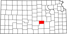 | |
| Unincorporated communities | ||
| Ghost town |
| |
| Townships | ||
| Footnotes | ‡This populated place also has portions in an adjacent county or counties | |
Municipalities and communities of Sedgwick County, Kansas, United States | ||
|---|---|---|
| Cities | 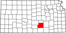 | |
| CDPs | ||
| Unincorporated communities | ||
| Townships | ||
| Footnotes | ‡This populated place also has portions in an adjacent county or counties | |