Bel Aire, Kansas
| Bel Aire, Kansas | |
|---|---|
| City | |
 Location within Sedgwick County and Kansas | |
 KDOT map of Sedgwick County (legend) | |
| Coordinates: 37°45′50″N 97°15′58″W / 37.76389°N 97.26611°WCoordinates: 37°45′50″N 97°15′58″W / 37.76389°N 97.26611°W | |
| Country | United States |
| State | Kansas |
| County | Sedgwick |
| Founded | 1955 |
| Incorporated | 1980 |
| Government | |
| • Mayor | David Austin |
| Area[1] | |
| • Total | 6.86 sq mi (17.77 km2) |
| • Land | 6.83 sq mi (17.69 km2) |
| • Water | 0.03 sq mi (0.08 km2) |
| Elevation | 1,394 ft (425 m) |
| Population (2010)[2] | |
| • Total | 6,769 |
| • Estimate (2015)[3] | 7,435 |
| • Density | 990/sq mi (380/km2) |
| Time zone | Central (CST) (UTC-6) |
| • Summer (DST) | CDT (UTC-5) |
| ZIP codes | 67220, 67226 |
| Area code(s) | 316 |
| FIPS code | 20-05337[4] |
| GNIS feature ID | 473837[5] |
| Website | belaireks.gov |
Bel Aire is a city in Sedgwick County, Kansas, United States, and a suburb of Wichita.[6] As of the 2010 census, the city population was 6,769.[7]
History
Bel Aire was founded in January 1955 when a group of local residents petitioned the county government to create it as an improvement district for water.[8]
On November 26, 1980, Bel Aire formally incorporated as a city. This was despite a two-year legal dispute with the Wichita city government over whether or not it had the right to do so. The case ultimately went to the Kansas Supreme Court which ruled in Bel Aire's favor.[8]
Geography
Bel Aire is located at 37°45′50″N 97°15′58″W / 37.76389°N 97.26611°W (37.763758, -97.266177)[5] at an elevation of 1,394 feet (425 m).[9] It lies on the north side of the East Fork of Chisholm Creek roughly 6 miles (10 km) northeast of the Arkansas River in the Wellington-McPherson Lowlands region of the Great Plains. Located on the south side of K-254 in south-central Kansas, Bel Aire is within the Wichita metropolitan area, bordered by Wichita to the south and west and bordered by Kechi to the north.[10][11]
According to the United States Census Bureau, the city has a total area of 6.86 square miles (17.77 km2), of which, 6.83 square miles (17.69 km2) is land and 0.03 square miles (0.08 km2) is water.[1]
Demographics
| Historical population | |||
|---|---|---|---|
| Census | Pop. | %± | |
| 1990 | 3,695 | — | |
| 2000 | 5,836 | 57.9% | |
| 2010 | 6,769 | 16.0% | |
| Est. 2015 | 7,435 | [3] | 9.8% |
| U.S. Decennial Census | |||
Bel Aire is part of the Wichita, KS Metropolitan Statistical Area.
2010 census
As of the census[2] of 2010, there were 6,769 people, 2,465 households, and 1,854 families residing in the city. The population density was 991.1 inhabitants per square mile (382.7/km2). There were 2,554 housing units at an average density of 373.9 per square mile (144.4/km2). The racial makeup of the city was 81.1% White, 8.6% African American, 0.9% Native American, 4.5% Asian, 1.4% from other races, and 3.5% from two or more races. Hispanic or Latino of any race were 4.8% of the population.
There were 2,465 households of which 38.7% had children under the age of 18 living with them, 65.3% were married couples living together, 7.2% had a female householder with no husband present, 2.7% had a male householder with no wife present, and 24.8% were non-families. 21.3% of all households were made up of individuals and 9.6% had someone living alone who was 65 years of age or older. The average household size was 2.75 and the average family size was 3.21.
The median age in the city was 36 years. 28.3% of residents were under the age of 18; 6.7% were between the ages of 18 and 24; 26.3% were from 25 to 44; 26.9% were from 45 to 64; and 11.6% were 65 years of age or older. The gender makeup of the city was 48.2% male and 51.8% female.
2000 census
As of the census of 2000, there were 5,836 people, 1,976 households, and 1,618 families residing in the city. The population density was 2,680.8 people per square mile (1,033.6/km²). There were 2,024 housing units at an average density of 929.7 per square mile (358.5/km²). The racial makeup of the city was 85.47% White, 7.32% African American, 0.45% Native American, 3.68% Asian, 0.02% Pacific Islander, 1.10% from other races, and 1.97% from two or more races. Hispanic or Latino of any race were 3.02% of the population.
There were 1,976 households out of which 47.3% had children under the age of 18 living with them, 73.4% were married couples living together, 6.8% had a female householder with no husband present, and 18.1% were non-families. 15.4% of all households were made up of individuals and 5.6% had someone living alone who was 65 years of age or older. The average household size was 2.95 and the average family size was 3.30.
In the city the population was spread out with 32.9% under the age of 18, 5.2% from 18 to 24, 33.2% from 25 to 44, 21.1% from 45 to 64, and 7.6% who were 65 years of age or older. The median age was 33 years. For every 100 females there were 98.0 males. For every 100 females age 18 and over, there were 95.1 males.
As of 2000 the median income for a household in the city was $66,937, and the median income for a family was $72,091. Males had a median income of $50,236 versus $35,298 for females. The per capita income for the city was $23,202. About 3.7% of families and 4.8% of the population were below the poverty line, including 8.9% of those under age 18 and 3.0% of those age 65 or over.[4]
References
- 1 2 "US Gazetteer files 2010". United States Census Bureau. Archived from the original on 2012-01-24. Retrieved 2012-07-06.
- 1 2 "American FactFinder". United States Census Bureau. Retrieved 2012-07-06.
- 1 2 "Annual Estimates of the Resident Population for Incorporated Places: April 1, 2010 to July 1, 2015". Retrieved July 2, 2016.
- 1 2 "American FactFinder". United States Census Bureau. Archived from the original on 2013-09-11. Retrieved 2008-01-31.
- 1 2 "US Gazetteer files: 2010, 2000, and 1990". United States Census Bureau. 2011-02-12. Retrieved 2011-04-23.
- ↑ "City of Bel Aire - Our Community". City of Bel Aire. Retrieved 2011-01-22.
- ↑ "2010 City Population and Housing Occupancy Status". U.S. Census Bureau. Archived from the original on July 21, 2011. Retrieved March 6, 2011.
- 1 2 "City of Bel Aire - Celebrating 30 Years". City of Bel Aire. Retrieved 2013-03-06.
- ↑ "US Board on Geographic Names". United States Geological Survey. 2007-10-25. Retrieved 2008-01-31.
- ↑ "General Highway Map - Sedgwick County, Kansas" (PDF). Kansas Department of Transportation. June 2009. Archived (PDF) from the original on 17 December 2010. Retrieved 2011-01-22.
- ↑ "2003-2004 Official Transportation Map" (PDF). Kansas Department of Transportation. 2003. Retrieved 2011-01-22.
External links
| Wikimedia Commons has media related to Bel Aire, Kansas. |
- City
- Schools
- Maps
- Bel Aire City Map, KDOT
Municipalities and communities of Sedgwick County, Kansas, United States | ||
|---|---|---|
| Cities | 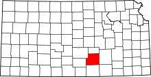 | |
| CDPs | ||
| Unincorporated communities | ||
| Townships | ||
| Footnotes | ‡This populated place also has portions in an adjacent county or counties | |