Seals, Georgia
| Seals, Georgia | |
|---|---|
| Unincorporated community | |
 Seals  Seals Location within the state of Georgia | |
| Coordinates: 30°52′22″N 81°42′15″W / 30.87278°N 81.70417°WCoordinates: 30°52′22″N 81°42′15″W / 30.87278°N 81.70417°W | |
| Country | United States |
| State | Georgia |
| County | Camden |
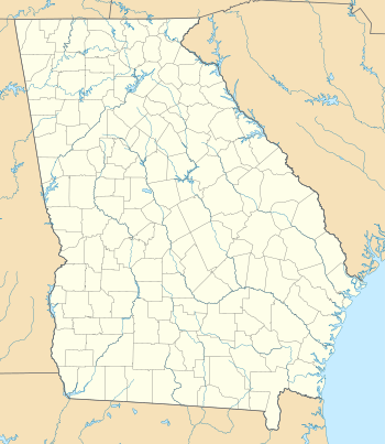
Seals is an unincorporated location in Camden County in the state of Georgia in the United States of America.[1] Its position is at 30°52′22″N 81°42′15″W / 30.87278°N 81.70417°W at an elevation of 21 feet.[2]
It is located at the point where the Old Jefferson Highway meets the railway line, just east of Floyd Hammock. It is shown on maps of the county between 1895 and 1955 as being about halfway between Woodbine and Kingsland, [3] [4] [5] [6] [7] and can be seen on modern topographic maps. [8]
Seals is the present north end of the First Coast Railroad, leased from CSX Transportation in April 2005.[9]
Seals Swamp lies to the east of Seals at 30°52′6″N 81°41′0″W / 30.86833°N 81.68333°W.[10]
History
Before the American Civil War the county supported a number of plantations; sixty eight were documented in the county history book Camden's Challenge (Readdick 1976). However, many of these were abandoned after the Civil War, and small farms started to flourish instead. Many tiny communities were formed and later abandoned, some now little more than a few overgrown remains, but presenting undoubted possibilities for archaeological investigation. A line of the Florida Central and Peninsular Railroad, later part of the Seaboard Air Line Railroad, was opened in January 1894[11] between Kingsland and Woodbine, and Seals was on the line about halfway between the two. Seals was only one of many villages - others included Burnt Fort, Center Village, Kinlaw, Scarlett, Walker Swamp, Tompkins, Clarksville, Red Cap, Ceylon, Satilla Bluff and Spring Hill.[12]
References
- ↑ "Georgia Cities & Towns S ~ T". Georgia USGenWeb Archives. 1998. Retrieved 2006-07-27.
- ↑ "Seals". PlacesNamed.com. Retrieved 2006-07-27.
- ↑ "Camden County, 1895". GeorgiaInfo - Carl Vinson Institute of Government. 2006. Retrieved 2006-07-27.
- ↑ "Camden County, 1899". GeorgiaInfo - Carl Vinson Institute of Government. 2006. Retrieved 2006-07-27.
- ↑ "Camden County, 1904". GeorgiaInfo - Carl Vinson Institute of Government. 2006. Retrieved 2006-07-27.
- ↑ "Camden County, 1915". GeorgiaInfo - Carl Vinson Institute of Government. 2006. Retrieved 2006-07-27.
- ↑ "Camden County, 1955". GeorgiaInfo - Carl Vinson Institute of Government. 2006. Retrieved 2006-07-27.
- ↑ "60 km N of Jacksonville, Florida, United States 7/1/1975". The National Map. USGS via Microsoft Research Maps. Retrieved 2006-07-28.
- ↑ Simmons-Boardman Publishing Corp. (2005). "Late Breaking Rail Industry News - CSXT leases Northeast Florida branch line to G&W subsidiary". RT&S - Railway Track and Structures. Retrieved 2006-07-28.
- ↑ "Seals Swamp Georgia". BrainyGeography. Retrieved 2006-07-28.
- ↑ Railga.com, Florida Central & Peninsular Railroad
- ↑ Carolyn Rock (2006). "An Archaeological Site Inventory of Camden County, Georgia" (pdf). Retrieved 2006-07-27.
External links
Municipalities and communities of Camden County, Georgia, United States | ||
|---|---|---|
| Cities | 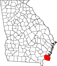 | |
| CDP | ||
| Unincorporated communities | ||