Seč (Chrudim District)
For other places with the same name, see Seč.
| Seč | |||
| Town | |||
%2C_n%C3%A1m.%2C_Se%C4%8D%2C_02.JPG) St. Lawrence church, Seč | |||
|
|||
| Country | Czech Republic | ||
|---|---|---|---|
| Region | Pardubice | ||
| District | Chrudim | ||
| Commune | Chrudim | ||
| Municipality | Třemošnice | ||
| Elevation | 532 m (1,745 ft) | ||
| Coordinates | CZ 49°50′55″N 15°39′25″E / 49.84861°N 15.65694°ECoordinates: CZ 49°50′55″N 15°39′25″E / 49.84861°N 15.65694°E | ||
| Area | 36.67 km2 (14.16 sq mi) | ||
| Population | 1,710 (2014-01-01) | ||
| Density | 47/km2 (122/sq mi) | ||
| First mentioned | 1318 | ||
| Mayor | Marcel Vojtěch | ||
| Timezone | CET (UTC+1) | ||
| - summer (DST) | CEST (UTC+2) | ||
| Postal code | 538 05 - 538 07 | ||
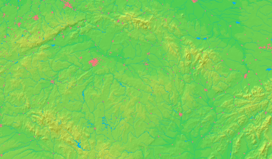  Location in the Czech Republic | |||
| Wikimedia Commons: Seč | |||
| Statistics: statnisprava.cz | |||
| Website: www.obec-sec.cz/ | |||
_vlajka.jpg)
Seč is a town in the Pardubice Region of the Czech Republic with approximately 1,700 inhabitants.
Villages Hoješín, Javorka, Kraskov, Počátky, Proseč, Prosíčka, Přemilov, Ústupky and Žďárec u Seče are administrative parts of Seč.
Seč dam was built next to the town.
External links
| Wikimedia Commons has media related to Seč (Chrudim District). |
- Town website (cz)
- InfoČesko (cz)
- MĚSTO CHRUDIM (cz)
This article is issued from Wikipedia - version of the 4/4/2016. The text is available under the Creative Commons Attribution/Share Alike but additional terms may apply for the media files.