Mrákotín (Chrudim District)
For other uses, see Mrákotín.
| Mrákotín | |||
| Village | |||
 | |||
|
|||
| Country | Czech Republic | ||
|---|---|---|---|
| Region | Pardubice | ||
| District | Chrudim | ||
| Commune | Chrudim | ||
| Municipality | Mrákotín | ||
| Elevation | 421 m (1,381 ft) | ||
| Coordinates | CZ 49°48′51″N 15°57′11″E / 49.81417°N 15.95306°ECoordinates: CZ 49°48′51″N 15°57′11″E / 49.81417°N 15.95306°E | ||
| Area | 5.18 km2 (2.00 sq mi) | ||
| Population | 335 (2014-01-01) | ||
| Density | 65/km2 (168/sq mi) | ||
| First mentioned | 1456 | ||
| Mayor | Ludmila Vacková | ||
| Timezone | CET (UTC+1) | ||
| - summer (DST) | CEST (UTC+2) | ||
| Postal code | 539 01 | ||
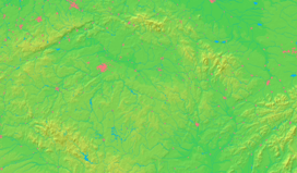  Location in the Czech Republic | |||
| Wikimedia Commons: Mrákotín (Chrudim District) | |||
| Statistics: statnisprava.cz | |||
| Website: www.obecmrakotin.cz | |||
_vlajka.jpg)
_znak.jpg)
Mrákotín is a village in the Pardubice Region of the Czech Republic. It is located 28 kilometres (17 mi) southeast of Pardubice and 112 kilometres (70 mi) east of Prague.
The municipality covers an area of 5.15 square kilometres (1.99 sq mi) and as of 2006 it had a population of 362. First written notice about the village is from year 1456.
Village Oflenda is administrative part of Mrákotín.
Gallery
 World War I memorial
 House No 31
 Road to Mrákotín from Oldřetice
External links
- Short official information about the village (in Czech)
| Wikimedia Commons has media related to Mrákotín (Chrudim District). |
This article is issued from Wikipedia - version of the 11/19/2016. The text is available under the Creative Commons Attribution/Share Alike but additional terms may apply for the media files.