Scobey, Montana
| Scobey, Montana | |
|---|---|
| City | |
|
Daniels County Courthouse in Scobey | |
 Location of Scobey, Montana | |
| Coordinates: 48°47′27″N 105°25′12″W / 48.79083°N 105.42000°WCoordinates: 48°47′27″N 105°25′12″W / 48.79083°N 105.42000°W | |
| Country | United States |
| State | Montana |
| County | Daniels |
| Area[1] | |
| • Total | 0.76 sq mi (1.97 km2) |
| • Land | 0.76 sq mi (1.97 km2) |
| • Water | 0 sq mi (0 km2) |
| Elevation | 2,467 ft (752 m) |
| Population (2010)[2] | |
| • Total | 1,017 |
| • Estimate (2015)[3] | 1,033 |
| • Density | 1,338.2/sq mi (516.7/km2) |
| Time zone | Mountain (MST) (UTC-7) |
| • Summer (DST) | MDT (UTC-6) |
| ZIP code | 59263 |
| Area code(s) | 406 |
| FIPS code | 30-66925 |
| GNIS feature ID | 0776297 |

Scobey is a city in and the county seat of Daniels County, Montana, United States.[4] The population was 1,017 at the 2010 census.[5]
History
The city was named by local rancher Mansfield Daniels, after whom Daniels County is named, for his friend Major Charles Richardson Anderson Scobey, a cattleman from the Glendive area who served as a Montana Territory legislator and an Indian agent at Fort Peck and Poplar.[6]
"During the height of the homestead boom in the 1910s," according to historical marker author Bob Fletcher, "Scobey was the largest primary shipping point of grain in the world."[7]
Geography
Scobey is located at 48°47′27″N 105°25′12″W / 48.790955°N 105.419925°W (48.790955, -105.419925).[8]
According to the United States Census Bureau, the city has a total area of 0.76 square miles (1.97 km2), all of it land.[1]
Demographics
| Historical population | |||
|---|---|---|---|
| Census | Pop. | %± | |
| 1920 | 1,170 | — | |
| 1930 | 1,259 | 7.6% | |
| 1940 | 1,311 | 4.1% | |
| 1950 | 1,628 | 24.2% | |
| 1960 | 1,726 | 6.0% | |
| 1970 | 1,486 | −13.9% | |
| 1980 | 1,382 | −7.0% | |
| 1990 | 1,154 | −16.5% | |
| 2000 | 1,082 | −6.2% | |
| 2010 | 1,017 | −6.0% | |
| Est. 2015 | 1,033 | [9] | 1.6% |
| U.S. Decennial Census[10] 2015 Estimate[3] | |||
2010 census
As of the census[2] of 2010, there were 1,017 people, 472 households, and 252 families residing in the city. The population density was 1,338.2 inhabitants per square mile (516.7/km2). There were 600 housing units at an average density of 789.5 per square mile (304.8/km2). The racial makeup of the city was 94.9% White, 0.1% African American, 2.5% Native American, 0.3% Asian, 0.2% from other races, and 2.1% from two or more races. Hispanic or Latino of any race were 1.6% of the population.
There were 472 households of which 22.0% had children under the age of 18 living with them, 44.1% were married couples living together, 6.4% had a female householder with no husband present, 3.0% had a male householder with no wife present, and 46.6% were non-families. 41.5% of all households were made up of individuals and 22.3% had someone living alone who was 65 years of age or older. The average household size was 2.07 and the average family size was 2.84.
The median age in the city was 49.9 years. 21.9% of residents were under the age of 18; 4.4% were between the ages of 18 and 24; 17.2% were from 25 to 44; 27.8% were from 45 to 64; and 28.6% were 65 years of age or older. The gender makeup of the city was 48.5% male and 51.5% female.
2000 census
As of the census[11] of 2000, there were 1,082 people, 500 households, and 280 families residing in the city. The population density was 1,481.6 people per square mile (572.3/km2). There were 611 housing units at an average density of 836.6 per square mile (323.2/km2). The racial makeup of the little city was 95.75% White, 0.74% Native American, 0.37% Asian, 0.92% from other races, and 2.22% from two or more races. Hispanic or Latino of any race were 2.50% of the population. There were 499 households out of which 23.0% had children under the age of 18 living with them, 47.5% were married couples living together, 6.8% had a female householder with no husband present, and 43.1% were non-families. 39.7% of all households were made up of individuals and 22.4% had someone living alone who was 65 years of age or older. The average household size was 2.09 and the average family size was 2.81.
In the city the population was spread out with 21.0% under the age of 18, 4.3% from 18 to 24, 17.6% from 25 to 44, 29.4% from 45 to 64, and 27.7% who were 65 years of age or older. The median age was 50 years. For every 100 females there were 84.6 males. For every 100 females age 18 and over, there were 81.9 males.
The median income for a household in the city was $45,553 and the median income for a family was $35,521. Males had a median income of $27,411 versus $18,304 for females. The per capita income for the city was $17,150. About 8.7% of families and 13.4% of the population were below the poverty line, including 12.1% of those under age 18 and 11.8% of those age 65 or over.
Climate
Scobey experiences a semi-arid climate (Köppen BSk) with long, cold, dry winters and short, hot, wetter summers.
| Climate data for Scobey, Montana | |||||||||||||
|---|---|---|---|---|---|---|---|---|---|---|---|---|---|
| Month | Jan | Feb | Mar | Apr | May | Jun | Jul | Aug | Sep | Oct | Nov | Dec | Year |
| Record high °F (°C) | 60 (16) |
65 (18) |
76 (24) |
85 (29) |
98 (37) |
106 (41) |
110 (43) |
107 (42) |
99 (37) |
95 (35) |
75 (24) |
56 (13) |
110 (43) |
| Average high °F (°C) | 19.3 (−7.1) |
27.7 (−2.4) |
39.4 (4.1) |
56.3 (13.5) |
68.1 (20.1) |
77.0 (25) |
81.6 (27.6) |
82.3 (27.9) |
70.5 (21.4) |
56.7 (13.7) |
36.0 (2.2) |
23.8 (−4.6) |
53.23 (11.78) |
| Daily mean °F (°C) | 7.9 (−13.4) |
16.6 (−8.6) |
28.0 (−2.2) |
41.9 (5.5) |
53.4 (11.9) |
62.4 (16.9) |
66.4 (19.1) |
65.8 (18.8) |
54.1 (12.3) |
42.4 (5.8) |
24.3 (−4.3) |
12.5 (−10.8) |
39.64 (4.25) |
| Average low °F (°C) | −3.6 (−19.8) |
5.5 (−14.7) |
16.6 (−8.6) |
27.5 (−2.5) |
38.6 (3.7) |
47.8 (8.8) |
51.1 (10.6) |
49.3 (9.6) |
37.7 (3.2) |
28.1 (−2.2) |
12.6 (−10.8) |
1.1 (−17.2) |
26.03 (−3.32) |
| Record low °F (°C) | −48 (−44) |
−45 (−43) |
−38 (−39) |
−9 (−23) |
12 (−11) |
23 (−5) |
35 (2) |
28 (−2) |
10 (−12) |
−13 (−25) |
−34 (−37) |
−43 (−42) |
−48 (−44) |
| Average precipitation inches (mm) | 0.26 (6.6) |
0.14 (3.6) |
0.54 (13.7) |
0.83 (21.1) |
1.72 (43.7) |
3.02 (76.7) |
2.13 (54.1) |
1.64 (41.7) |
0.88 (22.4) |
0.65 (16.5) |
0.34 (8.6) |
0.33 (8.4) |
12.48 (317.1) |
| Source #1: NOAA (normals, 1971–2000) [12] | |||||||||||||
| Source #2: The Weather Channel (Records) [13] | |||||||||||||
Notable residents
- Kenneth Arnold, businessman and pilot who made the first widely publicized UFO sighting, grew up here.
- Alvin Straight, who inspired The Straight Story, was born here.
- Henry Schauer, World War II Medal of Honor winner, grew up in rural Scobey and enlisted in the Army from here, a member of the "Lucky 13" group of enlistees. He lived and worked in the area for many years after the war.
See also
Scobey–Coronach Border Crossing
References
- 1 2 "US Gazetteer files 2010". United States Census Bureau. Retrieved 2012-12-18.
- 1 2 "American FactFinder". United States Census Bureau. Retrieved 2012-12-18.
- 1 2 "Population Estimates". United States Census Bureau. Retrieved July 20, 2016.
- ↑ "Find a County". National Association of Counties. Retrieved 2011-06-07.
- ↑ "2010 Census Redistricting Data (Public Law 94-171) Summary File". American FactFinder. United States Census Bureau. Retrieved 2 May 2011.
- ↑ "Montana Place Names Companion". Montana Place Names From Alzada to Zortman. Montana Historical Society Research Center. Retrieved 9 May 2011.
- ↑ Wilson, Kurt (2014-11-02). "Roadside Wanderings: Resilient northeastern Montana". Missoulian. Retrieved 2014-11-02.
- ↑ "US Gazetteer files: 2010, 2000, and 1990". United States Census Bureau. 2011-02-12. Retrieved 2011-04-23.
- ↑ "Annual Estimates of the Resident Population for Incorporated Places: April 1, 2010 to July 1, 2015". Retrieved July 2, 2016.
- ↑ "Census of Population and Housing". Census.gov. Retrieved July 20, 2016.
- ↑ "American FactFinder". United States Census Bureau. Retrieved 2008-01-31.
- ↑ "Climatography of the United States NO.81" (PDF). National Oceanic and Atmospheric Administration. Retrieved January 15, 2011.
- ↑ "Monthly Averages for Scobey, MT". The Weather Channel. Retrieved January 15, 2011.
External links
- Daniels County Chamber of Commerce and Agriculture, Scobey Montana website
- Scobey High School Website
- Scobey Schools
Municipalities and communities of Daniels County, Montana, United States | ||
|---|---|---|
| City | 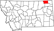 | |
| Town | ||
| Unincorporated communities | ||
| Indian reservation | ||
| Footnotes | ‡This populated place also has portions in an adjacent county or counties | |