Schoolhouse Point, Washington
| Schoolhouse Point, Washington | |
|---|---|
| Unincorporated community | |
 Schoolhouse Point Location within the state of Washington | |
| Coordinates: 48°2′9.8″N 123°1′12.8″W / 48.036056°N 123.020222°WCoordinates: 48°2′9.8″N 123°1′12.8″W / 48.036056°N 123.020222°W | |
| Country | United States |
| State | Washington |
| County | Clallam |
| Time zone | Pacific (PST) (UTC-8) |
| • Summer (DST) | PDT (UTC-7) |
Schoolhouse Point is an unincorporated community in Clallam County, Washington, United States, located on Sequim Bay along U.S. Route 101. The community is located about three miles southeast of Sequim, Washington, and about one mile northwest of Blyn, Washington. Schoolhouse Point is the location of Sequim Bay State Park. Prior to 2001, it was served by a general store.
In 2003, the accident-prone blind intersection of Dawley Road and Highway 101 was closed and replaced with a perpendicular intersection of Highway 101 and Schoolhouse Point Lane.
Schoolhouse Point is a cape protruding into Sequim Bay at 48°02′09″N 123°01′08″W / 48.035924°N 123.018786°W. It has also been known as "Skull Point" or "School Point".[1]
References
- ↑ "Schoolhouse Point". Geographic Names Information System. United States Geological Survey. Retrieved 2012-10-20.
Municipalities and communities of Clallam County, Washington, United States | ||
|---|---|---|
| Cities | 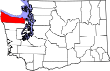 | |
| CDPs | ||
| Other unincorporated communities | ||
| Indian reservations | ||
| Ghost towns | ||