Santa Anna Township, DeWitt County, Illinois
| Santa Anna Township | |
|---|---|
| Township | |
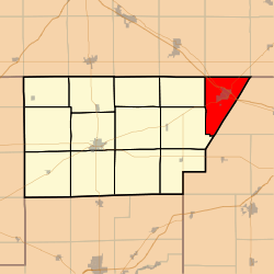 Location in DeWitt County | |
 DeWitt County's location in Illinois | |
| Coordinates: 40°14′23″N 88°38′55″W / 40.23972°N 88.64861°WCoordinates: 40°14′23″N 88°38′55″W / 40.23972°N 88.64861°W | |
| Country |
|
| State |
|
| County | DeWitt |
| Established | November 2, 1858 |
| Area | |
| • Total | 29.09 sq mi (75.3 km2) |
| • Land | 28.96 sq mi (75.0 km2) |
| • Water | 0.13 sq mi (0.3 km2) 0.45% |
| Elevation | 728 ft (222 m) |
| Population (2010) | |
| • Total | 2,502 |
| • Density | 86.4/sq mi (33.4/km2) |
| Time zone | CST (UTC-6) |
| • Summer (DST) | CDT (UTC-5) |
| ZIP code | 61842 |
| GNIS feature ID | 0429713 |
Santa Anna Township is one of thirteen townships in DeWitt County, Illinois, USA. As of the 2010 census, its population was 2,502 and it contained 1,116 housing units.[1] Its name was changed from Mt. Pleasant Township on June 7, 1859.
Geography
According to the 2010 census, the township has a total area of 29.09 square miles (75.3 km2), of which 28.96 square miles (75.0 km2) (or 99.55%) is land and 0.13 square miles (0.34 km2) (or 0.45%) is water.[1]
Cities, towns, villages
Unincorporated towns
(This list is based on USGS data and may include former settlements.)
Cemeteries
The township contains these five cemeteries: Campground, Farmer City, Greenleaf, Maple Grove and Saint Josephs Catholic.
School districts
- Blue Ridge Community Unit School District 18
- Deland-Weldon Community Unit School District 57
Political districts
- Illinois's 15th congressional district
- State House District 87
- State Senate District 44
References
- "Santa Anna Township, DeWitt County, Illinois". Geographic Names Information System. United States Geological Survey. Retrieved 2010-07-06.
- United States Census Bureau 2009 TIGER/Line Shapefiles
- United States National Atlas
- 1 2 "Population, Housing Units, Area, and Density: 2010 - County -- County Subdivision and Place -- 2010 Census Summary File 1". United States Census. Retrieved 2013-05-28.
External links

Municipalities and communities of DeWitt County, Illinois, United States | ||
|---|---|---|
| Cities | ||
| Villages | ||
| Townships | ||
| Unincorporated communities | ||
| Footnotes | ‡This populated place also has portions in an adjacent county or counties | |
This article is issued from Wikipedia - version of the 12/4/2013. The text is available under the Creative Commons Attribution/Share Alike but additional terms may apply for the media files.