DeWitt Township, DeWitt County, Illinois
| DeWitt Township | |
|---|---|
| Township | |
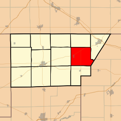 Location in DeWitt County | |
 DeWitt County's location in Illinois | |
| Coordinates: 40°11′02″N 88°44′52″W / 40.18389°N 88.74778°WCoordinates: 40°11′02″N 88°44′52″W / 40.18389°N 88.74778°W | |
| Country |
|
| State |
|
| County | DeWitt |
| Established | November 2, 1858 |
| Area | |
| • Total | 34.06 sq mi (88.2 km2) |
| • Land | 31.78 sq mi (82.3 km2) |
| • Water | 2.28 sq mi (5.9 km2) 6.69% |
| Elevation | 728 ft (222 m) |
| Population (2010) | |
| • Total | 479 |
| • Density | 15.1/sq mi (5.8/km2) |
| Time zone | CST (UTC-6) |
| • Summer (DST) | CDT (UTC-5) |
| ZIP codes | 61735, 61842, 61882 |
| GNIS feature ID | 0428894 |
DeWitt Township is one of thirteen townships in DeWitt County, Illinois, USA. As of the 2010 census, its population was 479 and it contained 215 housing units.[1] It was renamed from its original name of Marion Township on June 7, 1859.
Geography
According to the 2010 census, the township has a total area of 34.06 square miles (88.2 km2), of which 31.78 square miles (82.3 km2) (or 93.31%) is land and 2.28 square miles (5.9 km2) (or 6.69%) is water.[1]
Cities, towns, villages
Unincorporated towns
- Fullerton at 40°12′37″N 88°44′40″W / 40.210313°N 88.744516°W
- Parnell at 40°13′23″N 88°43′14″W / 40.223091°N 88.720626°W
(This list is based on USGS data and may include former settlements.)
Cemeteries
The township contains these three cemeteries: Barnes, DeWitt and McCord.
School districts
- Blue Ridge Community Unit School District 18
- Clinton Community Unit School District 15
- Deland-Weldon Community Unit School District 57
Political districts
- Illinois's 15th congressional district
- State House District 110
- State House District 87
- State Senate District 44
- State Senate District 55
References
- "DeWitt Township, DeWitt County, Illinois". Geographic Names Information System. United States Geological Survey. Retrieved 2010-07-06.
- United States Census Bureau 2009 TIGER/Line Shapefiles
- United States National Atlas
- 1 2 "Population, Housing Units, Area, and Density: 2010 - County -- County Subdivision and Place -- 2010 Census Summary File 1". United States Census. Retrieved 2013-05-28.
External links
 |
Rutledge Township | Santa Anna Township | | |
| Harp Township | |
|||
| ||||
| | ||||
| Creek Township | Nixon Township | Goose Creek Township, Piatt County |
Municipalities and communities of DeWitt County, Illinois, United States | ||
|---|---|---|
| Cities | ||
| Villages | ||
| Townships | ||
| Unincorporated communities | ||
| Footnotes | ‡This populated place also has portions in an adjacent county or counties | |
This article is issued from Wikipedia - version of the 12/4/2013. The text is available under the Creative Commons Attribution/Share Alike but additional terms may apply for the media files.