San Ysidro, Doña Ana County, New Mexico
| San Ysidro, New Mexico | |
|---|---|
| Census-designated place | |
 San Ysidro | |
| Coordinates: 32°21′03″N 106°48′40″W / 32.35083°N 106.81111°WCoordinates: 32°21′03″N 106°48′40″W / 32.35083°N 106.81111°W | |
| Country | United States |
| State | New Mexico |
| County | Doña Ana |
| Area[1] | |
| • Total | 2.645 sq mi (6.85 km2) |
| • Land | 2.645 sq mi (6.85 km2) |
| • Water | 0 sq mi (0 km2) |
| Elevation | 3,911 ft (1,192 m) |
| Population (2010)[1] | |
| • Total | 2,090 |
| • Density | 790/sq mi (310/km2) |
| Time zone | Mountain (MST) (UTC-7) |
| • Summer (DST) | MDT (UTC-6) |
| Area code(s) | 575 |
| GNIS feature ID | 919881[2] |
San Ysidro is a census-designated place in Doña Ana County, New Mexico, United States. Its population was 2,090 as of the 2010 census.[1]
Geography
San Ysidro is located at 32°21′24″N 106°48′46″W / 32.356752°N 106.812892°W. According to the U.S. Census Bureau, the community has an area of 2.645 square miles (6.85 km2), all of it land.[1]
References
- 1 2 3 4 "2010 Census Gazetteer Files - Places: New Mexico". U.S. Census Bureau. Retrieved August 21, 2014.
- ↑ "San Ysidro". Geographic Names Information System. United States Geological Survey.
Municipalities and communities of Doña Ana County, New Mexico, United States | ||
|---|---|---|
| Cities | 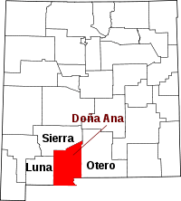 | |
| Town | ||
| Village | ||
| CDPs | ||
| Ghost towns | ||
This article is issued from Wikipedia - version of the 11/4/2015. The text is available under the Creative Commons Attribution/Share Alike but additional terms may apply for the media files.