Hatch, New Mexico
| Hatch, New Mexico | |
|---|---|
| Village | |
|
Sign in Hatch, New Mexico | |
 Location of Hatch, New Mexico | |
| Coordinates: 32°39′54″N 107°9′31″W / 32.66500°N 107.15861°WCoordinates: 32°39′54″N 107°9′31″W / 32.66500°N 107.15861°W | |
| Country | United States |
| State | New Mexico |
| County | Doña Ana |
| Area | |
| • Total | 3.0 sq mi (8.0 km2) |
| • Land | 3.0 sq mi (8.0 km2) |
| • Water | 0.0 sq mi (0.0 km2) |
| Elevation | 4,058 ft (1,237 m) |
| Population (2000) | |
| • Total | 1,673 |
| • Density | 540.2/sq mi (208.6/km2) |
| Time zone | Mountain (MST) (UTC-7) |
| • Summer (DST) | MDT (UTC-6) |
| ZIP code | 87937 |
| Area code(s) | Area code 575 |
| FIPS code | 35-31820 |
| GNIS feature ID | 0920610 |
| Website | villageofhatch.org |


Hatch is a village in Doña Ana County, New Mexico, United States. The population was 1,648 at the 2010 census. It is part of the Las Cruces Metropolitan Statistical Area. The town is experiencing moderate growth, along with its outliers of Salem, Arrey, Derry, and Rincon. Hatch is widely known as the "Chile Capital of the World," for growing a wide variety of peppers, especially the New Mexican cuisine staple, and one of New Mexico's state vegetables, the New Mexico chile.
History
Hatch was originally settled as Santa Barbara in 1851, however Apache raids drove the farmers away until 1853 when the nearby Fort Thorn was established.[2] When Fort Thorn closed in 1859, the town was abandoned again in 1860.[2] It was not until 1875 that it was re-occupied and at that time it was renamed for Indian fighter Edward Hatch, who was then commander of the New Mexico Military District.[3]
Economy
The Hatch Chile Festival[4] is an annual event that occurs each Labor Day.[3] This event attracts people worldwide to a place known as the chile capital of the world. The small town has accommodated up to 30,000 people for this event. This small farming community is known worldwide for raising very good chiles. By 2012, Hatch chiles were being marketed under their name in most major urban markets in the US. Other crops such as onions, cotton, and corn are also raised there. Irrigation of local farms is accomplished by water wells as well as irrigation ditches which divert water from the Rio Grande and two lakes approximately 20 miles north of Hatch named Caballo (Spanish for "horse") and Elephant Butte Reservoir (named after a rock formation in the middle of the lake that looks similar to an elephant).
Hatch is 40 miles northwest of Las Cruces, New Mexico, on Interstate 25, and 34 miles south of Spaceport America, a new purpose-built spaceport being built by the New Mexico Spaceport Authority (NMSA) with State and county funding.[5] In 2012, the NMSA announced it would be building a spaceport visitor's center in Hatch.[6]
Geography
Hatch is located at 32°39′54″N 107°9′31″W / 32.66500°N 107.15861°W (32.664919, -107.158668).[7]
According to the United States Census Bureau, the village has a total area of 3.1 square miles (8.0 km2), all of it land.
The village is located just off Interstate 25 about 40 miles northwest of Las Cruces, NM and approximately 80 miles northwest of El Paso, TX.
Demographics
| Historical population | |||
|---|---|---|---|
| Census | Pop. | %± | |
| 1930 | 364 | — | |
| 1940 | 822 | 125.8% | |
| 1950 | 1,064 | 29.4% | |
| 1960 | 888 | −16.5% | |
| 1970 | 867 | −2.4% | |
| 1980 | 1,028 | 18.6% | |
| 1990 | 1,136 | 10.5% | |
| 2000 | 1,673 | 47.3% | |
| 2010 | 1,648 | −1.5% | |
| Est. 2015 | 1,600 | [8] | −2.9% |
As of the census[10] of 2000, there were 1,673 people, 538 households, and 402 families residing in the village. The population density was 540.2 people per square mile (208.4/km²). There were 635 housing units at an average density of 205.0 per square mile (79.1/km²). The racial makeup of the village was 46.03% White, 0.36% African American, 0.96% Native American, 0.24% Pacific Islander, 50.03% from other races, and 2.39% from two or more races. Hispanic or Latino of any race were 79.20% of the population.
There were 538 households out of which 43.7% had children under the age of 18 living with them, 56.7% were married couples living together, 14.3% had a female householder with no husband present, and 25.1% were non-families. 20.6% of all households were made up of individuals and 11.0% had someone living alone who was 65 years of age or older. The average household size was 3.11 and the average family size was 3.63.
In the village the population was spread out with 35.7% under the age of 18, 9.7% from 18 to 24, 24.3% from 25 to 44, 17.9% from 45 to 64, and 12.3% who were 65 years of age or older. The median age was 30 years. For every 100 females there were 94.5 males. For every 100 females age 18 and over, there were 93.9 males.
The median income for a household in the village was $21,250, and the median income for a family was $23,819. Males had a median income of $21,923 versus $17,188 for females. The per capita income for the village was $14,619. About 28.5% of families and 34.5% of the population were below the poverty line, including 50.1% of those under age 18 and 14.6% of those age 65 or over.
References
- ↑ Las Uvas Mountains WSA
- 1 2 Julyan, Robert Hixson (1998) "Hatch " The place names of New Mexico (2nd ed.) University of New Mexico Press, Albuquerque, NM, p. 162, ISBN 0-8263-1688-3
- 1 2 Archuletta, Phil T. and Holden, Sharyl S. (2003) "Hatch" Traveling New Mexico: A Guide to the Historical and State Park Markers Sunstone Press, Santa Fe, NM, page 111, ISBN 0-86534-400-0
- ↑ "Hatch Chile Festival"
- ↑ New era draws closer: Spaceport dedicates runway on New Mexico ranch El Paso Times, 2010-10-23, accessed 2010-10-25. "two-thirds of the $212 million required to build the spaceport came from the state of New Mexico... The rest came from construction bonds backed by a tax approved by voters in Doña Ana and Sierra counties."
- ↑ "Plan for "Spaceport America visitor experience" unveiled". RLV and Space Transport News. 2012-02-07. Retrieved 2012-02-08.
- ↑ "US Gazetteer files: 2010, 2000, and 1990". United States Census Bureau. 2011-02-12. Retrieved 2011-04-23.
- ↑ "Annual Estimates of the Resident Population for Incorporated Places: April 1, 2010 to July 1, 2015". Retrieved July 2, 2016.
- ↑ "Census of Population and Housing". Census.gov. Retrieved June 4, 2015.
- ↑ "American FactFinder". United States Census Bureau. Retrieved 2008-01-31.
External links
| Wikimedia Commons has media related to Hatch, New Mexico. |
Municipalities and communities of Doña Ana County, New Mexico, United States | ||
|---|---|---|
| Cities | 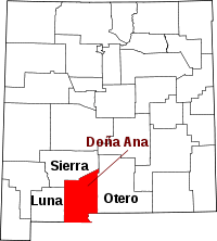 | |
| Town | ||
| Village | ||
| CDPs | ||
| Ghost towns | ||