San Felipe, Texas
| San Felipe, Texas | |
|---|---|
| Town | |
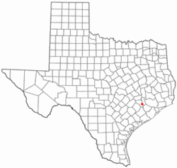 Location of San Felipe, Texas | |
 | |
| Coordinates: 29°47′40″N 96°6′17″W / 29.79444°N 96.10472°WCoordinates: 29°47′40″N 96°6′17″W / 29.79444°N 96.10472°W | |
| Country | United States |
| State | Texas |
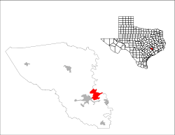
| County | Austin |
| Area | |
| • Total | 8.7 sq mi (22.6 km2) |
| • Land | 8.5 sq mi (21.9 km2) |
| • Water | 0.3 sq mi (0.8 km2) |
| Elevation | 154 ft (47 m) |
| Population (2010) | |
| • Total | 747 |
| • Density | 88/sq mi (34.1/km2) |
| Time zone | Central (CST) (UTC-6) |
| • Summer (DST) | CDT (UTC-5) |
| ZIP code | 77473 |
| Area code(s) | 979 |
| FIPS code | 48-65372[1] |
| GNIS feature ID | 1346329[2] |
| Website |
townofsanfelipe |
San Felipe (/ˌsæn fᵻˈliːp/ SAN fe-LEEP), also known as San Felipe de Austin, is a town in Austin County, Texas, United States. The town was the social, economic, and political center of the early Stephen F. Austin colony. The population was 747 at the 2010 census.[3]
Geography
San Felipe is located in eastern Austin County at 29°47′40″N 96°6′17″W / 29.79444°N 96.10472°W, along the west bank of the Brazos River. The town limits extend south as far as Interstate 10, with access at Exit 723. Sealy is 3 miles (5 km) to the west, and downtown Houston is 46 miles (74 km) to the east. Stephen F. Austin State Park is located in the northern part of the town.
Climate
The climate in this area is characterized by hot, humid summers and generally mild to cool winters. According to the Köppen Climate Classification system, San Felipe has a humid subtropical climate, abbreviated "Cfa" on climate maps.[4]
Education
San Felipe is served by the Sealy Independent School District.
History
In 1823 John McFarland operated a ferry on the Brazos River near this location. In the fall of same year, the site was chosen by Stephen F. Austin with the help of Baron de Bastrop to be the main site in Texas for colonization. Founded in 1824 as San Felipe de Austin, the town served as the capital of Stephen F. Austin's first colony and the founding spot of the Texas Rangers. It was first governed by James (Jack) Cummins who was appointed the first alcalde.
In 1828, the population numbered about 200. The town had three general stores, two taverns, a hotel, a blacksmith shop, and forty to fifty log cabins. By 1835, its population had increased to around 600. It was home to the first post office and one of the earliest newspapers and land offices in Texas. San Felipe was second only to San Antonio as the commercial center of Texas.
The Texas conventions of 1832, 1833 and the Consultation of November 3, 1835, were held here. San Felipe would act as the capital for the provisional government of Texas until the Convention of 1836. The town was burned in 1836 to prevent the Mexican army from capturing it, and rebuilt a few years later, but never regained its popularity. The oldest post office in Texas is located here (ZIP code 77473).[5]
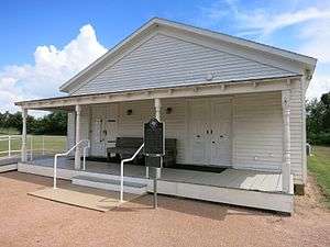 J.J. Josey General Store at the San Felipe de Austin State Historic Site
 Historical marker for San Felipe de Austin on FM 1458
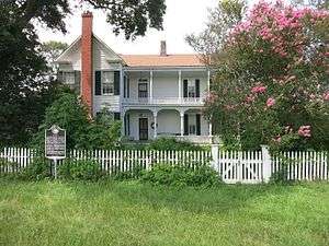 Historic Hill House on Park Road 38
Demographics
| Historical population | |||
|---|---|---|---|
| Census | Pop. | %± | |
| 1880 | 156 | — | |
| 1890 | 177 | 13.5% | |
| 1900 | 241 | 36.2% | |
| 1910 | 206 | −14.5% | |
| 1920 | 451 | 118.9% | |
| 1930 | 313 | −30.6% | |
| 1940 | 305 | −2.6% | |
| 1950 | 296 | −3.0% | |
| 1960 | 367 | 24.0% | |
| 1970 | 422 | 15.0% | |
| 1980 | 532 | 26.1% | |
| 1990 | 618 | 16.2% | |
| 2000 | 868 | 40.5% | |
| 2010 | 747 | −13.9% | |
| Est. 2015 | 793 | [6] | 6.2% |
The population was 747 at the 2010 census.
As of the census[1] of 2000, there were 868 people, 312 households, and 234 families residing in the town. The population density was 103.7 people per square mile (40.0/km²). There were 347 housing units at an average density of 41.5/sq mi (16.0/km²). The racial makeup of the town was 60.83% White, 34.56% African American, 0.35% Native American, 3.00% from other races, and 1.27% from two or more races. Hispanic or Latino of any race were 9.45% of the population.
There were 312 households out of which 29.8% had children under the age of 18 living with them, 57.7% were married couples living together, 13.5% had a female householder with no husband present, and 24.7% were non-families. 23.1% of all households were made up of individuals and 8.3% had someone living alone who was 65 years of age or older. The average household size was 2.78 and the average family size was 3.26.
In the town the population was spread out with 27.8% under the age of 18, 8.1% from 18 to 24, 22.9% from 25 to 44, 27.0% from 45 to 64, and 14.3% who were 65 years of age or older. The median age was 39 years. For every 100 females there were 102.3 males. For every 100 females age 18 and over, there were 92.3 males.
The median income for a household in the town was $38,203, and the median income for a family was $43,558. Males had a median income of $31,667 versus $22,500 for females. The per capita income for the town was $17,169. About 9.1% of families and 9.1% of the population were below the poverty line, including 3.1% of those under age 18 and 16.0% of those age 65 or over.
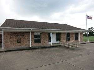 US Post Office on FM 1458
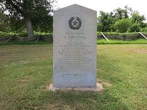 Town Hall memorial at the San Felipe de Austin State Historic Site
 San Felipe-Frydek Volunteer Fire Department
References
- 1 2 "American FactFinder". United States Census Bureau. Retrieved 2008-01-31.
- ↑ "US Board on Geographic Names". United States Geological Survey. 2007-10-25. Retrieved 2008-01-31.
- ↑ "Geographic Identifiers: 2010 Demographic Profile Data (G001): San Felipe town, Texas". U.S. Census Bureau, American Factfinder. Retrieved August 26, 2013.
- ↑ Climate Summary for San Felipe, Texas
- ↑ Charles Christopher Jackson, "SAN FELIPE DE AUSTIN, TX," Handbook of Texas Online (http://www.tshaonline.org/handbook/online/articles/hls10), accessed May 31, 2011. Published by the Texas State Historical Association.
- ↑ "Annual Estimates of the Resident Population for Incorporated Places: April 1, 2010 to July 1, 2015". Retrieved July 2, 2016.
- ↑ "Census of Population and Housing". Census.gov. Retrieved June 4, 2015.
External links
- Town of San Felipe official website
- San Felipe de Austin State Historic Site
- Stephen F. Austin State Park
- Colonial Capital of Texas
Municipalities and communities of Austin County, Texas, United States | ||
|---|---|---|
| Cities | 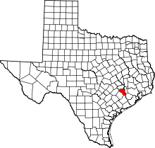 | |
| Town | ||
| Unincorporated communities | ||
| Ghost towns |
| |
| Footnotes | ‡This populated place also has portions in an adjacent county or counties | |