Bleiblerville, Texas
| Bleiblerville | |
|---|---|
| Unincorporated community | |
 Bleiblerville  Bleiblerville Location within the state of Texas | |
| Coordinates: 30°0′29″N 96°26′51″W / 30.00806°N 96.44750°WCoordinates: 30°0′29″N 96°26′51″W / 30.00806°N 96.44750°W | |
| Country | United States |
| State | Texas |
| County | Austin |
| Elevation | 371 ft (113 m) |
| Time zone | Central (CST) (UTC-6) |
| • Summer (DST) | CDT (UTC-5) |
| ZIP codes | 78931 |
| GNIS feature ID | 1330860 |
Bleiblerville is an unincorporated community in northern Austin County, Texas, United States. It lies along Farm to Market Road 2502 (FM 2502) northwest of Bellville, the county seat of Austin County.[1] Its elevation is 371 feet (113 m).[2] Although Bleiblerville is unincorporated, it has a post office, with the ZIP code of 78931.[3]
History
Bleiblerville was named for Robert Bleibler, a Swiss immigrant, who ran the general store, post office, and saloon. Bleibler opened the general store in the area in the late 1880s. The community grew rapidly with the influx of many German immigrants in the late nineteenth century, and its post office was established in 1891. The community expanded in the 1960s with the increase of oil drilling in the community, but has since declined.[4]
Geography
Bleiblerville is situated on FM 2502 a distance of 3.4 miles (5.5 km) northwest of its intersection with State Highway 159 at Nelsonville and 12.1 miles (19.5 km) northwest of Bellville. From Bleiblerville northwest to the intersection of FM 2502 and Farm to Market Road 109 near Welcome is 2.9 miles (4.7 km). From the center of Bleiblerville, Industry Road snakes its way to the southwest a distance of 3.8 miles (6.1 km) to Industry. Bleiblerville Road leaves the community heading northeast and connects with New Wehdem Road to cover the 8.9 miles (14.3 km) to an intersection with State Highway 36 south of Brenham. Bleiblerville addresses extend northwest along FM 2502 as far as the FM 109 intersection, but only a short distance to the southeast. The Bleiblerville postal zone extends as far as Industry Road and Begonia Lane to the southwest and to Bleiblerville and West Uekert Roads to the northeast.[5]
References
- ↑ Rand McNally. The Road Atlas '08. Chicago: Rand McNally, 2008, pp. 100-101.
- ↑ U.S. Geological Survey Geographic Names Information System: Bleiblerville, Texas
- ↑ Zip Code Lookup Archived June 15, 2011, at the Wayback Machine.
- ↑ Jackson, Charles Christopher. "Texas Handbook Online: BLEIBLERVILLE, TX". Texas State Historical Association. Retrieved April 14, 2013.
- ↑ Google (April 14, 2013). "Bleiblerville, Texas" (Map). Google Maps. Google. Retrieved April 14, 2013.
Municipalities and communities of Austin County, Texas, United States | ||
|---|---|---|
| Cities | 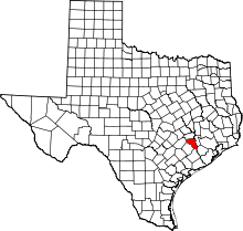 | |
| Town | ||
| Unincorporated communities | ||
| Ghost towns |
| |
| Footnotes | ‡This populated place also has portions in an adjacent county or counties | |