San Borja, Bolivia
| San Borja | |
|---|---|
| Town | |
 | |
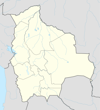 San Borja Location in Bolivia | |
| Coordinates: 14°51′30″S 66°44′51″W / 14.85833°S 66.74750°WCoordinates: 14°51′30″S 66°44′51″W / 14.85833°S 66.74750°W | |
| Country |
|
| Department |
|
| Province | José Ballivián Province |
| Municipality | San Borja Municipality |
| Canton | San Borja Canton |
| Elevation | 197 m (646 ft) |
| Population (2012)[1] | |
| • Total | 24,610 |
| Area code(s) | +591 3895 |
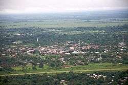
San Borja is a town in the Beni Department in northern Bolivia.
Location
San Borja is the seat of the San Borja Municipality, the second municipal section of the José Ballivián Province.[2] The town is located at an elevation of 197 m on the left bank of Río Maniqui, a tributary of Río Rapulo which flows into Río Mamoré.
Transport
By road, San Borja is situated 230 km west of the department's capital, Trinidad.
San Borja is connected towards the southwest with Yucumo situated on the road and a bus route La Paz - Yolosa/Coroico - Caranavi - Rurrenabaque. Yucumo is halfway between Caranavi and Rurrenabaque. Towards the east of San Borja Route 3 leads to San Ignacio de Moxos and farther to Trinidad, the capital of the Beni Department.
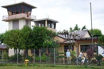
The airport of San Borja has regular services from two airlines: Línea Aérea Amaszonas and TAM - Transporte Aéreo Militar (the Bolivian Military Airline)
Population
The town's population has increased strongly over the past three decades:
- 1976: 4,613 inhabitants (census)[3]
- 1992: 11,072 inhabitants (census)[4]
- 2001: 16,273 inhabitants (census)[5]
- 2010: 24,610 inhabitants (est.)[6]
In spite of high migration figures over the past decades, the town still has a noteworthy percentage of indigenous population; 17.7 percent of the San Borja Municipality population speak local indigenous languages.[7]
Maps
- www.mirabolivia.com/mapas (four different types)
- www.mirabolivia.com/mapa_muestra.php?id_mapa=12 (road map sheet showing San Borja and Yucumo)
References
External links
Capital: La Santísima Trinidad | ||
| Provinces |  | |
| Municipalities and seats |
| |