Riberalta
| Riberalta | |
|---|---|
| Town and municipality | |
|
Street in Riberalta | |
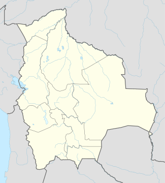 Riberalta Location of Riberalta town in Bolivia | |
| Coordinates: 10°59′S 66°6′W / 10.983°S 66.100°W | |
| Country |
|
| Department |
|
| Province | Vaca Díez Province |
| Settled | 1897 |
| Area | |
| • Total | 20.1 km2 (7.8 sq mi) |
| Elevation | 144 m (472 ft) |
| Population (2012) | |
| • Total | 97,982 |
| • Density | 4,900/km2 (13,000/sq mi) |
| Area code(s) | +591 2 |
| Website | Official website |

Riberalta is a town in the Beni Department in northern Bolivia, situated where the Madre de Dios River joins the Beni River. Riberalta is on the south (south east) bank of the Beni River.
The town is the capital of the Vaca Díez Province and Riberalta Municipality.[1] The area is in the Amazon Basin.
The town population is 78,100 (2006 official estimate).
Climate

View of Riberalta

View along the Riberalta to Cobija highway
This area typically has a pronounced dry season. According to the Köppen Climate Classification system, Riberalta has a tropical savanna climate, abbreviated "Aw" on climate maps.[2]
| Climate data for Riberalta, Bolivia | |||||||||||||
|---|---|---|---|---|---|---|---|---|---|---|---|---|---|
| Month | Jan | Feb | Mar | Apr | May | Jun | Jul | Aug | Sep | Oct | Nov | Dec | Year |
| Record high °C (°F) | 35.0 (95) |
35.0 (95) |
36.0 (96.8) |
34.6 (94.3) |
35.8 (96.4) |
33.3 (91.9) |
34.2 (93.6) |
36.4 (97.5) |
38.3 (100.9) |
36.5 (97.7) |
36.0 (96.8) |
36.8 (98.2) |
38.3 (100.9) |
| Average high °C (°F) | 30.2 (86.4) |
30.8 (87.4) |
31.5 (88.7) |
30.7 (87.3) |
29.4 (84.9) |
30.1 (86.2) |
30.5 (86.9) |
32.1 (89.8) |
33.3 (91.9) |
32.2 (90) |
31.3 (88.3) |
31.3 (88.3) |
31.1 (88) |
| Daily mean °C (°F) | 27.1 (80.8) |
27.0 (80.6) |
27.1 (80.8) |
26.8 (80.2) |
26.4 (79.5) |
25.6 (78.1) |
25.7 (78.3) |
27.3 (81.1) |
28.2 (82.8) |
28.1 (82.6) |
27.7 (81.9) |
27.3 (81.1) |
27.0 (80.6) |
| Average low °C (°F) | 22.3 (72.1) |
22.4 (72.3) |
21.7 (71.1) |
21.4 (70.5) |
18.7 (65.7) |
16.8 (62.2) |
17.5 (63.5) |
18.4 (65.1) |
20.3 (68.5) |
21.5 (70.7) |
21.6 (70.9) |
21.8 (71.2) |
20.4 (68.7) |
| Record low °C (°F) | 20.6 (69.1) |
20.0 (68) |
17.2 (63) |
15.0 (59) |
10.0 (50) |
9.9 (49.8) |
8.9 (48) |
10.0 (50) |
13.8 (56.8) |
16.1 (61) |
16.0 (60.8) |
19.0 (66.2) |
8.9 (48) |
| Average precipitation mm (inches) | 228 (8.98) |
242 (9.53) |
244 (9.61) |
170 (6.69) |
80 (3.15) |
31 (1.22) |
15 (0.59) |
20 (0.79) |
69 (2.72) |
121 (4.76) |
161 (6.34) |
230 (9.06) |
1,588 (62.52) |
| Average precipitation days (≥ 0.1 mm) | 17 | 17 | 18 | 13 | 7 | 3 | 2 | 2 | 5 | 10 | 12 | 16 | 122 |
| Average relative humidity (%) | 79 | 80 | 80 | 81 | 78 | 76 | 70 | 68 | 68 | 72 | 76 | 80 | 76 |
| Source: Deutscher Wetterdienst[3] | |||||||||||||
See also
References
- ↑ Municipalities of Bolivia at www.editorialox.com
- ↑ Climate Summary for Riberalta
- ↑ "Klimatafel von Riberalta, Prov. Pando / Bolivien" (PDF). Baseline climate means (1961-1990) from stations all over the world (in German). Deutscher Wetterdienst. Retrieved 27 January 2016.
External links
Coordinates: 11°0′46″S 66°3′26″W / 11.01278°S 66.05722°W
Capital: La Santísima Trinidad | ||
| Provinces |  | |
| Municipalities and seats |
| |
This article is issued from Wikipedia - version of the 1/28/2016. The text is available under the Creative Commons Attribution/Share Alike but additional terms may apply for the media files.