Sainte-Sophie, Quebec
| Sainte-Sophie | ||
|---|---|---|
| Municipality | ||
| ||
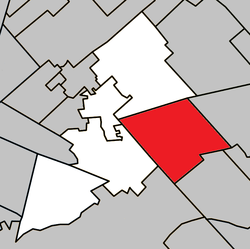 Location within La Rivière-du-Nord RCM. | ||
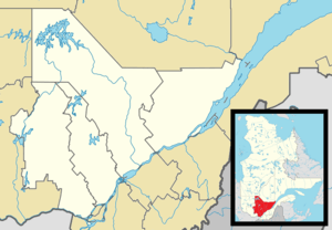 Sainte-Sophie Location in central Quebec. | ||
| Coordinates: 45°49′N 73°54′W / 45.817°N 73.900°WCoordinates: 45°49′N 73°54′W / 45.817°N 73.900°W[1] | ||
| Country |
| |
| Province |
| |
| Region | Laurentides | |
| RCM | La Rivière-du-Nord | |
| Constituted | May 3, 2000 | |
| Government[2] | ||
| • Mayor | Louise Gallant | |
| • Federal riding | Rivière-du-Nord | |
| • Prov. riding | Rousseau | |
| Area[2][3] | ||
| • Total | 111.50 km2 (43.05 sq mi) | |
| • Land | 111.28 km2 (42.97 sq mi) | |
| Population (2011)[3] | ||
| • Total | 13,375 | |
| • Density | 120.2/km2 (311/sq mi) | |
| • Pop 2006-2011 |
| |
| Time zone | EST (UTC−5) | |
| • Summer (DST) | EDT (UTC−4) | |
| Postal code(s) | J5J | |
| Area code(s) | 450 and 579 | |
| Highways |
| |
| Website |
www | |
Sainte-Sophie is a municipality in the Laurentides region of Quebec, Canada, part of the La Rivière-du-Nord Regional County Municipality.
History
The new Municipality of Sainte-Sophie was created on May 2, 2000, when the old Municipality of Sainte-Sophie was merged with the Village Municipality of New Glasgow.
Demographics
Population trend:[4]
- Population in 2011: 13375 (2006 to 2011 population change: 29.2%)
- Population in 2006: 10,355 (2001 to 2006 population change: 15.5%)
- Population in 2001: 8966
- Population in 1996: 8691
- Sainte-Sophie: 8534
- New Glasgow: 157
- Population in 1991:
- Sainte-Sophie: 7377
- New Glasgow: 167
Private dwellings occupied by usual residents: 5,162 (total dwellings: 5,437)
References
- ↑ Reference number 56411 of the Commission de toponymie du Québec (French)
- 1 2 Geographic code 75028 in the official Répertoire des municipalités (French)
- 1 2 "(Code 2475028) Census Profile". 2011 census. Statistics Canada. 2012.
- ↑ Statistics Canada: 1996, 2001, 2006, 2011 census
 |
Prévost | Saint-Hippolyte | | |
| Saint-Jérôme | |
Saint-Lin-Laurentides | ||
| ||||
| | ||||
| Mirabel, Sainte-Anne-des-Plaines | Terrebonne |
| Towns | |
|---|---|
| Municipalities | |
| |
This article is issued from Wikipedia - version of the 2/9/2014. The text is available under the Creative Commons Attribution/Share Alike but additional terms may apply for the media files.