Saint-Gabriel-de-Rimouski, Quebec
| Saint-Gabriel-de-Rimouski | |
|---|---|
| Municipality | |
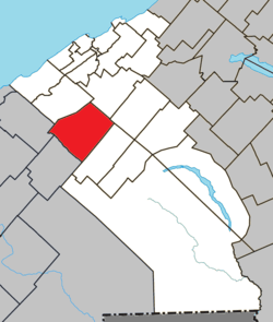 Location within La Mitis RCM | |
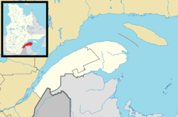 Saint-Gabriel-de-Rimouski Location in eastern Quebec | |
| Coordinates: 48°25′N 68°10′W / 48.42°N 68.17°WCoordinates: 48°25′N 68°10′W / 48.42°N 68.17°W[1] | |
| Country |
|
| Province |
|
| Region | Bas-Saint-Laurent |
| RCM | La Mitis |
| Constituted | January 7, 1989 |
| Government[2] | |
| • Mayor | Georges Deschenes |
| • Federal riding | Haute-Gaspésie—La Mitis—Matane—Matapédia |
| • Prov. riding | Matane-Matapédia |
| Area[2][3] | |
| • Total | 128.00 km2 (49.42 sq mi) |
| • Land | 128.88 km2 (49.76 sq mi) |
| There is an apparent contradiction between two authoritative sources | |
| Population (2011)[3] | |
| • Total | 1,180 |
| • Density | 9.2/km2 (24/sq mi) |
| • Pop 2006-2011 |
|
| • Dwellings | 560 |
| Time zone | EST (UTC−5) |
| • Summer (DST) | EDT (UTC−4) |
| Postal code(s) | G0K 1M0 |
| Area code(s) | 418 and 581 |
| Highways |
|
| Website |
www saint-gabriel-de-rimouski |
Saint-Gabriel-de-Rimouski is a municipality in Quebec, Canada. Prior to January 31, 1998 it was known simply as Saint-Gabriel.
See also
References
External links
-
 Media related to Saint-Gabriel-de-Rimouski, Quebec at Wikimedia Commons
 |
Saint-Donat | |
Sainte-Angèle-de-Mérici | |
| Saint-Anaclet-de-Lessard | |
Sainte-Jeanne-d'Arc | ||
| ||||
| | ||||
| Saint-Marcellin | |
Les Hauteurs |
| Cities & Towns | |
|---|---|
| Municipalities | |
| Parishes | |
| Villages | |
| Unorganized territories | |
| |
This article is issued from Wikipedia - version of the 12/1/2016. The text is available under the Creative Commons Attribution/Share Alike but additional terms may apply for the media files.