Saint-Cyr-la-Roche
| Saint-Cyr-la-Roche | ||
|---|---|---|
|
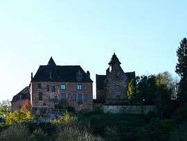
The manor and the church | ||
| ||
 Saint-Cyr-la-Roche | ||
|
Location within Nouvelle-Aquitaine region  Saint-Cyr-la-Roche | ||
| Coordinates: 45°16′20″N 1°23′30″E / 45.2722°N 1.3917°ECoordinates: 45°16′20″N 1°23′30″E / 45.2722°N 1.3917°E | ||
| Country | France | |
| Region | Nouvelle-Aquitaine | |
| Department | Corrèze | |
| Arrondissement | Brive-la-Gaillarde | |
| Canton | Juillac | |
| Government | ||
| • Mayor (2008–2014) | Jean-Philippe Delage | |
| Area1 | 8.24 km2 (3.18 sq mi) | |
| Population (2008)2 | 435 | |
| • Density | 53/km2 (140/sq mi) | |
| Time zone | CET (UTC+1) | |
| • Summer (DST) | CEST (UTC+2) | |
| INSEE/Postal code | 19196 / 19130 | |
| Elevation |
112–229 m (367–751 ft) (avg. 185 m or 607 ft) | |
|
1 French Land Register data, which excludes lakes, ponds, glaciers > 1 km² (0.386 sq mi or 247 acres) and river estuaries. 2 Population without double counting: residents of multiple communes (e.g., students and military personnel) only counted once. | ||
.svg.png)
Saint-Cyr-la-Roche is a commune in the Corrèze department in central France.
Population
| Historical population | ||
|---|---|---|
| Year | Pop. | ±% |
| 1962 | 302 | — |
| 1968 | 290 | −4.0% |
| 1975 | 296 | +2.1% |
| 1982 | 288 | −2.7% |
| 1990 | 276 | −4.2% |
| 1999 | 326 | +18.1% |
| 2008 | 435 | +33.4% |
See also
References
| Wikimedia Commons has media related to Saint-Cyr-la-Roche. |
This article is issued from Wikipedia - version of the 2/26/2015. The text is available under the Creative Commons Attribution/Share Alike but additional terms may apply for the media files.