Palisse
| Palisse | ||
|---|---|---|
|
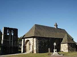
The church in Palisse | ||
| ||
 Palisse | ||
|
Location within Nouvelle-Aquitaine region  Palisse | ||
| Coordinates: 45°25′11″N 2°12′24″E / 45.4197°N 2.2067°ECoordinates: 45°25′11″N 2°12′24″E / 45.4197°N 2.2067°E | ||
| Country | France | |
| Region | Nouvelle-Aquitaine | |
| Department | Corrèze | |
| Arrondissement | Ussel | |
| Canton | Neuvic | |
| Government | ||
| • Mayor (2008–2014) | Daniel Gaye | |
| Area1 | 32.89 km2 (12.70 sq mi) | |
| Population (2008)2 | 231 | |
| • Density | 7.0/km2 (18/sq mi) | |
| Time zone | CET (UTC+1) | |
| • Summer (DST) | CEST (UTC+2) | |
| INSEE/Postal code | 19157 / 19160 | |
| Elevation | 511–706 m (1,677–2,316 ft) | |
|
1 French Land Register data, which excludes lakes, ponds, glaciers > 1 km² (0.386 sq mi or 247 acres) and river estuaries. 2 Population without double counting: residents of multiple communes (e.g., students and military personnel) only counted once. | ||
.svg.png)
Palisse is a commune in the Corrèze department in central France.
Geography
The Triouzoune flows south-southeast through the eastern part of the commune. The Vianon flows south through the middle of the commune. The Luzège forms part of the commune's western boundary.
Population
| Historical population | ||
|---|---|---|
| Year | Pop. | ±% |
| 1962 | 244 | — |
| 1968 | 293 | +20.1% |
| 1975 | 277 | −5.5% |
| 1982 | 260 | −6.1% |
| 1990 | 256 | −1.5% |
| 1999 | 226 | −11.7% |
| 2008 | 231 | +2.2% |
See also
References
| Wikimedia Commons has media related to Palisse. |
This article is issued from Wikipedia - version of the 2/25/2015. The text is available under the Creative Commons Attribution/Share Alike but additional terms may apply for the media files.