Saddlestring, Wyoming
| Saddlestring, Wyoming | |
|---|---|
| Unincorporated community | |
 Saddlestring, Wyoming  Saddlestring, Wyoming Location within the state of Wyoming | |
| Coordinates: 44°27′18″N 106°53′50″W / 44.45500°N 106.89722°WCoordinates: 44°27′18″N 106°53′50″W / 44.45500°N 106.89722°W | |
| Country | United States |
| State | Wyoming |
| County | Johnson |
| Elevation | 5,440 ft (1,660 m) |
| Time zone | Mountain (MST) (UTC-7) |
| • Summer (DST) | MDT (UTC-6) |
| ZIP codes | 82840 |
| GNIS feature ID | 1604592[1] |
Saddlestring is an unincorporated community in northwestern Johnson County, Wyoming, United States, on the eastern edge of the Bighorn National Forest. It lies along local roads northwest of the city of Buffalo, the county seat of Johnson County.[2] Its elevation is 5,440 feet (1,658 m).[1] Saddlestring possessed its own post office from 1946 to 1965, and from 1967 to 1999;[3] although the post office is now closed, Saddlestring retains its old ZIP Code of 82840.[4] The post office building still exists; located on the HF Bar Ranch, it is a contributing property to a historic district located on the ranch. The oldest building in Saddlestring is the log barn, which is attached to the Rock Creek Rod and Gun Club home to Rock Creek Anglers [5] a guide service, fly shop and bar.
[6] Public education in the community of Saddlestring is provided by Johnson County School District #1.
References
- 1 2 "Saddlestring, Wyoming". Geographic Names Information System. United States Geological Survey.
- ↑ Rand McNally. The Road Atlas '08. Chicago: Rand McNally, 2008, p. 116.
- ↑ U.S. Geological Survey Geographic Names Information System: Saddlestring Post Office
- ↑ Zip Code Lookup
- ↑
- ↑ Schroth, Margie (April 1984). "National Register of Historic Places Inventory - Nomination Form: HF Bar" (PDF). National Park Service. Retrieved 2009-08-05.
Municipalities and communities of Johnson County, Wyoming, United States | ||
|---|---|---|
| City | 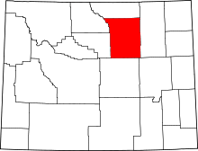 | |
| Town | ||
| Unincorporated communities | ||