Kaycee, Wyoming
| Kaycee, Wyoming | |
|---|---|
| Town | |
 Location of Kaycee, Wyoming | |
 Kaycee, Wyoming Location in the United States | |
| Coordinates: 43°42′35″N 106°38′19″W / 43.70972°N 106.63861°WCoordinates: 43°42′35″N 106°38′19″W / 43.70972°N 106.63861°W | |
| Country | United States |
| State | Wyoming |
| County | Johnson |
| Area[1] | |
| • Total | 0.41 sq mi (1.06 km2) |
| • Land | 0.40 sq mi (1.04 km2) |
| • Water | 0.01 sq mi (0.03 km2) |
| Elevation | 4,649 ft (1,417 m) |
| Population (2010)[2] | |
| • Total | 263 |
| • Estimate (2012[3]) | 261 |
| • Density | 657.5/sq mi (253.9/km2) |
| Time zone | Mountain (MST) (UTC-7) |
| • Summer (DST) | MDT (UTC-6) |
| ZIP code | 82639 |
| Area code(s) | 307 |
| FIPS code | 56-41353[4] |
| GNIS feature ID | 1590292[5] |
Kaycee is a town in Johnson County, Wyoming, United States. The population was 263 at the 2010 census. It is home to a museum that preserves the cattle ranching heritage of the area, especially the history of the Johnson County War.
Kaycee was incorporated in 1906 after the establishment of a small post office and general store. The town was named after the brand "KC" used by its earliest homesteader, John Nolan. The government required the name to be spelled out resulting in "Kaycee". The town is now home to three churches, two bars, one restaurant, one store, one museum, one k-12 school, and not a single stoplight.
Western music star and rodeo champion Chris LeDoux resided on a ranch near Kaycee, although he was born in Biloxi, Mississippi. NCAA Division III track and field athlete Noah Elm was born and raised in Kaycee.
Wyoming State Treasurer Mark Gordon was reared on the Gordon Ranch near Kaycee. Gordon is owner of the Merlin Ranch east of Buffalo and is affiliated with the 48 Ranch Partnership in Kaycee.[6]
Geography
Kaycee is located at 43°42′35″N 106°38′19″W / 43.70972°N 106.63861°W (43.709797, -106.638705).[7]
According to the United States Census Bureau, the town has a total area of 0.41 square miles (1.06 km2), of which, 0.40 square miles (1.04 km2) of it is land and 0.01 square miles (0.03 km2) is water.[1]
Demographics
| Historical population | |||
|---|---|---|---|
| Census | Pop. | %± | |
| 1920 | 217 | — | |
| 1930 | 161 | −25.8% | |
| 1940 | 210 | 30.4% | |
| 1950 | 211 | 0.5% | |
| 1960 | 284 | 34.6% | |
| 1970 | 272 | −4.2% | |
| 1980 | 271 | −0.4% | |
| 1990 | 256 | −5.5% | |
| 2000 | 249 | −2.7% | |
| 2010 | 263 | 5.6% | |
| Est. 2015 | 261 | [8] | −0.8% |
2010 census
As of the census[2] of 2010, there were 263 people, 115 households, and 76 families residing in the town. The population density was 657.5 inhabitants per square mile (253.9/km2). There were 134 housing units at an average density of 335.0 per square mile (129.3/km2). The racial makeup of the town was 98.9% White and 1.1% from two or more races. Hispanic or Latino of any race were 5.3% of the population.
There were 115 households of which 26.1% had children under the age of 18 living with them, 52.2% were married couples living together, 8.7% had a female householder with no husband present, 5.2% had a male householder with no wife present, and 33.9% were non-families. 30.4% of all households were made up of individuals and 15.6% had someone living alone who was 65 years of age or older. The average household size was 2.29 and the average family size was 2.83.
The median age in the town was 42.3 years. 21.3% of residents were under the age of 18; 4.9% were between the ages of 18 and 24; 25.8% were from 25 to 44; 28.8% were from 45 to 64; and 19% were 65 years of age or older. The gender makeup of the town was 50.6% male and 49.4% female.
2000 census
As of the census[4] of 2000, there were 249 people, 103 households, and 69 families residing in the town. The population density was 967.6 people per square mile (369.8/km²). There were 121 housing units at an average density of 470.2 per square mile (179.7/km²). The racial makeup of the town was 97.99% White, 0.80% Native American, 1.20% from other races. Hispanic or Latino of any race were 1.61% of the population.
There were 103 households out of which 36.9% had children under the age of 18 living with them, 57.3% were married couples living together, 6.8% had a female householder with no husband present, and 33.0% were non-families. 31.1% of all households were made up of individuals and 12.6% had someone living alone who was 65 years of age or older. The average household size was 2.42 and the average family size was 3.04.
In the town the population was spread out with 28.1% under the age of 18, 5.2% from 18 to 24, 28.1% from 25 to 44, 26.5% from 45 to 64, and 12.0% who were 65 years of age or older. The median age was 37 years. For every 100 females there were 90.1 males. For every 100 females age 18 and over, there were 84.5 males.
The median income for a household in the town was $33,056, and the median income for a family was $40,250. Males had a median income of $25,833 versus $21,875 for females. The per capita income for the town was $16,584. About 10.9% of families and 14.6% of the population were below the poverty line, including 8.6% of those under the age of eighteen and 33.3% of those sixty five or over.
Education
Public education in the town of Kaycee is provided by Johnson County School District #1. Kaycee School , a K-12 campus, serves the town.
Climate
Kaycee experiences a semi-arid climate (Köppen BSk) with cold, dry winters and hot, wetter summers.
| Climate data for Kaycee, WYoming | |||||||||||||
|---|---|---|---|---|---|---|---|---|---|---|---|---|---|
| Month | Jan | Feb | Mar | Apr | May | Jun | Jul | Aug | Sep | Oct | Nov | Dec | Year |
| Record high °F (°C) | 71 (22) |
71 (22) |
77 (25) |
87 (31) |
93 (34) |
104 (40) |
106 (41) |
107 (42) |
101 (38) |
88 (31) |
78 (26) |
70 (21) |
107 (42) |
| Average high °F (°C) | 35.2 (1.8) |
40.0 (4.4) |
48.4 (9.1) |
56.9 (13.8) |
66.4 (19.1) |
78.6 (25.9) |
86.5 (30.3) |
85.7 (29.8) |
74.7 (23.7) |
61.9 (16.6) |
45.3 (7.4) |
37.4 (3) |
59.75 (15.41) |
| Daily mean °F (°C) | 20.4 (−6.4) |
25.9 (−3.4) |
34.5 (1.4) |
42.8 (6) |
52.4 (11.3) |
63.2 (17.3) |
69.9 (21.1) |
68.4 (20.2) |
57.2 (14) |
45.6 (7.6) |
30.8 (−0.7) |
22.8 (−5.1) |
44.49 (6.94) |
| Average low °F (°C) | 5.5 (−14.7) |
11.8 (−11.2) |
20.5 (−6.4) |
28.6 (−1.9) |
38.3 (3.5) |
47.7 (8.7) |
53.3 (11.8) |
51.0 (10.6) |
39.6 (4.2) |
29.3 (−1.5) |
16.2 (−8.8) |
8.2 (−13.2) |
29.17 (−1.57) |
| Record low °F (°C) | −45 (−43) |
−37 (−38) |
−23 (−31) |
−5 (−21) |
12 (−11) |
25 (−4) |
31 (−1) |
28 (−2) |
13 (−11) |
−5 (−21) |
−37 (−38) |
−42 (−41) |
−45 (−43) |
| Average precipitation inches (mm) | 0.44 (11.2) |
0.40 (10.2) |
0.81 (20.6) |
1.49 (37.8) |
2.56 (65) |
2.09 (53.1) |
1.25 (31.8) |
0.87 (22.1) |
1.11 (28.2) |
1.28 (32.5) |
0.56 (14.2) |
0.40 (10.2) |
13.26 (336.9) |
| Source #1: NOAA (normals, 1971–2000) [10] | |||||||||||||
| Source #2: The Weather Channel (Records) [11] | |||||||||||||
References
- 1 2 "US Gazetteer files 2010". United States Census Bureau. Retrieved 2012-12-14.
- 1 2 "American FactFinder". United States Census Bureau. Retrieved 2012-12-14.
- ↑ "Population Estimates". United States Census Bureau. Retrieved 2013-06-01.
- 1 2 "American FactFinder". United States Census Bureau. Retrieved 2008-01-31.
- ↑ "US Board on Geographic Names". United States Geological Survey. 2007-10-25. Retrieved 2008-01-31.
- ↑ "Mark Gordon takes oath as Wyoming treasurer". Billings Gazette. Retrieved December 7, 2012.
- ↑ "US Gazetteer files: 2010, 2000, and 1990". United States Census Bureau. 2011-02-12. Retrieved 2011-04-23.
- ↑ "Annual Estimates of the Resident Population for Incorporated Places: April 1, 2010 to July 1, 2015". Retrieved July 2, 2016.
- ↑ "Census of Population and Housing". Census.gov. Retrieved June 4, 2015.
- ↑ "Climatography of the United States NO.81" (PDF). National Oceanic and Atmospheric Administration. Retrieved January 13, 2011.
- ↑ "Monthly Averages for Kaycee, WY". The Weather Channel. Retrieved January 13, 2011.
External links
Municipalities and communities of Johnson County, Wyoming, United States | ||
|---|---|---|
| City | 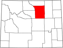 | |
| Town | ||
| Unincorporated communities | ||