São Filipe Airport
| São Filipe Airport | |||||||||||
|---|---|---|---|---|---|---|---|---|---|---|---|
 | |||||||||||
| IATA: SFL – ICAO: GVSF | |||||||||||
| Summary | |||||||||||
| Airport type | Public | ||||||||||
| Operator | Aeroportos e Segurança Aérea (ASA) | ||||||||||
| Serves | São Filipe | ||||||||||
| Location | Fogo, Cape Verde | ||||||||||
| Elevation AMSL | 66 ft / 20 m | ||||||||||
| Coordinates | 14°52′58.8″N 24°28′48″W / 14.883000°N 24.48000°WCoordinates: 14°52′58.8″N 24°28′48″W / 14.883000°N 24.48000°W | ||||||||||
| Map | |||||||||||
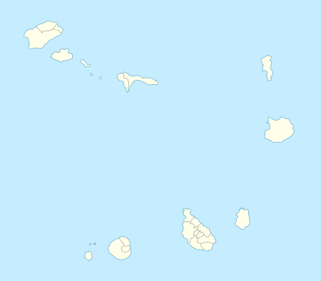 SFL Location in Cape Verde | |||||||||||
| Runways | |||||||||||
| |||||||||||
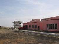
São Filipe Airport (Portuguese Aeródromo de São Filipe) (IATA: SFL, ICAO: GVSF) is Cape Verde's fifth most-used airport, located in the island of Fogo. It is located southeast of the town of São Filipe, near the Atlantic Ocean.
In May 2011, its runway was extended to 1,500 meters by 30 meters wide from the previous length of 1,197 meters by 20 meters wide, in order to accommodate bigger planes such as "ATR 42" and "ATR 72", upon landing and taking off or taxiing. The totality of the airport's terminal went through complete remodeling, followed by the extension of its runway.
Once the fourth most used, it carried 74,408 passengers in 2012 which made it the fifth most used.
Airlines and destinations
| Airlines | Destinations |
|---|---|
| Cabo Verde Express | Praia, Sal |
| TACV | Praia |
External links
- TACV Timetable for Fogo
- Airport information for GVSF at World Aero Data. Data current as of October 2006.
See also
This article is issued from Wikipedia - version of the 11/21/2016. The text is available under the Creative Commons Attribution/Share Alike but additional terms may apply for the media files.