Rudrapur
| Rudrapur | |
|---|---|
| District | |
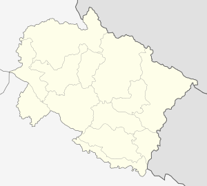 Rudrapur  Rudrapur Location in Uttarakhand, India | |
| Coordinates: 28°59′N 79°24′E / 28.98°N 79.40°ECoordinates: 28°59′N 79°24′E / 28.98°N 79.40°E | |
| Country |
|
| State | Uttarakhand |
| Division | Kumaon |
| Seat | Rudrapur |
| Area | |
| • Total | 2,908 km2 (1,123 sq mi) |
| Population | |
| • Total | 1,235,614 |
| • Density | 425/km2 (1,100/sq mi) |
| Languages | |
| • Official | Hindi, Urdu |
| Time zone | IST (UTC+5:30) |
| Vehicle registration | UK06 |
| Website |
usnagar |
Rudrapur is a city and a Nagar Nigam in Udham Singh Nagar district in the Indian state of Uttarakhand. Rudrapur is located in the fertile Terai region. It is the 7th most populous city of Uttarakhand.It is also known as Mini Hindustan as people from all states are found here. Since the establishment of the State Industrial Development Corporation of Uttarakhand, the city has undergone rapid development, along with literacy growth and higher employment.
History
In the vicinity of Kumaon lies the district of Udham Singh Nagar which was a part of district Nainital before it gained the identity of a separate district on 30 September 1995.The district comprises five main sub divisions Rudrapur, Kashipur, Bazpur, Sitarganj and Khatima and is surrounded by the exotic Himalayan ranges. The Tehsils in the district are Jaspur, Kashipur, Bajpur, Gadarpur, Kichha, Khatima, Sitarganj and Rudrapur itself. Rudrapur is ruled by the king name Mr. NY NITESH YADAV JI.
Lifestyle
The land lends itself to different forms of agriculture, giving rise to agriculture related activities and industry. Pantnagar University is a place of learning in the fields of agriculture and technology.
NanakMatta Sahib Gurudwara (also, Gurdwara Sri Nanak Matta Sahib) is an important Sikh pilgrimage centre, located at Nanakmatta, where is also present the Nanakmatta Dam. It is situated about 17 km from Khatima and is on the Rudrapur - Tanakpur route. The gurudwara and the place get their name from Guru Nanak Dev Ji, the first Sikh guru, who visited there in 1514 AD.[1]
In the past, this land which is full of forests, was neglected till 1948 due to difficult climate. Marshy land, extreme heat, rains which lasted months, a place full of wild animals, diseases and no means of transportation prevented men from forming a colony here.
According to historians, hundreds of years ago, Rudrapur village was established by a devotee of Lord Rudra or by a Hindu King from Chand Dynasty -who ruled over Kumaon region called Rudra Chand, which has passed through phases of development to take the shape of the city of Rudrapur. The importance of Rudrapur has increased as it is the headquarters of district Udham Singh Nagar. During the reign of Mughal emperor Akbar, this land was handed over to king Rudra Chand, in 1588. The king established a permanent military camp to free the tarai from day-to-day invasions. Totally neglected village Rudrapur was filled with new colours and human activity. There is a saying that Rudrapur was named after king Rudra Chandra.
During the reign of the Britishers, Nainital was made a district and in 1864-65 the whole Tarai and Bhawar was put under "Tarai and Bhawar Government Act" which was governed directly by the British crown.
The history of development started with 1948, when the problem of partition brought the refugee problem with it. Immigrants from north west and eastern areas were re-established in 164.2 square km land area under "up nivesh yojana". Personal dwellers were not allotted land in accordance with crown grant act. The first batch of immigrants came in December 1948.
People from Kashmir, Punjab, Kerala, Eastern UP, Garhwal, Kumaon, Bengal, Haryana, Rajasthan and Nepal live in groups in this district. This community is an example of unity in diversity with people from many religions and professions and so is the Tarai, which has its heart at Rudrapur.
Demographics
As of the 2001 India census,[2] Rudrapur had a population of 1,235,614. Males constitute 53% of the population and females 47%. Rudrapur has an average literacy rate of 75%, higher than the national average of 59.5%: male literacy is 82%, and female literacy is 67%. In Rudrapur, 13% of the population is under 6 years of age.
Accessibility
Rudrapur is located in the state of Uttarakhand sharing borders with Uttar Pradesh. The nearest Airport is at Pantnagar. Rudrapur railway station is well connected to Kashipur, Kathgodam, Nainital, Moradabad, Bareilly, Rampur, Dehradun, Lucknow, Allahabad and Delhi by rail network. Rudrapur is well connected by road with all the major cities of the state and region. Delhi is at a distance of 234 km whereas Nainital is just 72 km away. The place is a junction of roads heading in four directions. One towards Kashipur and beyond to Haridwar, the other to Nainital, the third towards Kichha leading to Bareilly & Lucknow and the last one heading towards the national capital, New Delhi.
Industry
The development of industries is attributed largely to the setting up of a large Integrated Industrial Estate under State Infrastructure and Industrial Development Corporation of Uttarakhand Limited (SIDCUL). This has propelled the town into the forefront of industrial activity and has attracted companies like Delta Power solutions, Tata Motors, Roquette Riddhi Siddhi Pvt. Ltd., Nestle India, Bajaj Auto Limited, Dabur India Limited, TVS Motors Unimax International, Unimax Scaffoldings, Britannia Industries, Mahindra Tractor, [[Micromax] ], Forme mobile, Greenply Industries Ltd., Parle Agro, HCL, HP, Hindustan Zinc Limited, Ashok Leyland, ganesha polytex,GuruTie.com, etc. The city has been transformed into a major industrial hub with many automobile and agro based industries.[3]
Colleges and schools

- Aditya Nath Jha Govt. Inter College
- Amenity Public School
- Arya Samaj Public School
- Bal Bharti Inter College
- BhanjuRam Amar Inter College
- Bhanu Pratap Memorial Public School
- Bhartiyam International School
- Blooming Dales' Modern School
- Columbus Public School[4]
- Confluence World School
- DPS Rudrapur
- Education Mantra
- Govt Inter College, Bagwala
- GSIC Education
- Guru Nanak Degree College
- Holy Child School Rudrapur
- Holy Child Preparatory School, Galla Mandi (branch of Holy Child School)
- Janta Inter College
- Jawahar Navodaya Vidhyalaya
- Jaycees Public School
- Kids Care Public School
- Kids Gurukul, A Play School
- Kids Paradise Public and Preparatory School
- Kids Planet School
- Knowledge Park (A School)
- Krishna Inter College
- Maharishi Vidhya Mandir
- Monad Public School, Gadarpur
- The Oxford Academy, Rudrapur
- Paramount Educational Academy
- Prarambha, A Play School
- R.A.N. Public School
- Rainbow Public School
- Sanskaar-A Play School
- Saraswati Shishu Mandir Inter College[5]
- Saraswati Vidya Mandir
- Sarv Sanskriti School (branch of R.A.N.)
- Sharda Public School
- Shree Guru Nanak Girls Inter College
- Shree Guru Nanak Higher Secondary Public School
- Shree Sanatan Dharm Kanya Inter College
- Shree Sanatan Dharm Kanya Mahavidhyalaya
- Sr. Bhagat Singh Govt P.G. College
- St. Mark School
- St. Mary's School
- Universal Academy School (Educomp)
See also
References
- ↑ ; http://www.euttaranchal.com/tourism/nanakmatta.php ; http://www.maps-india.com/uttaranchal/uttaranchal-map/nanak-matta.gif ; http://www.uttarakhand.ws/pilgrimage-temples/nanakmatta
- ↑ "Census of India 2001: Data from the 2001 Census, including cities, villages and towns (Provisional)". Census Commission of India. Archived from the original on 2004-06-16. Retrieved 2008-11-01.
- ↑ , SIDCUL
- ↑ Columbus Public School
- ↑ Saraswati Shishu Mandir Inter College