Bajpur
| Bajpur बाजपुर | |
|---|---|
| city | |
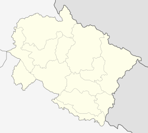 Bajpur  Bajpur Location in Uttarakhand, India | |
| Coordinates: 29°10′N 79°10′E / 29.17°N 79.16°ECoordinates: 29°10′N 79°10′E / 29.17°N 79.16°E | |
| Country |
|
| State | Uttarakhand |
| District | Udham Singh Nagar |
| Founded by | Lala Khushi Ram Sood |
| Population (2011) | |
| • Total | 25,524 |
| Languages | |
| • Official | Hindi, Punjabi |
| Time zone | IST (UTC+5:30) |
| Vehicle registration | UK |
| Website |
uk |
Bajpur (Hindi: बाजपुर) is a city and a municipality in Udham Singh Nagar district in the state of Uttarakhand, India.
It was formerly known as Bazpur, and was established early in the 20th century, by the one of the most powerful rulers of Chand dynasty was Baz Bahadur since 1950,
Bajpur is well connected with the industrial city of Rudrapur and the historical city of Kashipur. It is an affluent town, mainly due to large agricultural estates. It was initially, like most of the area which forms present day Udham Singh Nagar District, a part of the Terai, and was gradually transformed into arable land by migrants from Punjab. Most of the early settlers were those rendered homeless by the Partition of India in 1947.
Bajpur has the singular achievement of possessing the first co-operative sugar mill, which was dedicated to the nation by Jawahar Lal Nehru. It was the first effort of establishment of a sugar factory in the co-operative sector, which went into production on 16 February 1959. The much famous hill station "Nainital" is 58 km from this place. Sight seeing through this route is fantastic. 25 km ahead towards Nainital there is a place called Naya Gaon, where there is a natural waterfall named as Corbett Fall. Moving on the same road you can reach to Jim Corbett National Park, Which is famous for Tiger and elephants.
The area has a lot of large farm lands owned by people who migrated from Punjab in the early 1950s. A lot of prominent political figures at the National and State level like CM Parkash Singh Badal, CM Bhupinder Singh Hooda, MP Rana Gurjeet Singh, MLA Harbhajan Singh Cheema and Minister of Minorities Commission of Uttrakhand Sardar Mohar Singh Brah have their roots from this town.[1]
Geography
Bazpur is located at 29°10′N 79°10′E / 29.17°N 79.16°E.[2]
Demographics
As of 2001 India census,[3] Bazpur had a population of 21,782. Males constitute 55% of the population and females 45%. Bazpur has an average literacy rate of 66%, higher than the national average of 59.5%; with 60% of the males and 40% of females literate. 14% of the population is under 6 years of age.
Education
- Universal Academy (Educomp), Village Beejpuri, PO Kela Khera, Tehsil Bazpur, District Udham singh Nagar, Uttaranchal
- Sri Dashmesh School (http://dasmeshschoolbazpur.org/Index.html)
- St Mary's School (http://stmaryschoolbzpr.org/)
- RiverDale (http://www.riverdaleinternational.in/)
- Inter College Bazpur
- Rajkiya Mahavidyalaya
- Saraswati Sishu Mandir
- Saraswati Vidya Mandir
- Delhi public School
- S T M Convent school
Nearby Places of interest
Nainital, Moradabad, Jim Corbett National Park, Kashipur, New Delhi
References
- ↑ Prashar, A. S. (25 July 1998). "A powder keg about to explode?". The Tribune, Chandigarh, India. Retrieved 25 May 2016.
- ↑ "Yahoo maps location of Bazpur". Yahoo maps. Retrieved 2009-01-19.
- ↑ "Census of India 2001: Data from the 2001 Census, including cities, villages and towns (Provisional)". Census Commission of India. Archived from the original on 2004-06-16. Retrieved 2008-11-01.