Rudná (Prague-West District)
| Rudná | |||
| Rudná u Prahy, Město Rudná | |||
| Town | |||
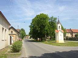 Havlíček Square with belfry | |||
|
|||
| Country | Czech Republic | ||
|---|---|---|---|
| Region | Central Bohemian | ||
| District | Prague-West | ||
| Commune | Černošice | ||
| Municipality | Hostivice | ||
| Elevation | 378 m (1,240 ft) | ||
| Coordinates | CZ 50°2′0″N 14°13′22″E / 50.03333°N 14.22278°ECoordinates: CZ 50°2′0″N 14°13′22″E / 50.03333°N 14.22278°E | ||
| Area | 8.19 km2 (3.16 sq mi) | ||
| Population | 3,509 | ||
| Density | 428/km2 (1,109/sq mi) | ||
| Founded | 1951 | ||
| Mayor | Jana Kozáková | ||
| Timezone | CET (UTC+1) | ||
| - summer (DST) | CEST (UTC+2) | ||
| Postal code | 252 19 | ||
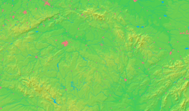  Location in the Czech Republic | |||
| Wikimedia Commons: Rudná | |||
| Statistics: statnisprava.cz | |||
| Website: www.rudnamesto.cz | |||

_CoA_CZ.jpg)
Rudná is a town in the Central Bohemian Region of the Czech Republic. It is located about 15 km west of Prague along an old road to Beroun and Pilsen. Nowadays a parallel D5 motorway runs just north of the town. Rudná was established in 1951 when two old villages of Dušníky and Hořelice merged into a new municipality (its new artificial name derives from the Czech word for ore and commemorates a long history of iron ore mining in the region). Rudná was promoted from a village to a town in 2000.
External links
| Wikimedia Commons has media related to Rudná (Prague-West District). |
This article is issued from Wikipedia - version of the 4/4/2016. The text is available under the Creative Commons Attribution/Share Alike but additional terms may apply for the media files.