Mníšek pod Brdy
| Mníšek pod Brdy | |||
| Town | |||
 Church on square in Mníšek pod Brdy | |||
|
|||
| Country | Czech Republic | ||
|---|---|---|---|
| Region | Central Bohemian | ||
| District | Prague-West | ||
| Commune | Černošice | ||
| Municipality | Mníšek pod Brdy | ||
| Elevation | 385 m (1,263 ft) | ||
| Coordinates | CZ 49°51′59.39″N 14°15′42.33″E / 49.8664972°N 14.2617583°ECoordinates: CZ 49°51′59.39″N 14°15′42.33″E / 49.8664972°N 14.2617583°E | ||
| Area | 26.50 km2 (10.23 sq mi) | ||
| Population | 4,297 | ||
| Density | 162/km2 (420/sq mi) | ||
| First mentioned | 1348 | ||
| Mayor | Petr Digrin | ||
| Timezone | CET (UTC+1) | ||
| - summer (DST) | CEST (UTC+2) | ||
| Postal code | 252 10 | ||
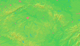  Location in the Czech Republic | |||
| Wikimedia Commons: Mníšek pod Brdy | |||
| Statistics: statnisprava.cz | |||
| Website: www.mnisek.cz | |||


Mníšek pod Brdy (Czech pronunciation: [ˈmɲiːʃɛk ˈpodbr̩dɪ]) is a town south west of Prague in the Czech Republic, in Central Bohemian Region. It hosts an annual cross-country Ultramarathon of 50 km length, which is part of the European Ultramarathon Cup. The town is part of the Prague metropolitan area.
External links
| Wikimedia Commons has media related to Mníšek pod Brdy. |
This article is issued from Wikipedia - version of the 11/16/2013. The text is available under the Creative Commons Attribution/Share Alike but additional terms may apply for the media files.