Rosamond Township, Christian County, Illinois
| Rosamond Township | |
|---|---|
| Township | |
 Location in Christian County | |
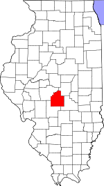 Christian County's location in Illinois | |
| Coordinates: 39°23′N 89°11′W / 39.383°N 89.183°WCoordinates: 39°23′N 89°11′W / 39.383°N 89.183°W | |
| Country |
|
| State |
|
| County | Christian |
| Established | November 7, 1865 |
| Area | |
| • Total | 36.03 sq mi (93.3 km2) |
| • Land | 36.03 sq mi (93.3 km2) |
| • Water | 0 sq mi (0 km2) 0% |
| Elevation | 689 ft (210 m) |
| Population (2010) | |
| • Total | 421 |
| • Density | 11.7/sq mi (4.5/km2) |
| Time zone | CST (UTC-6) |
| • Summer (DST) | CDT (UTC-5) |
| ZIP codes | 62083, 62555, 62557 |
| GNIS feature ID | 0429669 |
Rosamond Township is one of seventeen townships in Christian County, Illinois, USA. As of the 2010 census, its population was 421 and it contained 162 housing units.[1]
Geography
According to the 2010 census, the township has a total area of 36.03 square miles (93.3 km2), all land.[1]
Unincorporated towns
Cemeteries
The township contains these three cemeteries: Ohlman, Potters Field and Rosamond Grove.
Major highways
School districts
- Pana Community Unit School District 8
- Nokomis Community Unit School District 22
Political districts
- State House District 98
- State Senate District 49
References
- "Rosamond Township, Christian County, Illinois". Geographic Names Information System. United States Geological Survey. Retrieved 2010-01-10.
- United States Census Bureau 2009 TIGER/Line Shapefiles
- United States National Atlas
- 1 2 "Population, Housing Units, Area, and Density: 2010 - County -- County Subdivision and Place -- 2010 Census Summary File 1". United States Census. Retrieved 2013-05-28.
External links
 |
Johnson Township | Locust Township | | |
| Greenwood Township | |
Pana Township | ||
| ||||
| | ||||
| Nokomis Township, Montgomery County | Audubon Township, Montgomery County | Oconee Township, Shelby County |
Municipalities and communities of Christian County, Illinois, United States | ||
|---|---|---|
| Cities | ||
| Villages | ||
| Townships | ||
| CDP | ||
| Other unincorporated communities | ||
| Footnotes | ‡This populated place also has portions in an adjacent county or counties | |
This article is issued from Wikipedia - version of the 7/5/2014. The text is available under the Creative Commons Attribution/Share Alike but additional terms may apply for the media files.