Pana Township, Christian County, Illinois
| Pana Township | |
|---|---|
| Township | |
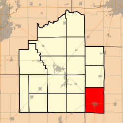 Location in Christian County | |
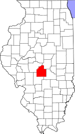 Christian County's location in Illinois | |
| Coordinates: 39°24′N 89°5′W / 39.400°N 89.083°WCoordinates: 39°24′N 89°5′W / 39.400°N 89.083°W | |
| Country |
|
| State |
|
| County | Christian |
| Established | November 7, 1865 |
| Area | |
| • Total | 49.25 sq mi (127.6 km2) |
| • Land | 49.03 sq mi (127.0 km2) |
| • Water | 0.22 sq mi (0.6 km2) 0.45% |
| Elevation | 673 ft (205 m) |
| Population (2010) | |
| • Total | 6,647 |
| • Density | 135.6/sq mi (52.4/km2) |
| Time zone | CST (UTC-6) |
| • Summer (DST) | CDT (UTC-5) |
| ZIP codes | 62557 |
| GNIS feature ID | 0429524 |
Pana Township is one of seventeen townships in Christian County, Illinois, USA. As of the 2010 census, its population was 6,647 and it contained 3,213 housing units.[1]
Geography
According to the 2010 census, the township has a total area of 49.25 square miles (127.6 km2), of which 49.03 square miles (127.0 km2) (or 99.55%) is land and 0.22 square miles (0.57 km2) (or 0.45%) is water.[1]
Cities, towns, villages
Cemeteries
The township contains these three cemeteries: Calvary, Linwood and Mound.
Major highways
Airports and landing strips
- Tex Landing Strip
Lakes
- Lake Pana (east of Pana - coordinates: 39.371862,-89.021114)
- Paragon Lake (southwestern corner of Pana - coordinates: 39.372592,-89.092611)
School districts
- Central A & M Community Unit School District 21
- Pana Community Unit School District 8
Political districts
- State House District 98
- State Senate District 49
References
- "Pana Township, Christian County, Illinois". Geographic Names Information System. United States Geological Survey. Retrieved 2010-01-10.
- United States Census Bureau 2009 TIGER/Line Shapefiles
- United States National Atlas
- 1 2 "Population, Housing Units, Area, and Density: 2010 - County -- County Subdivision and Place -- 2010 Census Summary File 1". United States Census. Retrieved 2013-05-28.
External links
Adjacent Townships

Municipalities and communities of Christian County, Illinois, United States | ||
|---|---|---|
| Cities | ||
| Villages | ||
| Townships | ||
| CDP | ||
| Other unincorporated communities | ||
| Footnotes | ‡This populated place also has portions in an adjacent county or counties | |
This article is issued from Wikipedia - version of the 11/29/2013. The text is available under the Creative Commons Attribution/Share Alike but additional terms may apply for the media files.