Rockville Township, Kankakee County, Illinois
| Rockville Township | |
|---|---|
| Township | |
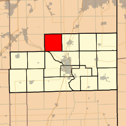 Location in Kankakee County | |
 Kankakee County's location in Illinois | |
| Coordinates: 41°15′09″N 87°56′52″W / 41.25250°N 87.94778°WCoordinates: 41°15′09″N 87°56′52″W / 41.25250°N 87.94778°W | |
| Country | United States |
| State | Illinois |
| County | Kankakee |
| Established | May 9, 1853 |
| Government | |
| • Supervisor | Richard Moran |
| Area | |
| • Total | 36.6 sq mi (95 km2) |
| • Land | 36.45 sq mi (94.4 km2) |
| • Water | 0.15 sq mi (0.4 km2) 0.41% |
| Elevation | 640 ft (195 m) |
| Population (2010) | |
| • Total | 879 |
| • Density | 24.1/sq mi (9.3/km2) |
| Time zone | CST (UTC-6) |
| • Summer (DST) | CDT (UTC-5) |
| ZIP codes | 60901, 60914, 60950 |
| GNIS feature ID | 0429662 |
Rockville Township is one of seventeen townships in Kankakee County, Illinois, USA. As of the 2010 census, its population was 879 and it contained 326 housing units.[1] It was formerly a township of Will County until Kankakee County was created. The township's name may have been derived from a Potawatomi village known to the pioneers as Rock Village.
Geography
According to the 2010 census, the township has a total area of 36.6 square miles (95 km2), of which 36.45 square miles (94.4 km2) (or 99.59%) is land and 0.15 square miles (0.39 km2) (or 0.41%) is water.[1]
Unincorporated towns
- Deselm at 41°14′58″N 87°58′28″W / 41.249476°N 87.974494°W
- Flickerville at 41°13′12″N 87°57′22″W / 41.220032°N 87.956159°W
(This list is based on USGS data and may include former settlements.)
Adjacent townships
- Wilton Township, Will County (north)
- Peotone Township, Will County (northeast)
- Manteno Township (east)
- Bourbonnais Township (southeast)
- Limestone Township (south)
- Salina Township (southwest)
- Custer Township, Will County (west)
- Wesley Township, Will County (west)
Cemeteries
The township contains these two cemeteries: Blooms Grove and DeSelm.
Airports and landing strips
- Moran Landing Strip
- Neiner Airport
Landmarks
- Kankakee River State Park (north edge)
- Kankakee River State Park (north quarter)
- Kankakee River State Park (vast majority)
Government
The township is governed by an elected Town Board of a Supervisor and four Trustees. The Township also has an elected Assessor, Clerk, Highway Commissioner and Supervisor. The Township Garage is located on Manteno-Deselm Road, Manteno Illinois 60950
Political districts
- Illinois' 11th congressional district
- State House District 79
- State Senate District 40
Schools
Rockville Township used to have 2 schools. Taylor Schoolhouse was a one room school located near Deselm which opened in 1905 and closed in 1954. Deselm School was located in Deselm and that school also closed in 1954 when the schools were consolidated into the Manteno school district.
School districts
- Manteno Community Unit School District 5
- Peotone Community Unit School District 207-U
References
- "Rockville Township, Kankakee County, Illinois". Geographic Names Information System. United States Geological Survey. Retrieved 2010-02-20.
- United States Census Bureau 2007 TIGER/Line Shapefiles
- United States National Atlas
- 1 2 "Population, Housing Units, Area, and Density: 2010 - County -- County Subdivision and Place -- 2010 Census Summary File 1". United States Census. Retrieved 2013-05-28.
External links
Municipalities and communities of Kankakee County, Illinois, United States | ||
|---|---|---|
| Cities | ||
| Villages | ||
| Townships | ||
| Unincorporated communities |
| |
| Footnotes | ‡This populated place also has portions in an adjacent county or counties | |