Momence Township, Kankakee County, Illinois
| Momence Township | |
|---|---|
| Township | |
|
Hubbard Trail Marker in Momence Township, Kankakee County, Illinois | |
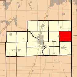 Location in Kankakee County | |
 Kankakee County's location in Illinois | |
| Coordinates: 41°09′45″N 87°35′45″W / 41.16250°N 87.59583°WCoordinates: 41°09′45″N 87°35′45″W / 41.16250°N 87.59583°W | |
| Country | United States |
| State | Illinois |
| County | Kankakee |
| Established | May 9, 1853 |
| Government | |
| • Supervisor | David Clifton |
| Area | |
| • Total | 42.92 sq mi (111.2 km2) |
| • Land | 42.45 sq mi (109.9 km2) |
| • Water | 0.47 sq mi (1.2 km2) 1.10% |
| Elevation | 620 ft (189 m) |
| Population (2010) | |
| • Total | 3,820 |
| • Density | 90/sq mi (30/km2) |
| Time zone | CST (UTC-6) |
| • Summer (DST) | CDT (UTC-5) |
| ZIP codes | 60940, 60954 |
| GNIS feature ID | 0429380 |
_nr_Momence_Illinois.JPG)
Momence Township is one of seventeen townships in Kankakee County, Illinois, USA. As of the 2010 census, its population was 3,820 and it contained 1,655 housing units.[1] Momence Township is one of the original six townships of Kankakee County, Illinois; when first created the township encompassed land now in Sumner, Ganeer, and Pembroke Townships. It was a township of Will County until Kankakee County was created.
Geography
According to the 2010 census, the township has a total area of 42.92 square miles (111.2 km2), of which 42.45 square miles (109.9 km2) (or 98.90%) is land and 0.47 square miles (1.2 km2) (or 1.10%) is water.[1]
Cities, towns, villages
- Momence (east half)
Unincorporated towns
- Ahern at 41°09′15″N 87°36′17″W / 41.154200°N 87.604758°W
- Edgetown at 41°10′46″N 87°34′32″W / 41.179478°N 87.575591°W
- Garden of Eden at 41°10′11″N 87°33′42″W / 41.169756°N 87.561702°W
- Illiana Heights at 41°10′08″N 87°32′35″W / 41.168923°N 87.543090°W
- Lake at 41°10′08″N 87°33′03″W / 41.168923°N 87.550868°W
- Litchfield at 41°09′48″N 87°35′12″W / 41.163367°N 87.586702°W
- Log Cabin Camp at 41°09′42″N 87°34′56″W / 41.161701°N 87.582258°W
- River at 41°09′33″N 87°35′36″W / 41.159201°N 87.593369°W
- Shadow Lawn at 41°09′35″N 87°34′18″W / 41.159756°N 87.571702°W
- Ward at 41°10′08″N 87°37′41″W / 41.168923°N 87.628092°W
- Woodland at 41°09′44″N 87°32′57″W / 41.162256°N 87.549201°W
(This list is based on USGS data and may include former settlements.)
Adjacent townships
- Yellowhead Township (north)
- West Creek Township, Lake County, Indiana (northeast)
- Lake Township, Newton County, Indiana (east)
- Pembroke Township (south)
- Ganeer Township (west)
- Sumner Township (northwest)
Cemeteries
The township contains these two cemeteries: Saint Judes and Shrontz.
Major highways
Airports and landing strips
- Johnson Airport
Rivers
Lakes
- Mirror Lake
Landmarks
- Island Park
Government
The township is governed by an elected Town Board of a Supervisor and four Trustees. The Township also has an elected Assessor, Clerk, Highway Commissioner and Supervisor. The Township Office is located at 203 East River Street, Momence, IL 60954.
Political districts
- Illinois' 11th congressional district
- State House District 79
- State Senate District 40
School districts
- Momence Community Unit School District 1
References
- "Momence Township, Kankakee County, Illinois". Geographic Names Information System. United States Geological Survey. Retrieved 2010-02-20.
- United States Census Bureau 2007 TIGER/Line Shapefiles
- United States National Atlas
- 1 2 "Population, Housing Units, Area, and Density: 2010 - County -- County Subdivision and Place -- 2010 Census Summary File 1". United States Census. Retrieved 2013-05-28.
External links
Municipalities and communities of Kankakee County, Illinois, United States | ||
|---|---|---|
| Cities | ||
| Villages | ||
| Townships | ||
| Unincorporated communities |
| |
| Footnotes | ‡This populated place also has portions in an adjacent county or counties | |