Ridgway Township, Gallatin County, Illinois
| Ridgway Township | |
|---|---|
| Township | |
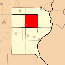 Location in Gallatin County | |
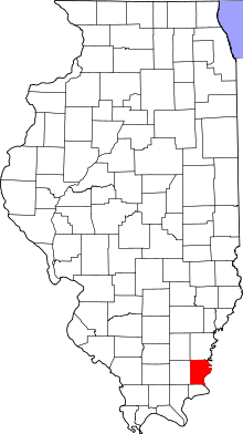 Gallatin County's location in Illinois | |
| Coordinates: 37°49′14″N 88°12′48″W / 37.82056°N 88.21333°WCoordinates: 37°49′14″N 88°12′48″W / 37.82056°N 88.21333°W | |
| Country | United States |
| State | Illinois |
| County | Gallatin |
| Established | November 5, 1890 |
| Area | |
| • Total | 35.52 sq mi (92.0 km2) |
| • Land | 35.51 sq mi (92.0 km2) |
| • Water | 0.02 sq mi (0.05 km2) 0.06% |
| Elevation | 371 ft (113 m) |
| Population (2010) | |
| • Total | 937 |
| • Density | 26.4/sq mi (10.2/km2) |
| Time zone | CST (UTC-6) |
| • Summer (DST) | CDT (UTC-5) |
| ZIP codes | 62871, 62954, 62979 |
| GNIS feature ID | 0429640 |
Ridgway Township is one of ten townships in Gallatin County, Illinois, USA. As of the 2010 census, its population was 937 and it contained 470 housing units.[1]
Geography
According to the 2010 census, the township has a total area of 35.52 square miles (92.0 km2), of which 35.51 square miles (92.0 km2) (or 99.97%) is land and 0.02 square miles (0.052 km2) (or 0.06%) is water.[1]
Cities, towns, villages
- Ridgway (east three-quarters)
Unincorporated towns
(This list is based on USGS data and may include former settlements.)
Extinct towns
- New Market at 37°47′30″N 88°14′18″W / 37.791713°N 88.238372°W
(These towns are listed as "historical" by the USGS.)
Cemeteries
The township contains these ten cemeteries: Asbury, Callicott, Jackson, Jones, Lamb, New Zion, Old Cottonwood, Riley, Saint Joseph Catholic, and Saint Patrick Catholic.
Airports and landing strips
- Downen Heliport
School districts
- Gallatin Community Unit School District 7
Political districts
- Illinois' 19th congressional district
- State House District 118
- State Senate District 59
References
- "Ridgway Township, Gallatin County, Illinois". Geographic Names Information System. United States Geological Survey. Retrieved 2010-01-17.
- United States Census Bureau 2007 TIGER/Line Shapefiles
- United States National Atlas
- 1 2 "Population, Housing Units, Area, and Density: 2010 - County -- County Subdivision and Place -- 2010 Census Summary File 1". United States Census. Retrieved 2013-05-28.
External links
 |
Omaha Township | Asbury Township | | |
| North Fork Township | |
New Haven Township | ||
| ||||
| | ||||
| Equality Township | Gold Hill Township | Shawnee Township |
Municipalities and communities of Gallatin County, Illinois, United States | ||
|---|---|---|
| City | ||
| Villages | ||
| Townships | ||
| Unincorporated communities | ||
This article is issued from Wikipedia - version of the 9/10/2016. The text is available under the Creative Commons Attribution/Share Alike but additional terms may apply for the media files.