Rich Valley Township, McLeod County, Minnesota
| Rich Valley Township, Minnesota | |
|---|---|
| Township | |
 Rich Valley Township, Minnesota Location within the state of Minnesota | |
| Coordinates: 44°51′30″N 94°12′5″W / 44.85833°N 94.20139°WCoordinates: 44°51′30″N 94°12′5″W / 44.85833°N 94.20139°W | |
| Country | United States |
| State | Minnesota |
| County | McLeod |
| Area | |
| • Total | 36.2 sq mi (93.8 km2) |
| • Land | 36.1 sq mi (93.5 km2) |
| • Water | 0.1 sq mi (0.3 km2) |
| Elevation | 1,001 ft (305 m) |
| Population (2000) | |
| • Total | 727 |
| • Density | 20.1/sq mi (7.8/km2) |
| Time zone | Central (CST) (UTC-6) |
| • Summer (DST) | CDT (UTC-5) |
| FIPS code | 27-54322[1] |
| GNIS feature ID | 0665417[2] |
Rich Valley Township is a township in McLeod County, Minnesota, United States. The population was 727 at the 2000 census.
Rich Valley Township was named for the fertile soil of the Crow River valley.[3]
Geography
According to the United States Census Bureau, the township has a total area of 36.2 square miles (93.8 km²), of which 36.1 square miles (93.5 km²) of it is land and 0.1 square miles (0.3 km²) of it (0.33%) is water.
Demographics
As of the census[1] of 2000, there were 727 people, 263 households, and 206 families residing in the township. The population density was 20.1 people per square mile (7.8/km²). There were 273 housing units at an average density of 7.6/sq mi (2.9/km²). The racial makeup of the township was 98.90% White, 0.14% Native American, 0.55% Asian, 0.28% from other races, and 0.14% from two or more races. Hispanic or Latino of any race were 0.14% of the population.
There were 263 households out of which 36.5% had children under the age of 18 living with them, 72.2% were married couples living together, 2.3% had a female householder with no husband present, and 21.3% were non-families. 19.4% of all households were made up of individuals and 6.1% had someone living alone who was 65 years of age or older. The average household size was 2.76 and the average family size was 3.19.
In the township the population was spread out with 29.6% under the age of 18, 3.2% from 18 to 24, 30.1% from 25 to 44, 25.2% from 45 to 64, and 12.0% who were 65 years of age or older. The median age was 38 years. For every 100 females there were 113.2 males. For every 100 females age 18 and over, there were 114.2 males.
The median income for a household in the township was $49,318, and the median income for a family was $55,104. Males had a median income of $35,972 versus $23,167 for females. The per capita income for the township was $21,226. About 2.4% of families and 5.1% of the population were below the poverty line, including 2.3% of those under age 18 and 11.6% of those age 65 or over.
References
- 1 2 "American FactFinder". United States Census Bureau. Archived from the original on September 11, 2013. Retrieved 2008-01-31.
- ↑ "US Board on Geographic Names". United States Geological Survey. 2007-10-25. Retrieved 2008-01-31.
- ↑ Upham, Warren (1920). Minnesota Geographic Names: Their Origin and Historic Significance. Minnesota Historical Society. p. 318.
Municipalities and communities of McLeod County, Minnesota, United States | ||
|---|---|---|
| Cities | 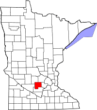 | |
| Townships | ||
| Unincorporated communities | ||