Rhodes Street Historic District
|
Rhodes Street Historic District | |
|
The William C. Rhodes House (ca. 1860) in the Rhodes Street Historic District | |
|
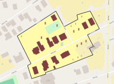
The Rhodes Street Historic District boundaries in Providence | |
| Location | Providence, Rhode Island |
|---|---|
| Coordinates | 41°48′28″N 71°24′32″W / 41.80778°N 71.40889°WCoordinates: 41°48′28″N 71°24′32″W / 41.80778°N 71.40889°W |
| Area | 4 acres (1.6 ha) |
| Architect | Unknown |
| Architectural style | Late Victorian |
| NRHP Reference # | 82000004 [1] |
| Added to NRHP | November 12, 1982 |

Rhodes Street Historic District is a residential historic district encompassing one block of Rhodes Street in southern Providence, Rhode Island, along with the dead-end Janes and Alphonso Streets. This area has a well-preserved collection of stylish 19th century houses, built roughly between 1850 and 1895. South Providence did not see much residential development until after industry began moving into the area. These houses were built on land that was originally part of the Rhodes family farm, and were built for managers of nearby industrial facilities. Architecturally the houses represent a cross-section of styles popular in the period.[2]
The district was listed on the National Register of Historic Places in 1982.[1]
See also
References
- 1 2 National Park Service (2007-01-23). "National Register Information System". National Register of Historic Places. National Park Service.
- ↑ "NRHP nomination for Rhodes Street Historic District" (PDF). Rhode Island Preservation. Retrieved 2014-10-27.
External links
 Media related to Rhodes Street Historic District (category) at Wikimedia Commons
| Topics | |
|---|---|
| Lists by states |
|
| Lists by insular areas | |
| Lists by associated states | |
| Other areas | |
| |
This article is issued from Wikipedia - version of the 11/26/2016. The text is available under the Creative Commons Attribution/Share Alike but additional terms may apply for the media files.