Red Rock, Apache County, Arizona
| Red Rock, Arizona | |
|---|---|
| Census-designated place | |
 Red Rock  Red Rock | |
| Coordinates: 36°36′16″N 109°03′38″W / 36.60444°N 109.06056°WCoordinates: 36°36′16″N 109°03′38″W / 36.60444°N 109.06056°W | |
| Country | United States |
| State | Arizona |
| County | Apache |
| Area | |
| • Total | 1.2 sq mi (3.0 km2) |
| • Land | 1.2 sq mi (3.0 km2) |
| • Water | 0 sq mi (0 km2) |
| Elevation | 5,797 ft (1,767 m) |
| Population (2010) | |
| • Total | 169 |
| • Density | 145/sq mi (56.0/km2) |
| Time zone | Mountain (MST) (UTC-7) |
| ZIP code | 86544 |
| Area code(s) | 928 |
| GNIS feature ID | 25270[1] |
Red Rock (also known as Red Valley) is an unincorporated community and census-designated place (CDP) in Apache County, Arizona, United States. Red Rock is located on the Navajo Nation near the New Mexico border, 16 miles (26 km) northeast of Lukachukai. Red Rock has a post office with ZIP code 86544; the post office uses the Red Valley name.[2] As of the 2010 census, the Red Rock CDP had a population of 169.[3]
Red Rock is named after a nearby 386-foot-high (118 m) sandstone peak. The area was first noted by white military men in 1892 when Lt. W. C. Brown observed many springs during a water survey. A trading post was established in 1906.[4]
References
- ↑ U.S. Geological Survey Geographic Names Information System: Red Rock, Apache County, Arizona
- ↑ ZIP Code Lookup
- ↑ "Geographic Identifiers: 2010 Demographic Profile Data (G001): Red Rock CDP (Apache County), Arizona". U.S. Census Bureau, American Factfinder. Retrieved April 29, 2013.
- ↑ Byrd H. Granger (1960). Arizona Place Names. University of Arizona Press. p. 20. Retrieved 8 December 2011.
Municipalities and communities of Apache County, Arizona, United States | ||
|---|---|---|
| City | 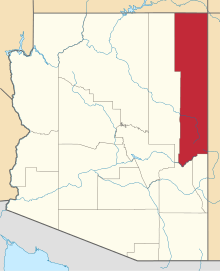 | |
| Towns | ||
| CDPs |
| |
| Unincorporated communities |
| |
| Indian reservations | ||
| Footnotes | ‡This populated place also has portions in an adjacent county or counties | |
This article is issued from Wikipedia - version of the 10/19/2016. The text is available under the Creative Commons Attribution/Share Alike but additional terms may apply for the media files.