Reardan, Washington
| Reardan | |
|---|---|
| Town | |
| Reardan, Washington | |
|
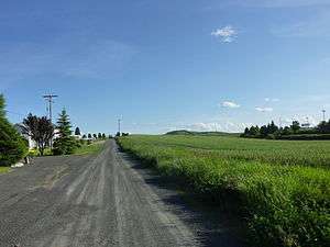
Spring in Reardan | |
 Location of Reardan, Washington | |
| Coordinates: 47°40′9″N 117°52′42″W / 47.66917°N 117.87833°WCoordinates: 47°40′9″N 117°52′42″W / 47.66917°N 117.87833°W | |
| Country | United States |
| State | Washington |
| County | Lincoln |
| Area[1] | |
| • Total | 0.50 sq mi (1.29 km2) |
| • Land | 0.49 sq mi (1.27 km2) |
| • Water | 0.01 sq mi (0.03 km2) |
| Elevation | 2,513 ft (766 m) |
| Population (2010)[2] | |
| • Total | 571 |
| • Estimate (2015)[3] | 554 |
| • Density | 1,165.3/sq mi (449.9/km2) |
| Time zone | Pacific (PST) (UTC-8) |
| • Summer (DST) | PDT (UTC-7) |
| ZIP code | 99029 |
| Area code(s) | 509 |
| FIPS code | 53-57465[4] |
| GNIS feature ID | 1507746[5] |
Reardan is a town in Lincoln County, Washington, United States. The population was 571 at the 2010 census.
History
Founded in 1882 and platted in 1889, Reardan was named for Central Washington Railroad engineer C.F. Reardan.[6] Reardan was incorporated on April 14, 1903.
The town is home to the elementary/middle/high school serving the Reardan-Edwall School District, covering over 360 square miles (930 km2) in Lincoln and Spokane counties. The slough north of town, known as Audubon Lake, is well known among birders as a busy stop on the Pacific Northwest flyway and features public facilities for viewers. A Hutterite colony settled in the area in 1961.[7]
Mule Days has been celebrated on the first Saturday in June for over 50 , featuring a Kiddie Parade, Main Parade, entertainment and games for kids at the park, three on three basketball in front of the high school, food and craft fair at the park, Community BBQ pork luncheon, Beer Garden, and Mule Days Dance.
Geography
Reardan is located at 47°40′9″N 117°52′42″W / 47.66917°N 117.87833°W (47.669057, -117.878471).[8]
According to the United States Census Bureau, the town has a total area of 0.50 square miles (1.29 km2), of which, 0.49 square miles (1.27 km2) is land and 0.01 square miles (0.03 km2) is water.[1]
Demographics
| Historical population | |||
|---|---|---|---|
| Census | Pop. | %± | |
| 1910 | 527 | — | |
| 1920 | 420 | −20.3% | |
| 1930 | 422 | 0.5% | |
| 1940 | 422 | 0.0% | |
| 1950 | 410 | −2.8% | |
| 1960 | 474 | 15.6% | |
| 1970 | 389 | −17.9% | |
| 1980 | 498 | 28.0% | |
| 1990 | 482 | −3.2% | |
| 2000 | 608 | 26.1% | |
| 2010 | 571 | −6.1% | |
| Est. 2015 | 554 | [9] | −3.0% |
| U.S. Decennial Census[10] 2015 Estimate[3] | |||
2010 census
As of the census[2] of 2010, there were 571 people, 240 households, and 160 families residing in the town. The population density was 1,165.3 inhabitants per square mile (449.9/km2). There were 255 housing units at an average density of 520.4 per square mile (200.9/km2). The racial makeup of the town was 92.5% White, 0.5% African American, 4.7% Native American, 0.4% Asian, and 1.9% from two or more races. Hispanic or Latino of any race were 2.5% of the population.
There were 240 households of which 30.0% had children under the age of 18 living with them, 49.6% were married couples living together, 13.8% had a female householder with no husband present, 3.3% had a male householder with no wife present, and 33.3% were non-families. 29.2% of all households were made up of individuals and 10.9% had someone living alone who was 65 of age or older. The average household size was 2.38 and the average family size was 2.88.
The median age in the town was 43.2 . 24.7% of residents were under the age of 18; 5.5% were between the ages of 18 and 24; 21.6% were from 25 to 44; 32.6% were from 45 to 64; and 15.8% were 65 of age or older. The gender makeup of the town was 47.3% male and 52.7% female.
2000 census
As of the census[4] of 2000, there were 608 people, 227 households, and 174 families residing in the town. The population density was 1,285.2 people per square mile (499.5/km²). There were 242 housing units at an average density of 511.6 per square mile (198.8/km²). The racial makeup of the town was 93.91% White, 0.16% African American, 2.30% Native American, 0.66% Pacific Islander, 0.16% from other races, and 2.80% from two or more races. Hispanic or Latino of any race were 1.32% of the population.
There were 227 households out of which 33.9% had children under the age of 18 living with them, 59.5% were married couples living together, 11.9% had a female householder with no husband present, and 23.3% were non-families. 21.6% of all households were made up of individuals and 6.2% had someone living alone who was 65 of age or older. The average household size was 2.68 and the average family size was 3.06.
In the town the population was spread out with 28.9% under the age of 18, 8.1% from 18 to 24, 24.7% from 25 to 44, 26.6% from 45 to 64, and 11.7% who were 65 of age or older. The median age was 37 . For every 100 females there were 101.3 males. For every 100 females age 18 and over, there were 92.9 males.
The median income for a household in the town was $38,750, and the median income for a family was $44,167. Males had a median income of $32,279 versus $21,429 for females. The per capita income for the town was $18,610. About 7.3% of families and 7.4% of the population were below the poverty line, including 12.8% of those under age 18 and none of those age 65 or over.
Famous connections
Famous Native American writer Sherman Alexie attended Reardan High School, which is featured in a few of his stories and in his 2007 novel for young adults, The Absolutely True Diary of a Part-Time Indian.
World War II Medal of Honor recipient PFC Joe E. Mann was born July 8, 1922 in Reardan and was killed in action, September 19, 1944 in Best, Netherlands. He was a soldier assigned to the 502nd PIR, 101st Airborne Division.
After Colfax and Ritzville, it is one of Washington's most infamous speed traps.[11]
Education
It is within the Reardan-Edwall School District.
References
- 1 2 "US Gazetteer 2010". United States Census Bureau. Retrieved 2012-12-19.
- 1 2 "American FactFinder". United States Census Bureau. Retrieved 2012-12-19.
- 1 2 "Population Estimates". United States Census Bureau. Retrieved July 14, 2016.
- 1 2 "American FactFinder". United States Census Bureau. Retrieved 2008-01-31.
- ↑ "Reardan". Geographic Names Information System. United States Geological Survey.
- ↑ Majors, Harry M. (1975). Exploring Washington. Van Winkle Publishing Co. p. 111. ISBN 978-0-918664-00-6.
- ↑ Schmeltzer, Michael (1988). Spokane: The City and The People. American Geographic Publishing. p. 75. ISBN 0-938314-53-X.
- ↑ "US Gazetteer : 2010, 2000, and 1990". United States Census Bureau. 2011-02-12. Retrieved 2011-04-23.
- ↑ "Annual Estimates of the Resident Population for Incorporated Places: April 1, 2010 to July 1, 2015". Retrieved July 2, 2016.
- ↑ United States Census Bureau. "Census of Population and Housing". Retrieved September 21, 2014.
- ↑ "Reardan, Washington Speed Traps | The National Speed Trap Exchange". www.speedtrap.org. Retrieved 2016-10-29.
External links
Municipalities and communities of Lincoln County, Washington, United States | ||
|---|---|---|
| Cities | 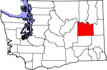 | |
| Towns | ||
| Unincorporated communities | ||
| Ghost town | ||